


Hawaii's lava flows have gobbled up a car for the world to see but there have been flights cancelled due to the ash cloud, earthquakes and special clouds thanks to volcano Kilauea's activity.
There has been some incredible footage coming out of Hawaii as lava appears out of the 17 fissures across Big Island. There was a red aviation warning for the ash plume, earthquakes and ashfall over homes. There is danger from vents collapsing after spewing lava, potentially lethal concentrations of sulphur dioxide, active lava flows and methane blasts, it's an active situation.
This afternoon, eruptive activity remained concentrated at fissure 17 but the spattering was decreasing in vigour. The advance of the flow has slowed significantly since yesterday afternoon; the flow remains nearly 2.5 km (1.5 mi) in length.
Volcanic gas emissions remain elevated throughout the area downwind of the fissures. USGS
Hawaii is a hotspot centred in the middle of a tectonic plate, so Kilauea is not like volcanos which sit along so called Ring of fire along the very active zones where plates move and grind past or under each other. Suggestions by some UK tabloids about ensuing catastrophes should be treated in the same way as stories about EXTREME bank holiday KILLER heat and Asteroid in NEAR-MISS collision path.
Flights have been affected as tremendous plumes of ash have been produced and ‘pyrocumulus clouds’ have been seen. This is an unofficial name for Cumulus Flammagenitus. Clouds may develop as a consequence of convection initiated by heat from forest fires, wildfires or volcanic eruption activity. If they consist, at least in part of water drops (not just ash) and can be observed to originate as a consequence of localized natural heat sources, such as volcanic activity they are known as Flammagenitus.
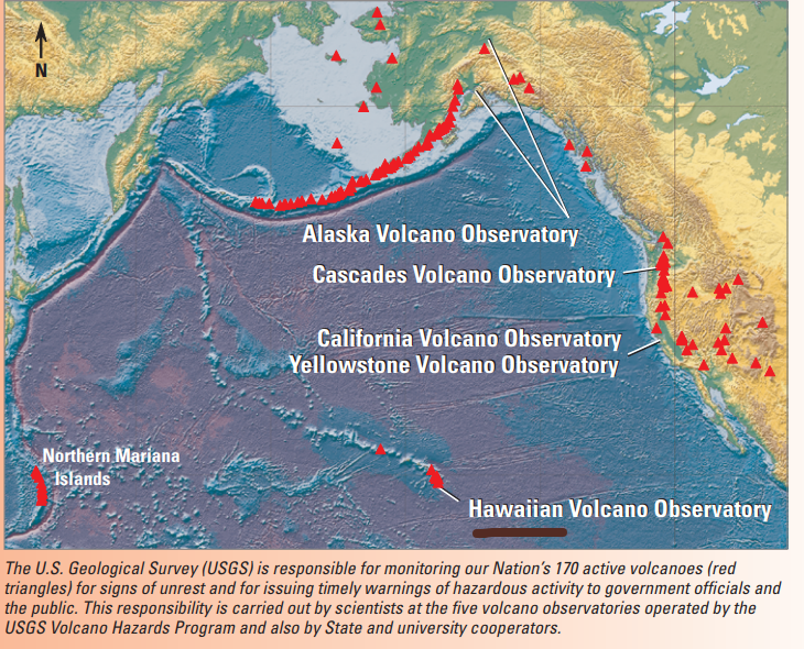
Covering the world are VAACs. Volcanic Ash Advisory Centres. Responsible for Hawaii is the Washington VAAC. "A text-based VAA is issued and distributed through several global networks, and is placed on the internet. Imagery from polar orbiting and geostationary satellites allows the boundaries of a volcanic ash cloud to be detected and to estimate the altitude and movement of the ash plume.
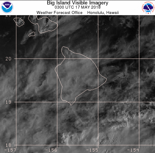
Forecasting where this ash will go is the responsibility of the National Center for Environmental Prediction (NCEP) side of the Washington VAAC. The satellite image below just shows everyday cloud cover which is obscuring any volcanic ash emissions.
Knowing where the volcanic ash plume is, and where it is likely to go are important because volcanic eruptions produce clouds of ash that present a hazard to aviation. Accidentally flying through an ash cloud is likely to severely damage an aircraft by damaging lift surfaces, wind screens, and clogging engines. This damage endangers passengers and crew through the potential loss of lift, engine power, visibility and degrading communications.”
Other remarks -
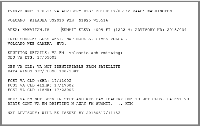
RECENT INFO FRM VO INDICATES INTERMITTENT VA EM FROM SUMMIT CONT AND MAY BE MOV N BASED ON WINDS. VA NOT DETECTED IN STLT OR WEBCAM DUE TO MET CLDS. ...VELASCO
RMK: RECENT STLT IMAGERY SHOWED CONS VA PLUME EXTND APRX 25 NM FRM SUMMIT BUT MAY EXTND FARTHER. EXTENT OBSC BY MET CLDS IN VCY. PILOT RPRT FRM 1905Z DESCRIBED VA STICKING TO WINDSHIELD. ...VELASCO
These VAAs are for aviation but other statements are more use for the general public
There are wind forecasts, ash predictions, SO2 concentration maps all set out on a dashboard for clear communication of current and forecast data. Vog is Volcanic Gas. There is some nice data available for the National Volcano Park area of Hawaii.
![]()
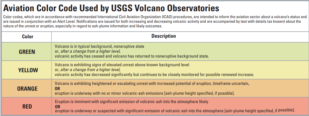
The aviation code rose to red as Kilauea erupted in mid May. The USGS, United States geological survey use a sequence of colours for volcanic eruption states, it is four tiered, green, yellow, amber and red. There is also a Watch and Warning system for the public which links to the wording used by the US National Weather service for their alert system. For example ; "an eruption that produces a huge cloud of volcanic ash that does not drift over inhabited areas might warrant a Volcano Alert Level of Watch and an Aviation Color Code of Red. USGS"
Without the intriguing footage of the car being gobbled up by a lava flow, Kilauea may not have got as much worldwide attention. It has been erupting nearly continuously since 1983 and erupted from the summit in 2008. This is life by an active volcano.
Other Kilauea images and videos
Hawaii weather - Worldwide city forecast
Iceland's volcanoes, ash and UK airspace
Bali's Agung volcano


