Mostly fine and dry with warm sunshine today, cooler tomorrow behind a cold front passing through, which will bring a little rain.
Today will be the warmest day of the week, perhaps reaching 24C in the south, before a cold front passing southeast tonight and through tomorrow, brings cloud and some rain and introduces cooler and fresher air from the west behind it. However, high pressure will build back in from the west, bringing a return of fine and dry weather with sunny spells on Thursday and Friday, this fine weather holding into the weekend too.
For now, there is some fog patches around coasts of the west and even inland across NW England, while further east there is some low cloud and mist plaguing East Anglia and East Kent. But for the majority it’s a fine, dry and sunny start – with clear blue skies.
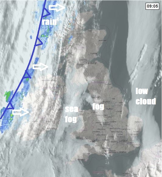
There is thicker cloud and some patchy rain across the far northwest of Scotland and cloud will continue to thicken across northern and western Scotland along with Northern Ireland through the morning and into the afternoon, bringing some patchy rain further east. Otherwise, morning fog and low cloud will burn back to coasts to leave most areas to enjoy plenty of warm sunshine.
Cooler across northern and western Scotland along with Northern Ireland - where we have the thicker cloud and some rain and also cool around western and eastern coasts, temperatures here reaching 12-16C at best. But inland, temperatures 17-19C in the north, 20-24C in the south.
A band of cloud and rain will continue eastwards across Scotland this evening, before moving down across northern England and Wales overnight, the rain generally dying away though. Clearer conditions following across Scotland and N. Ireland during the evening and overnight and turning chilly, while to the south of the cold front there will be clear spells but also some mist, fog and low cloud moving back in across eastern England.
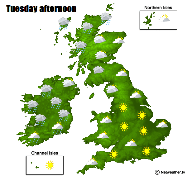
A weak cold front continues to sink southeast across England and Wales on Wednesday, bringing a cloudy day across Wales, central, southern and eastern England, with a few spots of rain in places, breezy too, especially towards the east. Perhaps some sunny spells across SE England ahead of the cloud moving down. Scotland, N. Ireland and northern England seeing a sunnier day, but cooler and fresher here. Temperatures reaching the low to mid teens generally, perhaps reaching 17C where there sun comes out in eastern areas.
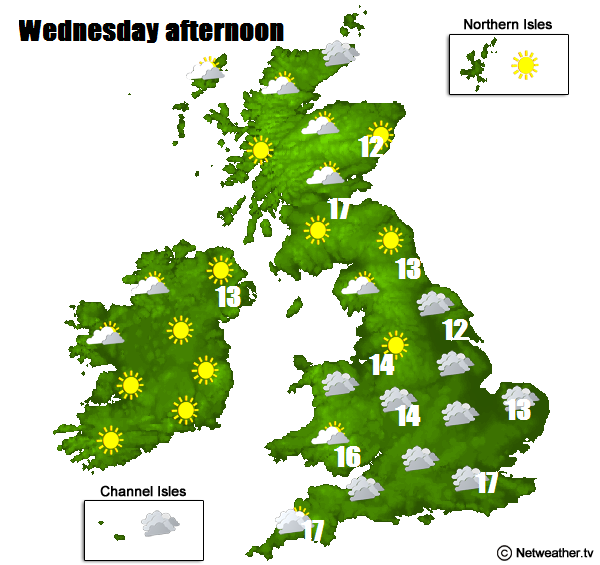
High pressure building back in from the west on Thursday will push away eastwards the weak front with its cloud, so many places will be dry with sunny spells and winds will become lighter too. Cloud will tend to build and fill out during the day, so it won’t be wall-to-wall sunshine, but no sign of rain anywhere. Temperatures reaching 13-17C.
A similar day on Friday, most dry with sunny spells, some areas of cloud drifting around, perhaps some thicker cloud and rain reaching the far northwest of Scotland by evening. A little warmer, temperatures reaching 15-19C generally.
The weekend is looking generally dry, sunny and warm inland with high pressure in control, cooler around eastern coasts of England – where there will be a brisk northeasterly breeze. Perhaps becoming cloudier from the west across northwest Britain, as Atlantic fronts graze here, cloud thickening enough to bring some patchy rain. Temperatures inland reaching the low twenties Celsius.