Mixed fortunes this week. Much cooler especially in the wind. There will be sunshine but showers and bands of rain to watch out for. Yes, you will need your coat.
We have some well-spaced bands of rain moving across the UK, blustery showers from the west and good amounts of fine, bright but fresh weather in-between.
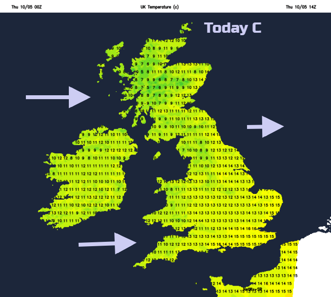
Temperatures remain in the teens, with strong sunshine but often also a brisk breeze.
One band of rain is clearing north-eastern England but bringing a damp start for East Anglia and SE England. This rain will continue to move off into the North Sea leaving behind sunny weather and a fine day.
Many areas will have bright skies, sunshine and lengthy dry spells but there will be blustery showers from the west. Northern Ireland, Scotland and for a time SW Britain will see a good scattering. There will be heavier showers for NW UK, maybe even the odd rumble of thunder. In the westerly winds a few showers will be blown inland for other parts of Britain, it will be quite hit and miss.
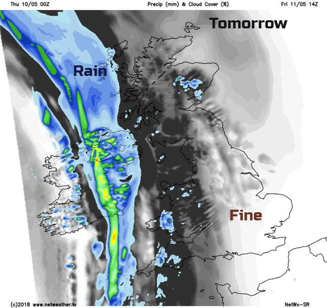
Today’s fine weather is thanks to a nose of high pressure building up from the south which hangs on for tonight over Britain. The showers fade, and winds will be light with a clear, cool night to come. There could be grass frost for inland rural areas. Northern Ireland will cool off early on, but the southerly winds will freshen as cloud and then rain heads in. This is from another cold front linked to a low pressure which settles south of Iceland for Friday. After a cloudy start for Northern Ireland, rain will move over the western counties for Friday morning. It is quite slow moving, this front and will only gradually reach Co. Antrim and Co. Down through the afternoon and evening.
For Britain it will be a degree or so warmer than today, but with a freshening southerly wind. Many areas will see sunshine although cloud will increase for western Scotland and NW England with patchy rain in the afternoon reaching Wales and southwest England. So not such a great end to the week for western parts and the winds will back a little to the SE as they strengthen for Northern Ireland and western Scotland
The band of rain is the cold front, behind this it will be chilly with westerly winds and clear skies. Ahead of the slow-moving frontal band will be some milder air, so staying in double figures for SE Britain on Friday night.
The rain area pivots NE during Saturday morning, away from Wales but across northern England and Scotland. It fades a bit over the far north of Scotland and may not trouble Shetland at all.
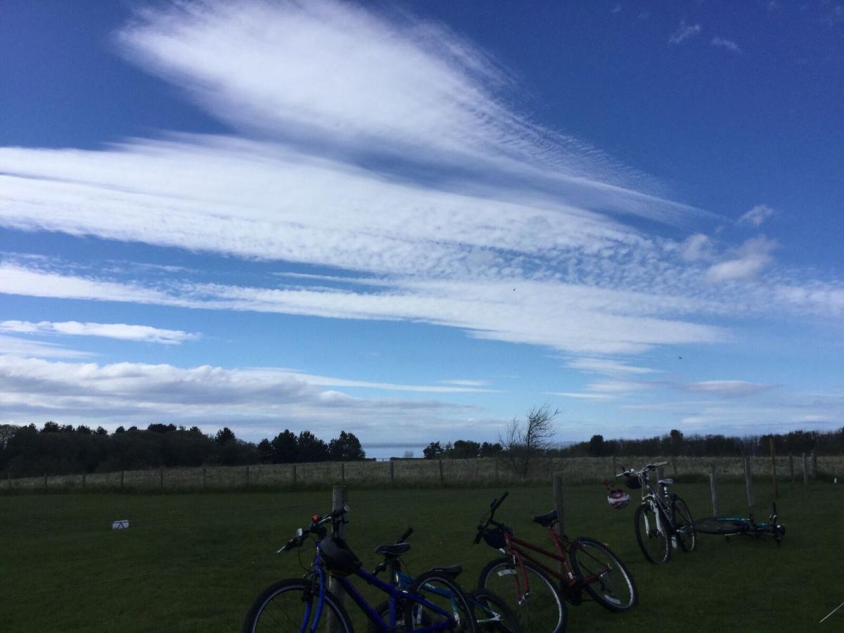
A few sightings of halos yesterday
There will be lighter winds again with temperatures in the teens, later in the day hefty showers begin to appear from the south, these could bring hail and thundery for Saturday evening and into Sunday. Bands are rotating around the low pressure out to the west. They tend to feed into S Britain, but other areas could clip eastern Britain and Northern Ireland before settling down for Monday.
Not repeat heat for this weekend. Temperatures remain at 12 to 18C tops. There will still be some fine sunshine but take your jumper and your brolly. Even next week looks cool.