More showers again today, especially across the northern half of the UK. Friday brings a repeat in the north and a spell of wet weather further south.
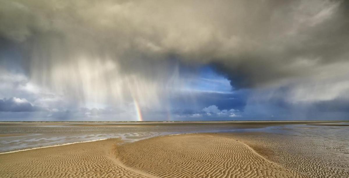
Wednesday gave us a classic day of April showers, with heavy downpours bringing hail and thunder across much of the UK. Today the heaviest and most frequent showers with hail and thunder will be across northern areas, more in the way of sunshine and fewer showers for southern areas. Friday sees a north-south split, with sunshine and showers theme continuing for northern areas, while it will be cloudy, cool and wet across the south. Then the coming weekend will be a far cry from last weekend, when we saw an early taste of summer, with all areas on the cool side with some showers around, with some cold nights and a risk of ground frost in the north.
For now, for many it’s been a dry, sunny and chilly start to Thursday, though there have been some showers from the word go across more western areas, driven in by a brisk westerly breeze, these frequent and heavy across western Scotland, N. Ireland and the Pennines, lighter and more scattered across Wales and SW England.
The showers in the northwest will develop widely across Scotland, N. Ireland and northern England through the day, heavy with a risk of hail and thunder, sunny spells in between. Some well scattered and mainly light showers further south across England and Wales, mainly in the west, but most areas staying dry and sunny.
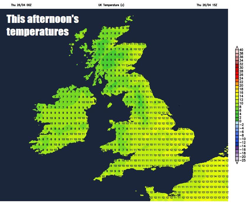
Windy across the northwest, breezy elsewhere, temperatures reaching 11-12C in the north, 13-17C in the south. Last Thursday we saw temperatures reach the high 20s Celsius in the south!
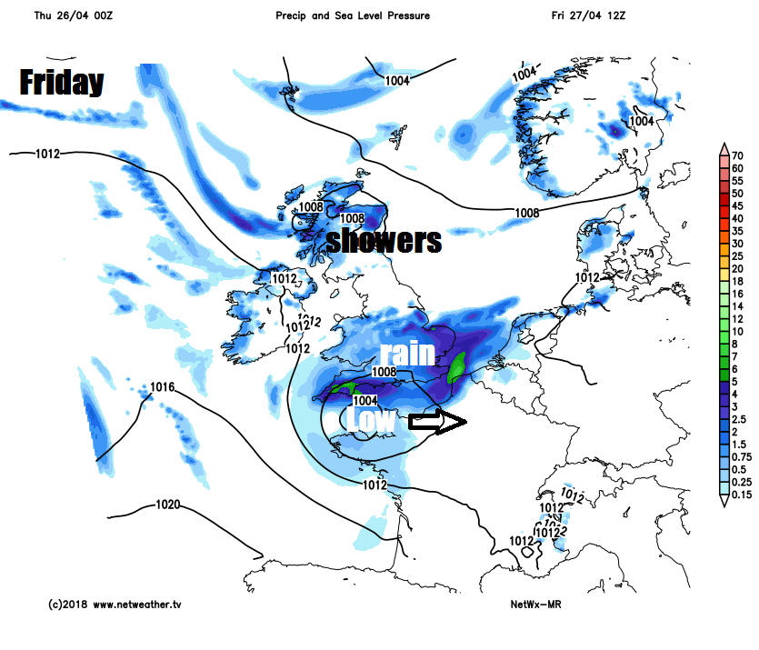
Then we look to the southwest for Friday’s weather, as an area of low pressure moves in off the Atlantic, turning much of England and Wales cloud, wet and increasingly wind through from the west by the end of the night. Scotland, N. Ireland and far north of England will be left with clear spells and turning chilly once today’s showers fade and become confined to the far north of Scotland.
Outbreaks of rain continuing to spread east across England and Wales through Friday, though the far north of England could stay dry and bright. Scotland and Northern Ireland will have sunny spells and scattered heavy and perhaps thunder showers. A cool day, not helped in the south by the cloud and rain, temperatures reaching 9-12C at best.
 Weekend
Saturday is looking cool with sunshine and scattered showers developing for many. Sunday cold in the southeast with cloudy skies and outbreaks of rain accompanied by a strong and chilly northeasterly wind, which could reach gale force, sunnier elsewhere – with showers in the northwest. Temperatures not great compared to last weekend, reaching 8-12C at best generally. Where skies clear overnight, it will turn cold, with a risk of a ground frost in sheltered northern and western areas.
Cold, wet and windy conditions continuing into Monday across the southeast, dry and bright elsewhere. Tuesday looking mostly dry and bright with a few isolated showers in the south. Perhaps a spell of rain moving east mid-week, followed by mostly dry and bright weather for the rest of the week, though perhaps rain or showers moving into the northwest.