


Lots of cloud, a chilly wind, along with rain and showers at times, it's a different type of April weather this week.
Cast ne'er a clout, till May be out.
For those who put away their winter coat last week and are now feeling chilly, we still have a week to go until the 1st of May. Or, if you follow the saying that it refers to May flowers or hawthorn, there could be a while to wait as the cold March delayed lots of the spring buds.
Top temperatures today will only reach 11 to 15C. London peaked at 29C last week. The sun is still strong and warm, yet the wind is brisk and cool, and, in the shade, there will be more of a chill this week.
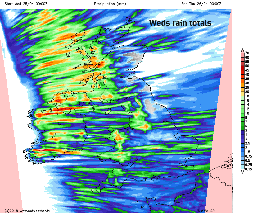
This morning there is a good deal of cloud over England, Wales and Northern Ireland with sunshine for much of Scotland but with a few hefty showers littered about. An old front is still over the Northern Isles with more cloud and rain and a fresh to strong west wind for Scotland.
The cloud further south is from a waving frontal band with areas of rain moving in today from the west or southwest. There is more rain for Wales today, across the West Country and Midlands. Further south and east it will be more patchy this morning, with a few brighter spells. This afternoon the rain gathers itself and will march across southern Britain as the winds pick up around the coasts.
The main band of rain will only move over SE England later this evening as the front finally pull away into the Channel tonight
Midweek we have a day of true Aprils showers. There will be a freshening westerly wind driving rain showers across the UK with hail and thunder possible. Temperatures will struggle low to mid-teens, and the wind will make it feel colder. Areas exposed to the west wind will see more downpours whereas eastern Britain will be more sheltered but not immune. And there will be lines of showers forming, so some areas will see hardly any, and others shower after shower.
The Met Eireann tweet sums it up well.
This showery pattern continues into Thursday with western Britain and Northern Ireland seeing more showers but with fewer inland and to the east with more sunshine. The low driving this showery flow begins to move away to the NE on Thursday night as a new low pressure sneaks into sight, away to the SW of the UK.
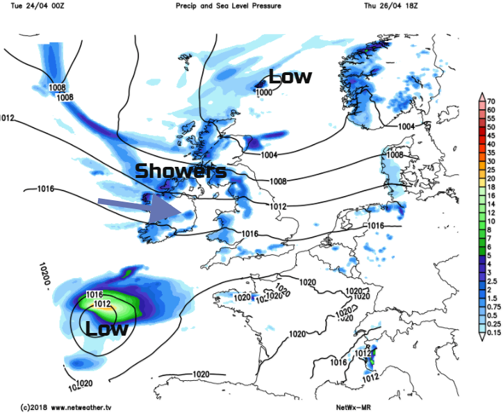
This will move towards the Bay of Biscay but could influence our weekend weather maybe spinning another low and heavy frontal rain into the south on Sunday. Something to keep an eye on. The air will be colder by the end of the week with a risk of frost and even some snow for the mountain tops. That’s April for you.


