From near record-breaking heat last week to coat and brolly weather this week. By Thursday the April showers will even turning wintry over the hills.
Take your coat and a brolly this week. The heat has gone that brought us the warmest April day for nearly 70 years 29.1 on Friday and the warmest London marathon since 1981 on a day when temperatures in the capital reached 24.1C. Hot enough for the spectators, never mind running all that way.
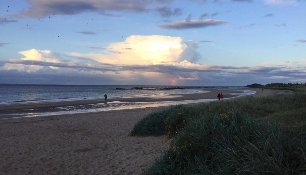
It is now cooler and fresher with a westerly wind off the Atlantic and it will stay like that, feeling even chillier from Thursday onwards.
Today
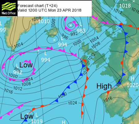
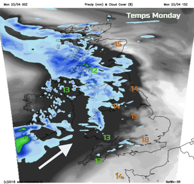
Monday morning will bring a lot of bright, fair weather with sunny spells and a cool moderate to fresh west winds. There is a scattering of showers over Scotland blown in on those winds and the first signs of a frontal system heading into Ireland which will bring rain to western Britain this afternoon and evening. NE Scotland and SE Britain will hold onto fine, sunny weather through most of today. Eastern areas will see mid-teens maybe 18C in London, for areas under the rain or further west it will be low to mid-teens and a brisk wind.
The occlusion moves over western Scotland this afternoon with some heavy bursts of rain and slows down tonight over the far north. Northern Ireland looks grey and damp over lunchtime but then the warm and cold front clear across the Irish Sea with a marked improvement by Monday evening, but it will feel cool. The rain band then moves over NW England and Wales this evening and this then trails back across southern Britain ready for Tuesday morning. So, 4 or 5C in the north, still 9 or 10 further south overnight.
Tuesday
The southern frontal band will bring a grey damp morning for southern Britain before the rain peps up from the southwest as a wave moves in. This pushes heavier rain over SW England and Wales in the afternoon. Wet weather then moves across more of southern England on Tuesday evening.
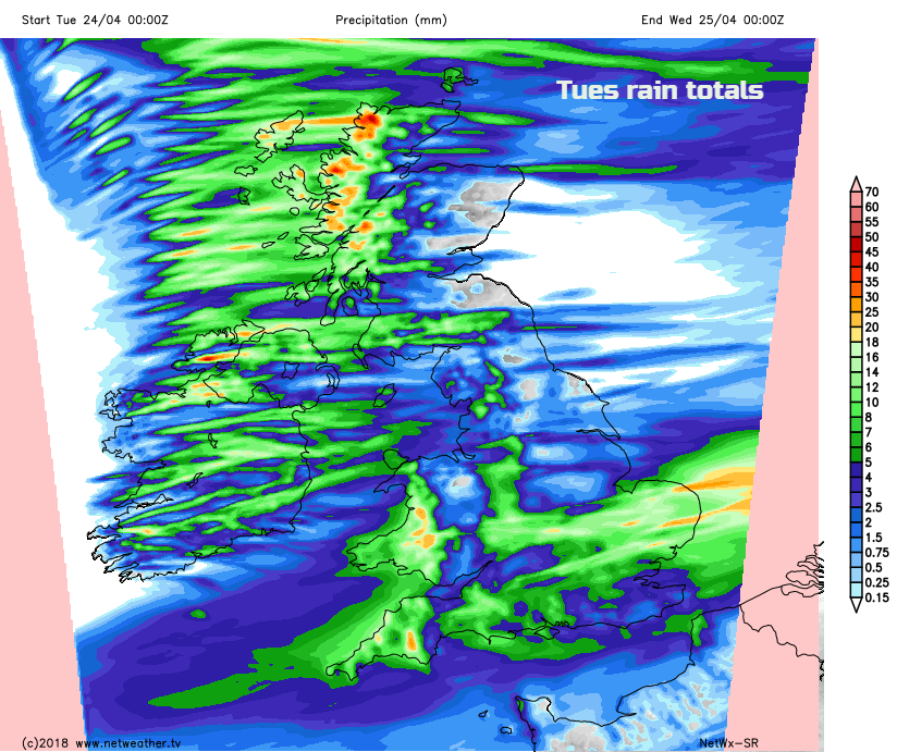
The northern frontal band fades from the Northern Isles in the morning and there will be blustery showers from the west throughout the day. In-between there will be a favoured drier brighter section for central Britain and parts of eastern Scotland which will escape most of the wet weather. We’ll have to see how far north the rain from the SW waves up on Tuesday afternoon. Temperatures will be around 12 to 15C. Cooler in the shade and the wind, feeling warm in sheltered sunshine. That’s the way with April, still put on your sunscreen, it’s all about the UV values.
This mixed picture of blustery showers, warm feeling sunny spells with bright skies then dark clouds continues before colder air approaches from the NW
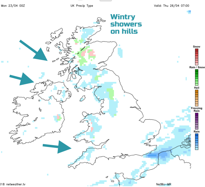
Then the showers will contain a bit of a wintry mix over the hills of the north and west, with hail, sleet and snow for the tops. There will be more chance of sharp showers with thunder and lightning as these continue to blow in on the brisk chilly W to NW wind.
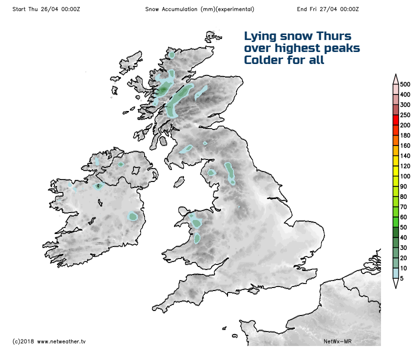
And by Thursday night, there is a risk of frost on the grass over a wide area, an air frost possible too. It still looks cool for next weekend.