The fine spell of UK weather is slowly breaking down this weekend. Thundery, heavy showers will spread north today, with cooler, cloudier weather heading east tomorrow.
Friday brought another glorious day for many, not quite as warm for many as Thursday, with more of a breeze from the west, but with lighter winds across SE England, Frittenden in Kent recorded the highest temperature of the day, reaching 26.8C. There will be more warm sunshine today, however, scattered heavy showers or thunderstorms will develop and spread northeast across parts of England and Wales, these eventually clearing overnight. Cloud and patchy rain moving east on Sunday along a weakening cold front, cooler and fresher conditions following, though warm and humid weather hanging on in the southeast. Cooler, changeable and breezy conditions for all next week, with rain or showers at times, but also some sunny spells, temperatures back down nearer to average.
For now, a glorious start to Saturday for many, with clear blue skies for most, though it is cloudy across the far northwest and we do have some low cloud across the East Midlands, Yorkshire and Norfolk – which should clear through the morning.
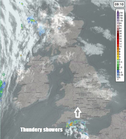
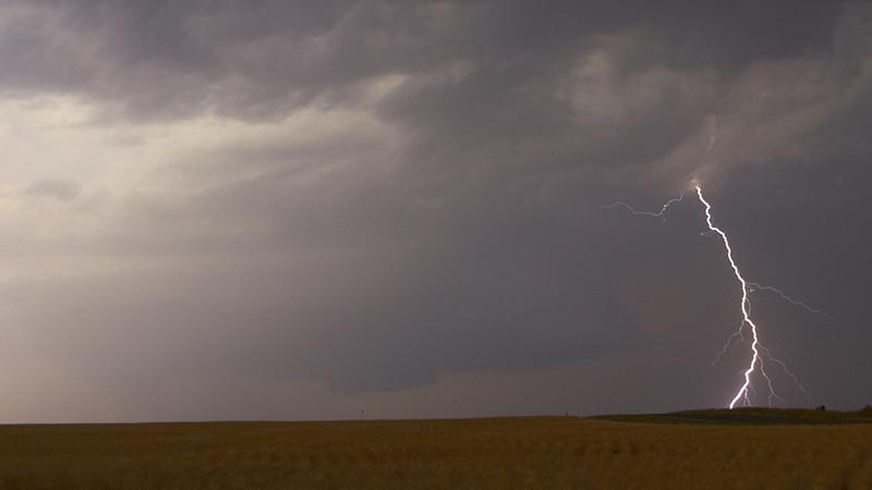
There is some heavy and thundery downpours spreading north across the English Channel towards Devon and Dorset, these isolated thundery downpours will then spread or develop northeast across SW England, south Wales and the Midlands this morning and into the afternoon, before reaching north Wales and parts of northern England by the evening. Not everywhere will catch one, with many staying dry and warm. But where you do, the rain could be torrential leading to some localised flooding, there could also be some hail and gusty winds. Netweather have issued a Thunderstorm Outlook covering today’s risk of thunderstorms.
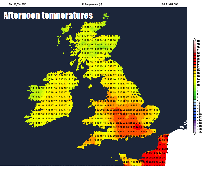
Scotland and Northern Ireland staying largely dry and sunny, as will SE England and East Anglia. The highest temperatures again across SE England – where we temperatures could reach 26C, more generally across England and Wales reaching 18-21C, across Scotland and Northern Ireland reaching 15-17C, though cooler across far north of Scotland.
Further thunderstorms are forecast to develop over northern France and move northeast across the English Channel to affect parts of SE England and East Anglia later this evening and overnight before clearing in the early hours, ongoing thunderstorms or heavy showers over northern England eventually clearing northeast into the North Sea. Otherwise, most areas dry with clear spells overnight, though cloud spreading in across the far west, with patchy rain arriving across Northern Ireland and western Scotland.
Some heavy thundery downpours around to start the day across parts of eastern England before clearing first thing, then most of England having a dry and bright morning. A cold front moving in from the west will bring cooler and cloudier conditions with patchy rain to Northern Ireland, Scotland, Wales and northern England through the morning, before reaching eastern England in the afternoon, where it will turn showery, with a risk of heavy thundery downpours developing across SE England and East Anglia – where we will hang onto warm and humid conditions . Brighter and breezier conditions, with a few showers, following across the northwest. Temperatures reaching 22-23C across SE England and East Anglia ahead of approaching cold front, cooler and fresher air arriving elsewhere with temperatures reaching 12-16C.
So it’s looking very warm for the runners taking part in the London Marathon, with temperatures in the afternoon reaching 22C coupled with humid air.
Temperatures dropping away for all as start the new week, as we see cooler and fresher westerly winds blowing in off the Atlantic. Monday will be cool and breezy for all, southern, central and eastern England staying mostly dry – northern and western areas cloudy with patchy rain. Tuesday breezy with cloud and patchy rain across southern areas, sunshine and showers in the north. Cool and breezy for the rest of the week, with sunshine and April showers for most.