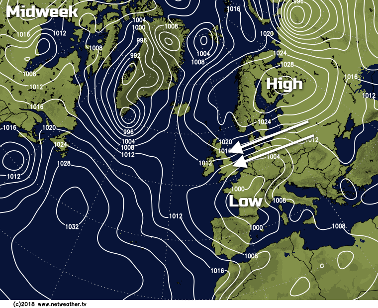
Rain spreading up from the southwest today but mild in the east. Tomorrow wet weather affecting the southeast and far north but drier in between. Easterly winds will then start to develop tomorrow, covering all parts through next week.
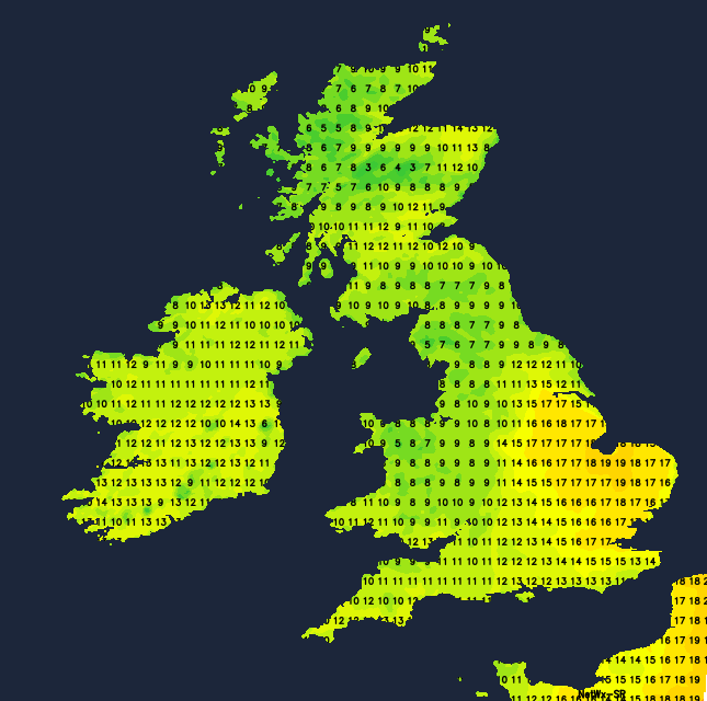
There are two main stories for our weather today - first the rain, which'll be heavy in places, with the main bulk spreading up from the southwest. Second, the warmth - parts of the southeast and East Anglia may see highs touching 17-19c. So, a reasonable chance we'll top yesterday, which was the warmest day of the year so far when St James Park in London took the honours with 17.3c.
The radar image below shows the state of play earlier this morning, with an area wet weather in the west pushing north and east, along with some showery rain in the southeast.
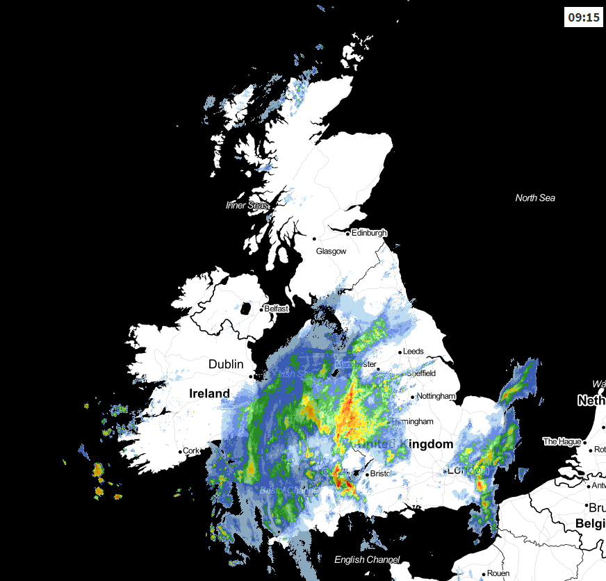
The rain in the north and west will continue to make its way northeast through the day, clearing from the southwest to leave brighter spells and a few showers. By later evening, some of it will have moved off into the North Sea, with Scotland catching the remainder, which'll be a bit more showery by this point. The showers in the southeast will also continue to come and go through the day, mostly clipping into Kent, Sussex and maybe East Anglia. Elsewhere, there'll be some heavy, thundery showers breaking out across a good part of Ireland. Scotland will stay dry for a good part of the day, and winds will ease here, so it ought to be another opportunity to get up and enjoy the great snow conditions at the various ski resorts if you're nearby.
Temperatures today will be warmest in the East reaching the mid-high teens, coolest under the rain and in the north of Scotland, where 8-13c is more likely.
Overnight, the wet weather affecting Scotland will move away, but at the same time, further rain will move up into southeast England. In between, it stays mostly dry but cloudy. Sunday then brings a three-way split. The southeast will see patchy rain continue through much of the day. The far north of Scotland will also see rain at times, with persistent rain possible in the Northern Isles. In between, it's drier with a scattering of showers, and the best of any bright or sunny spells likely to be in the west and north. Temperatures will typically peak at 9-14c, feeling cooler in the southeast though as a northeast wind develops.
Later in the day, and overnight, the showery rain in the southeast will tend to spread further north and west, along with the east to northeast wind. That'll become more widespread during Monday, leaving a much of England and Wales, cool and cloudy with showery outbreaks of rain. For Scotland and Northern Ireland, it's another story, with some sunny spells and perhaps just a few showers around.
By Tuesday the east wind will be stronger still, so starting to feel cold and pretty miserable close to eastern coasts. Further west, with a bit more shelter and some breaks in the cloud it'll be warmer though, with highs nicely into the teens in places. There'll continue to be showers moving in from the east, generally affecting England and Wales, but occasionally getting up into Eastern Scotland. The best of the drier, brighter, sunnier weather will be in the north and west though.
The same pattern will then carry on through toward the end of the week, as that easterly wind continues to blow. We may start to see a bit more of a southeast tilt to it later in the week, which could see some warmer, drier air filtering in with it, but that's a long way off.