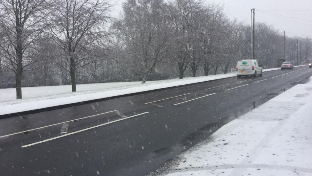
Wet, windy and, especially over the hills, wintry weather is moving northeast across the UK and Ireland today.
The long weekend is shooting by, and it's ending on a wet, windy and in places, snowy note. The rain, wind and mostly hill snow is moving northeast through the day, milder weather with sunny spells and showers follows behind it.
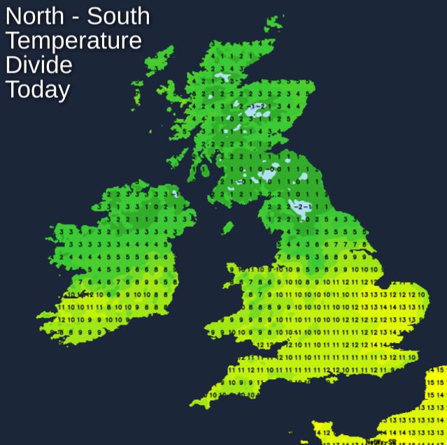
If you're travelling today, there is likely to be some disruption, and at the least, tricky conditions on the road, so it's worth building that into your plans. Temperature wise, we'll have a real north-south divide by this afternoon. The southeast could see highs up to 14c in any sunny spells, but further north it'll be a struggle to reach 3-5c.
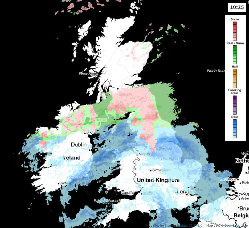
This evening and overnight, the rain, wind, sleet and snow continues to move north through Scotland and Northern Ireland. Lying snow will be mainly limited to higher ground, but some wet snow is still likely at times, lower down. On the hills and mountains, accumulations of 10cm plus are possible. Tricky for driving on higher routes, but great news for the Scottish Ski Resorts, who are having a really good season.
Further south, it's a milder night with lows perhaps staying in double figures for some; there'll also be a fair few showers blowing through.
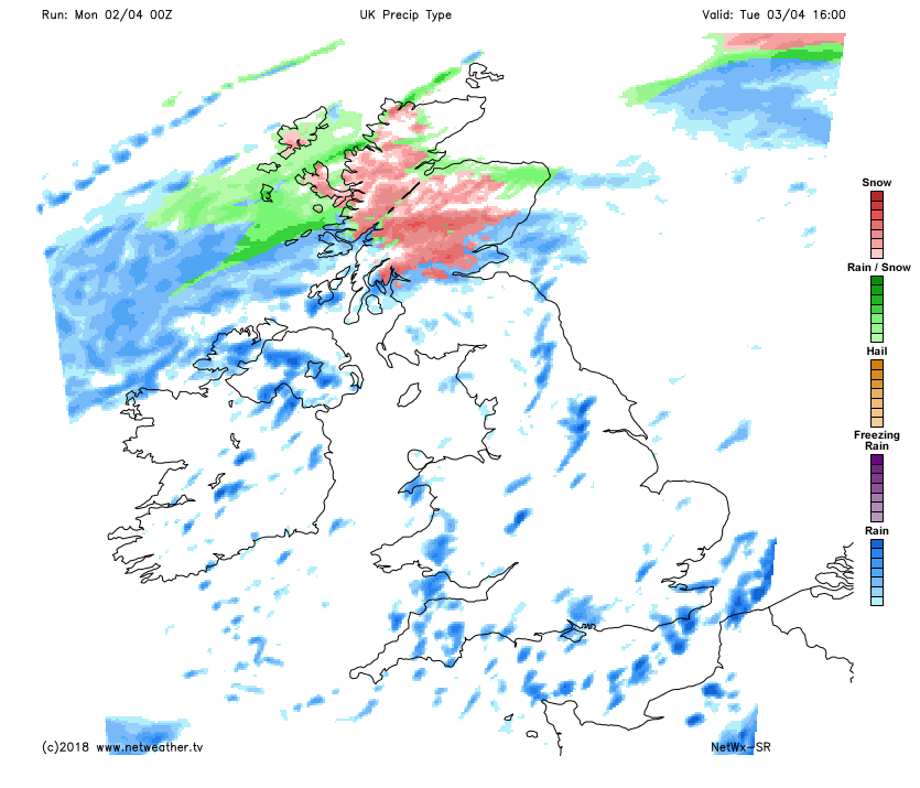
As we head back to work on Tuesday, there'll be further rain, sleet and snow affecting the far north of England, Northern Ireland and Scotland, which'll continue to come and go through the day. Elsewhere it's a day of bright or sunny spells and heavy showers.
 Much like today, temperatures will be split north to south, with highs into the teens in the south, but a colder 4-7c further north.
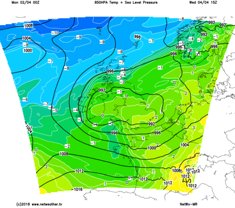
Wednesday will see low pressure moving right over England and Wales, so there'll be more showers or longer spells of rain here. Cold air will still be hanging around over northern Scotland, so keeping the risk of snow going here as well.
 The colder air will actually head it's way further south again later in the day. That's likely to lead to a widespread frost over Scotland overnight.
For the remainder of the week, it stays unsettled with temperatures varying day by day, as fronts move through, although colder air will never be too far away from the north. Friday has the potential to be the warmest day of the year so far as low pressure briefly pumps up some much milder air from the south, with highs maybe reaching 15-17c, but there's some uncertainty over this.