A lovely day before wet and blustery conditions take hold for midweek. Still looking chilly for Easter weekend but wouldn't call it a beast
A fine, bright day to start the working week before wet and windy weather arrives from the Atlantic. It will then be unsettled and colder in the run up to Easter.
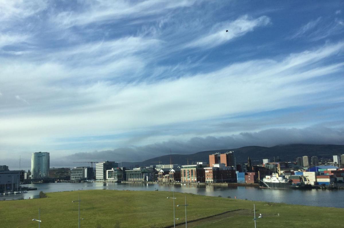
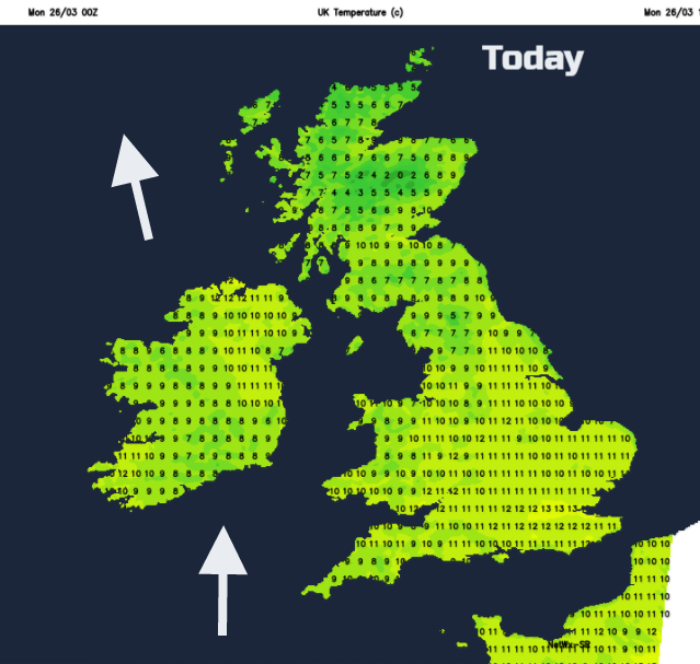
We have a cool start this morning around freezing for many, with light winds and a frost in places and a glorious sunrise (more people getting to see it after the clock change). Overall, it is sunny and bright with just a few areas seeing low cloud and mist. Top temperatures around 12C and again it will be feel warm in any sheltered sunshine, but the air isn’t that warm. Anyone who caught the sun this weekend and is glowing a bit in the office this morning shows the sun’s rays are strong now. Find the sunscreen.
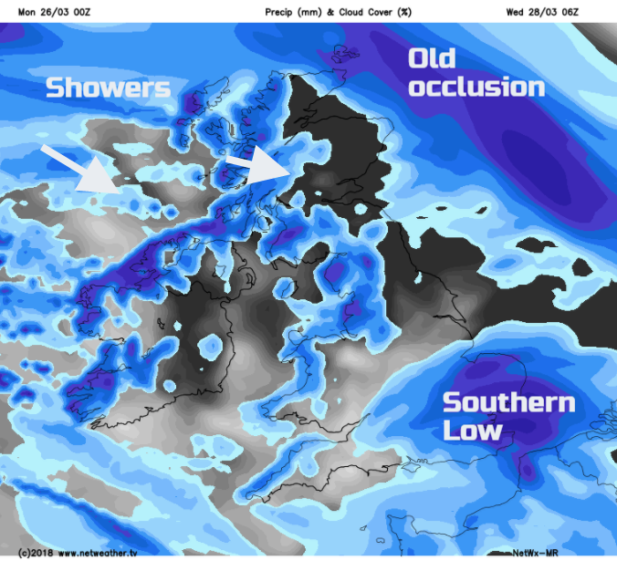
High cloud will arrive from the west and then more cloud with rain into Cornwall and Co Fermanagh as the day progresses. Ahead of the frontal band there will be a few showery outbreaks of rain over the West Country. By this evening, it will be wet and blustery over Northern Ireland as the warm front/occlusion arrives. This whole frontal system will take a while to move across the UK as one low centre sits off NW Scotland through Tuesday and another low centre develops and moves over southern Britain on Wednesday morning. These bring more rain, blustery winds and are followed by colder air midweek.
Tuesday will start off wet for much of Britain with more patchy cloud and showery bits left over Northern Ireland and quickly SW England and Wales. Heavy rain is expected during Monday night, especially for the hills of western Britain with snow over the tops of the Scottish mountains. The rain eases through Tuesday morning, swinging eastwards away from northern and eastern England but struggling to clear Scotland. The brisk SE wind will veer to the west and temperatures will vary from 7 to 13C once more.
Although showery outbreaks remain by Tuesday evening, the frontal band will be over northern Scotland, creeping NE. This area will continue to bring precipitation but will feel the effects of much colder air away to the NE, so begins to turn wintry in a strong SE wind.
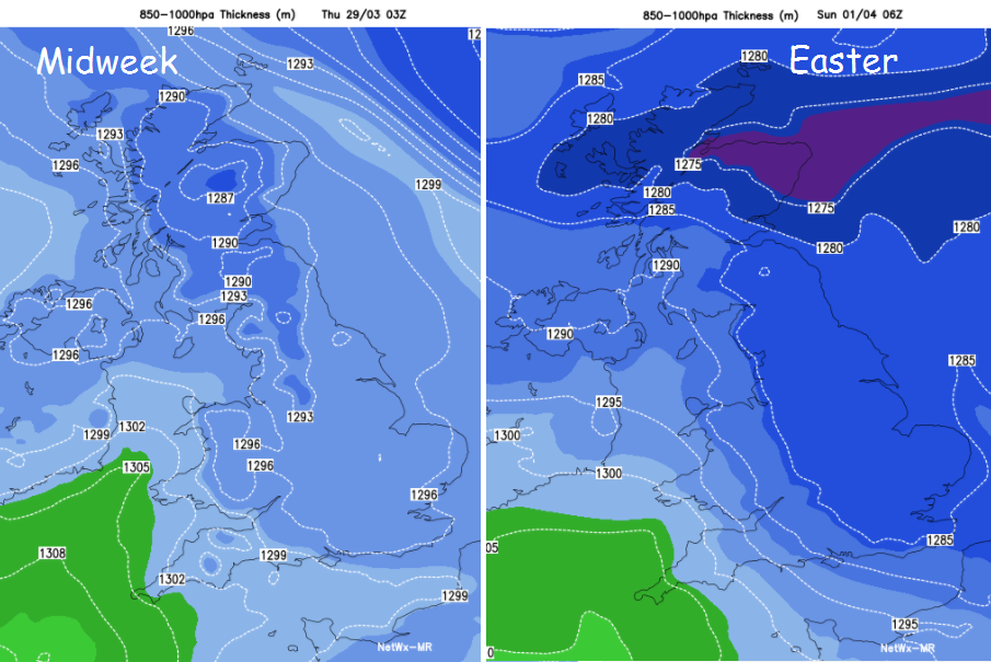
The far south of England will manage to hold onto mild air for Tuesday night, but a fresh westerly wind will bring colder conditions across the UK by Wednesday. It’s unsettled again by day, but calmer and clearer Wednesday night and the frost will return.
By Thursday, yet another low pressure appears from the SW but a high pressure over Scandinavian begins to influence our UK weather and a push from the east slows down systems heading in from the Atlantic. Showery bands look set to rotate over SW Britain where it will be windy and that occluded front in the NE could bring wintry bits to NE Scotland and the Northern Isles with snow over the Grampians.
Good Friday could see a cold easterly wind, noticeable across southern England, so a chill if you are out and about. Again, still a shower risk but hit and miss, so don’t rely on a weather app for fine details at this stage. Showers in Grampian will turn to snow but be quite scattered.
For Easter weekend there should be a lot of heavy showers about, mixed with bright spells. It will feel cold in the wind, but any sunshine will be strong and cheery and the frosts continue. Unreliable really.