With two low pressures nearby today, there's a fair amount of cloud and rain to talk about. The weekend will see an improving picture though.
We have two low pressure systems in play today, one just off the north coast of Scotland and one moving in toward the SW of England. The first low has brought rain through overnight, which has just about cleared eastern England now, but is still affecting Northern Ireland and Scotland, and will take until the end of the day to finally move away from the northeast. As that is clearing, low number two will be showing its hand in the southwest of England, with rain and wind spreading in.
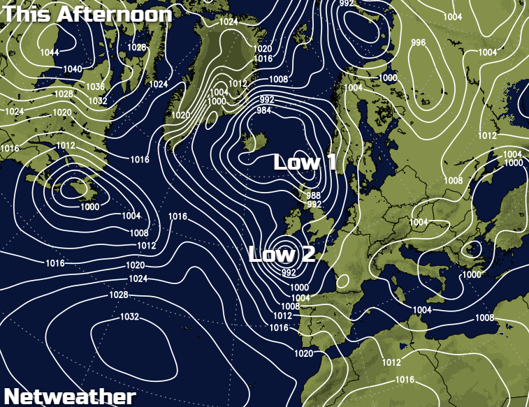
Between the two, not a bad day: breezy with some bright spells, these most likely in the east, and some showers, these most likely in the west. It's a cold front that has been moving through bringing the rain overnight, so temperatures today won't be as mild as they were yesterday. 10c will be the peak in southern regions, 6-9c will be typical in most parts though.
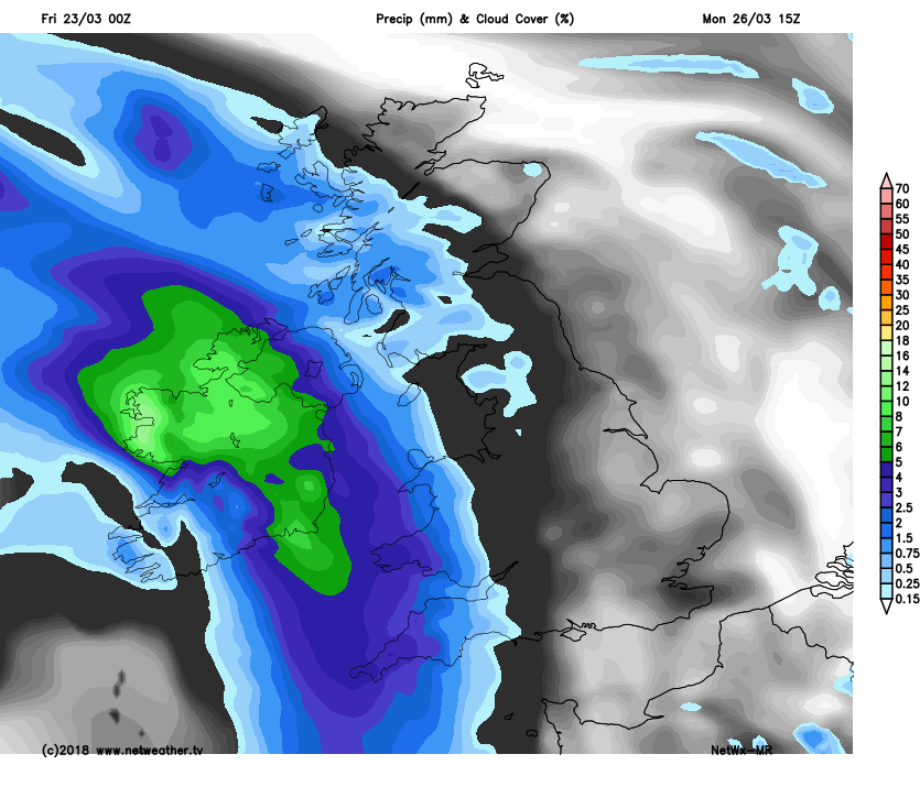
During the late afternoon and early evening, the rain in northeast Scotland will clear. Some rain will already have arrived into the southwest of England, with showers tending to break out ahead of it. The outbreaks of mostly showery rain will then spread further northeast through the remainder of the day and overnight tonight, with a good deal of England and Wales at risk of at least catching a shower or two. Further north, Scotland and Northern Ireland will see clearer skies, with some frost patches forming, there'll also be a scattering of showers in the west.
Saturday starts with a lot of cloud and still some patchy, showery rain across England and Wales. That'll all slide slowly southeast through the day to allow some brighter, if not sunnier spells to break through. Further north, there'll be plenty more sunshine, but with showers spreading into northern and western regions through the day, which'll be wintry up over the high ground. Temperatures tomorrow will typically make it to 7-11c, although tempered a bit across Scotland and Southwest England by a blustery breeze.
A cool night then follows, with some patches of frost in places. Sunday then dawns with plenty of sunny spells, which for the most part should continue right through the day. There will be some showers, but they should be fairly well scattered and mostly confined to the north and west. Temperatures will be on a par with Saturday.
The pattern then repeats overnight, with a frost returning. Monday begins with lots of sunshine, but cloud will by thickening from the west, with rain and strengthening winds crossing into Ireland and perhaps reaching western Britain during the second half of the day.
 That all moves east into Tuesday with sunshine and blustery showers following behind, we then continuing with an unsettled and often cool theme as we move through the week and toward the Easter weekend.