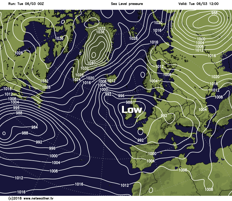
Slow moving low pressure is running the show across the UK this week. That means it stays unsettled with outbreaks of rain, sleet and snow moving through.
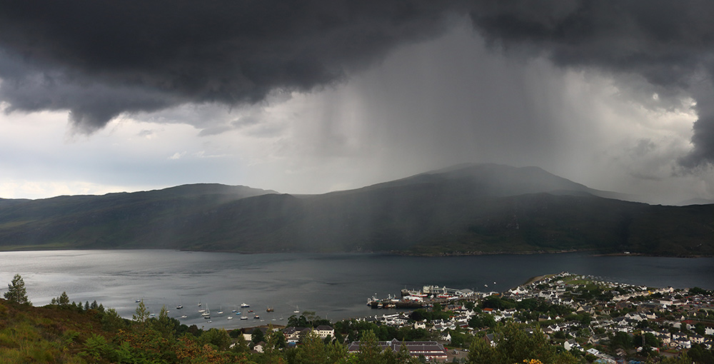
After the severe weather early in the month, it's a bit more like early spring now with sanity restored. In its wake though, we've been left with slow-moving complex areas of low pressure that are generally giving large amounts of cloud and some rain or showers. It'll remain this way at least for the rest of this week, and it'll still be cold enough at times for snow, in the far North and over Scottish hills.
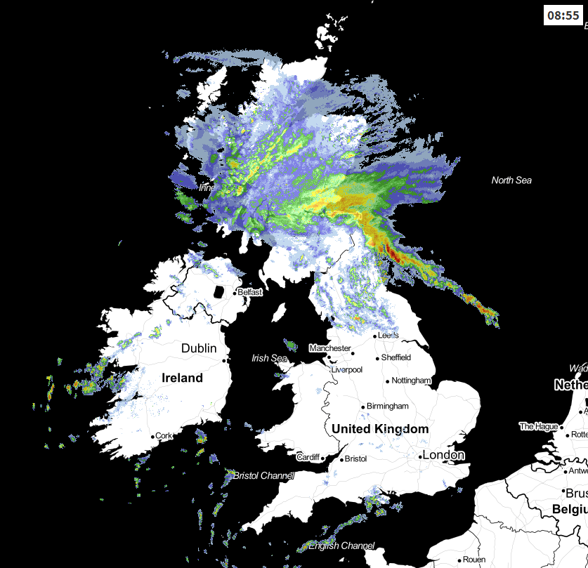
Overnight rain and hill snow are still affecting parts of northern England making it misty with hill fog, but this'll move away to the North through the morning. England, Wales and much of Northern Ireland then have a mixed day, once mist, areas of low cloud, patchy fog and the odd pocket of rural ground frost have cleared. There'll be sunny intervals, and most parts will stay dry but variable cloud will produce a few showers, so take a 'brolly' just in case. Across Northern Ireland, Cornwall and Devon, towards the South coast and in the West you're more likely to catch a shower, some of which will be heavy later with a risk of thunder but even here, not everywhere will see them.
 View the live weather radar here.
It's a different story for Scotland, where it's dull, wet and very misty with hill fog. There's also some mostly hill snow that'll spread to Highland through the day where it's mainly dry at the moment. Any snow at first across the Central Lowlands though should be reluctant to settle and is not expected to cause major problems. Some of the rain will be heavy, with Dumfries, Lothian and The Borders perhaps turning drier and somewhat brighter later. A North East wind across northern Scotland will feel raw, but across England and Wales, winds will be mostly light and from a southerly quarter. Top temperatures 8 to 10C, with 11 or 12C possible in the South where you see some sun. Scotland will be colder, with temperatures here no higher than 2 to 4C in the North and 5 or 6C in the South.
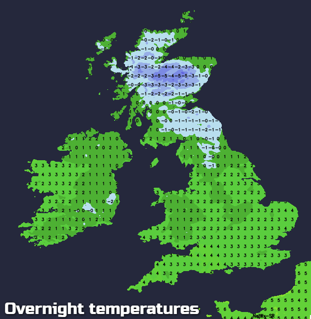
After dark, the North and West of Scotland see further outbreaks of rain in misty conditions, with hill fog. Additional snow is likely in the far North, but this'll become increasingly confined to hills, as temperatures here rise a little. The East and South of Scotland see some drizzle, in very misty conditions with patchy fog. Elsewhere it'll also turn misty fairly generally, with patchy fog and areas of low cloud forming again. There'll continue to be the risk of catching a shower, with the South West, West and southern England most likely to see these. Winds remain light except over the far North of Scotland where you'll keep a raw North Easterly wind. Where skies clear some rural areas will see a ground frost, with minimum temperatures mostly in the range 1 to 5C.
Wednesday continues much the same, but with subtle changes. Some places dawn bright but cold, while others begin grey and misty, with patchy fog and low cloud that'll clear through the morning. This'll leave sunny intervals but cloud amounts continue to vary, with probably more in the way of showers about that'll be heavy in places giving local hail and perhaps thunder. Again not everywhere will see them but keep that 'brolly' handy just in case in a mixed day.
The exceptions could be Highland, the Western Isles and the West of Northern Ireland, where it could be grey and misty for much of the day with outbreaks of rain and hill snow. A southerly breeze continues to be mostly light, with maximum temperatures 3 to 5C in the far North and 7 to 10C more generally slightly down on Tuesday's values.
Little change is expected during Wednesday evening and overnight, with the wettest areas probably Northern Ireland and the North and West of Scotland. Elsewhere there'll continue to be a few showers but also a fair amount of dry weather. Skies will break at times to give clear intervals, allowing mist, low cloud and patchy fog to form again. Winds remain light and mostly from a southerly quarter with a ground frost in rural areas where skies clear, as temperatures fall mainly to between 0 and 4C.