Less cold, even mild in the south. We do have some rain and still the risk of snow for Scotland and the Pennines but not like last week.
What’s changed? Last week’s weather resulted from an unusual setup, coming together with extreme cold from the east, a continual feed of snow showers off the North Sea and then a deepening area of low pressure moving up from the south. This low, storm Emma, came up against that very cold air and heavy snowfall resulted in other parts of the UK. We don’t have that intensely cold air over us now.
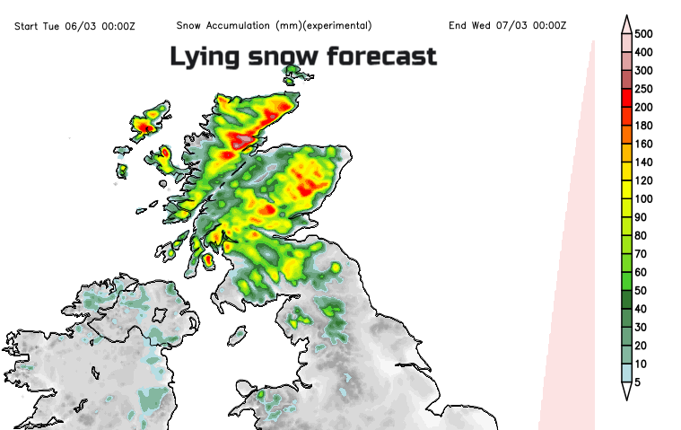
This week will bring milder conditions to the south, winter continues in Scotland and in-between some fair weather with spells of rain and hill snow. Even seeing sunshine! There could be a bit more snow for NW England and Northern Ireland on Tuesday, but Scotland stays wintry over the next few days.
Temperatures this Monday morning range from 5 or 6C in the south and only 1 or 2 further north where there are warnings for Ice. After the severe drifting, there are still some roads closed in northern Britain, mounds of snow at the roadsides and slushy wet snow and ice. There is still a yellow Be Aware warning for snow for Scotland (away from the west)
“Snow will mainly fall inland and will become increasingly confined to hills and mountains during Monday. Further delays to travel and public transport could occur.” Met Office
It is murky and grey in places with mist and fog. There is a dampness in the air with the melting snow and sodden ground. There could be localised flooding due to surface water from the gradual thaw and isolated coastal flooding issues around high tides, Wye estuary today – Environment agency. SEPA in Scotland said that a
“Steady thaw of lying snow will minimise flood risk.”
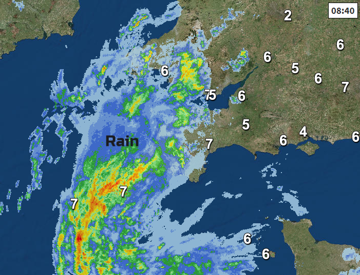
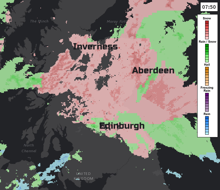
As snow showers continue to come into the far NE of Britain, we have an area of heavy rain over SW Britain. This rain rotates up from the Channel Islands today, staying wet over Cornwall and Devon, then more of the West Country and Wales. Later in the day, the rain spills over central southern England too, reaching the south Midlands, and the rain over Wales extends to the Isle of Man into Dumfries & Galloway by this evening.
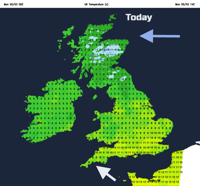
Temperatures in southern counties will reach into double figures, much milder than it has been, but there will be a brisk SE wind off the Channel. Northern Ireland might see 5C with a bit of rain and sleet for eastern and northern counties. The far north of Scotland will have a fresh to strong easterly wind making it feel even colder; the snow will continue to blow in for Grampian, Sutherland, Caithness and Orkney.
Tonight
Overnight the SW area of rain continues to move northwards through the Midlands, Wales and into northern England, also affecting eastern Northern Ireland. This should mainly be rain but will have sleet and then hill snow for the hills of northern England. With a fresh east wind, it won’t be very nice over the Pennines and still the risk of ice in the north.
Tuesday
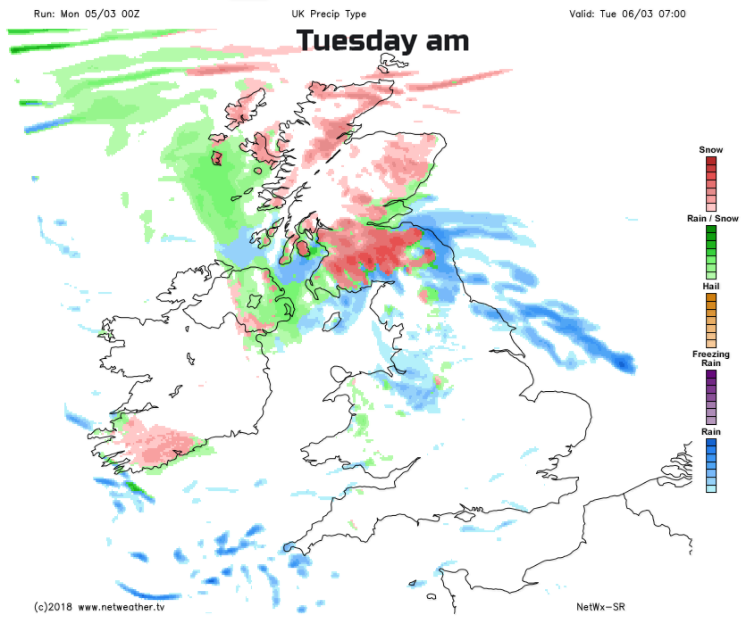
Looking at the charts for Tuesday morning over the far north of England and central southern Scotland, there could be more snow, wet snow not snow like last week. We have this area of rain hitting the cold air over Scotland for morning rush times, particularly over the Central Belt inland. It’s cold here anyway with plenty of lingering snow. There will be falling snow for higher ground and a cold east wind. It’s all moving northwards through Tuesday morning, reaching northern mainland Scotland afternoon/evening. So, shouldn’t be prolonged but worth keeping an eye on this through today even at low levels if travelling tomorrow. Rest of the UK will see brighter skies behind the rain area. In the SW breeze, the day will have a different feel after last weeks chill.