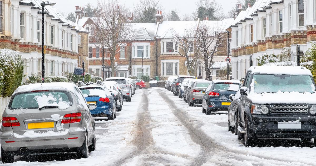
The cold spell continues, with plenty more snow showers packing in on that biting wind - especially in the east.
The cold spell continues. Overnight we've seen lows down well below freezing in many parts, Altnaharra in Scotland was the coldest spot at -8.5c, but even in southern England, Farnborough made it to -8c.
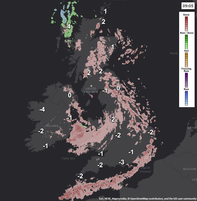
As well as the cold start, we also have snow showers, these are particularly affecting eastern regions, but a system also moved through overnight is pulling away from Wales and moving toward Ireland now. Here's the radar and temperatures from a little earlier (you can view the live radar here).
The snow showers carry on through today as well. It's mostly eastern regions bearing the brunt, but some will move a good way inland. The southeast and northeast of England will be the most prone spots, with several cm's expected here. Not everyone will catch the showers though, so one place could get a whole load of snow, whereas a few minutes down the road, very little or none.
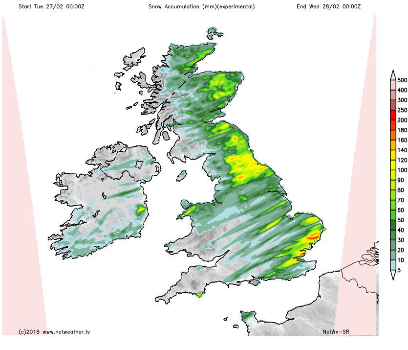
These are the forecast snow amounts for today.
 As you may expect, temperatures will struggle today, with most parts struggling up to 0 to 3c. The wind is still strong too, so feeling even colder when you take it into account. This evening and overnight, it'll be another very cold one with lows widely dipping from -5c to -8c.
The snow showers will keep coming overnight as well, with those accumulations really beginning to grow, with drifting snow becoming more of an issue. Into tomorrow, it's more of the same, although southeast corner may well see the showers ease back through the day, as the focus shifts a little further north.
If anything it'll be colder still tomorrow, with -1c to 1c perhaps the max. Overnight another severe frost will form, with -10c not out of the question in some places.
And then we get to Thursday... Starting with the simple bit first, it stays cold with the bitter east wind still blowing lots of snow showers in from the east. There will be a complication arriving though, in the form of low pressure to our south. That's going to increase winds to gale force in southern regions - especially near to coasts. It's also going to be trying to push weather fronts up into the colder flow, which is likely to mean some heavy snow, perhaps blizzard conditions and maybe some freezing rain as milder air sneaks north later.
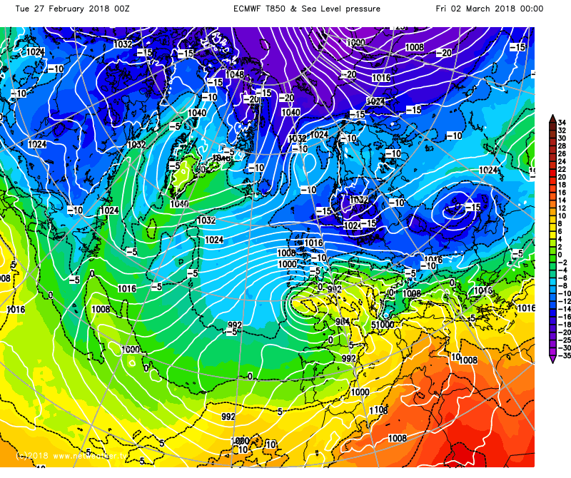 There is a lot of uncertainty over how this is all going to play out though, with the models struggling with the track and intensity of the low. That uncertainty continues right through into the weekend too, with the low pressure doing what it can to push milder air, with rain, sleet and snow further north, but potentially really struggling. The most likely outcome currently, is an eventual north-south split, with the very cold air staying in the north with snow showers, whereas the south turns a bit milder. We'll keep you updated on during the next few days as things become clearer.