Mostly dry and bright but cold to end the week and through the weekend. Even colder next week, as bitter conditions arrive from Siberia
It’s been a cold start for most with a frost in places, which will lead into a generally day, though cloudy in places. The story to end the week and through weekend is of staying mostly dry and settled thanks to high pressure close by to the east, but feeling a little colder, as an easterly breeze picks up. The easterly wind will strengthen as we head into next week and will pull in bitterly cold air all the way from Siberia by Monday, bringing with it snow showers, particularly for eastern areas. Temperatures early to middle of next week will plummet in the increasingly cold air with many areas struggling to get above freezing by day, while overnight temperatures fall well below freezing, perhaps into minus double digits.
For now, some will have to scrape their windscreens this morning, with temperatures widely falling close to or below freezing away from the far southeast and far northwest – where we have more in the way of cloud to start the day. There are few fog patches around as well, but for many it’s a cold but sunny start to the day.
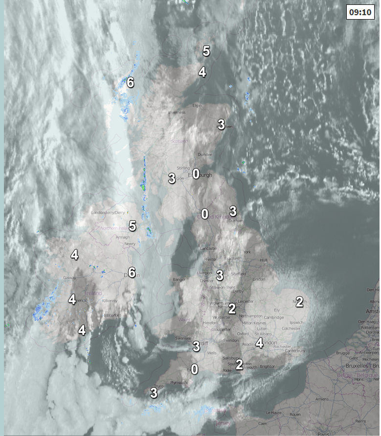
For most it will remain dry with sunny spells, once any early mist and fog has cleared this morning. There will be more in the way of cloud at times across SE England and East Anglia, where there will also be an easterly breeze, making it feel colder than of late. But for most, winds will be light and from the east. Thicker cloud and turning windy for the far northwest, with some rain later in NW Scotland.
Temperatures this afternoon at 3pm
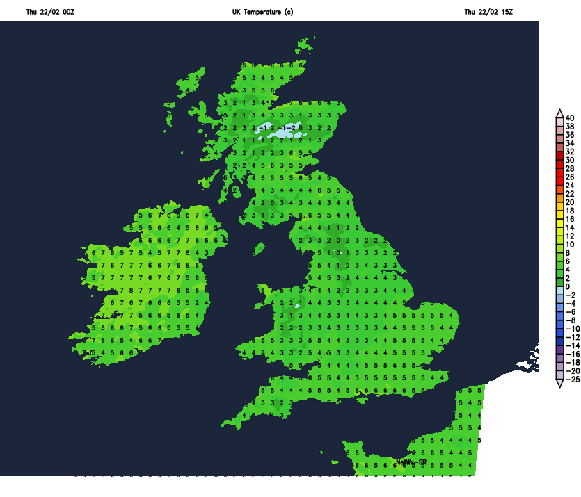
The highest temperatures today will be across Northern Ireland and NW Scotland – reaching 7C here, generally temperatures reaching 4-6C, so colder than of late.
Windy with some patchy rain for a time across the far northwest of Scotland, before clearing overnight to join all parts to a dry night with clear spells, temperatures will fall close to or below zero in many places, leading to a widespread frost forming.
Friday will be another generally dry day with sunny spells, after a frosty start. High pressure building over Scandinavia will be in control, bringing an easterly flow – which will make it feel on the cold side and will bring a few light wintry showers to eastern coasts. With the breeze tomorrow coming off a cold near continent, temperatures will reach 4-5C at best, perhaps 6C in the far west.
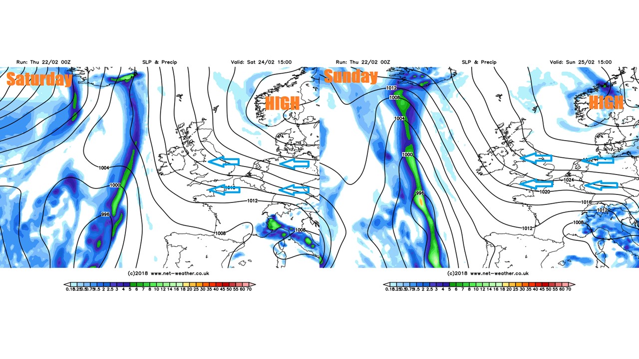
Similar conditions as we head through the weekend, with high pressure over Scandinavia continuing to build and keeping Atlantic frontal systems at bay to the west of the British Isles, so it will be mostly dry and sunny by day, but with a widespread frost developing overnight where skies clear. The easterly wind will be a noticeable feature as it strengthens further through the weekend, bringing more in the way of cloud and perhaps snow flurries to eastern coastal areas, but generally making it feel raw in the wind. Temperatures will struggle to reach 3-5C generally, despite the sunshine. Risk of snow showers developing later on Sunday towards eastern coastal areas, perhaps giving a dusting overnight.
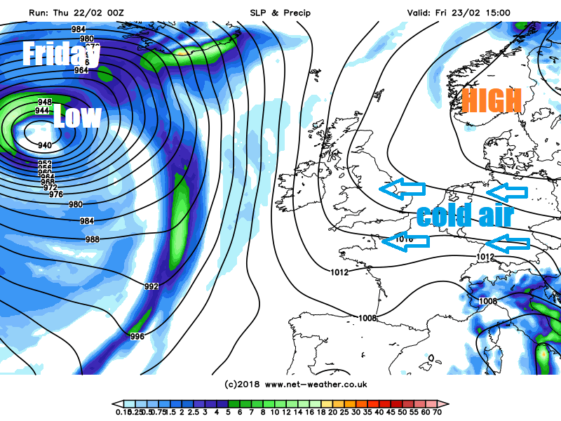
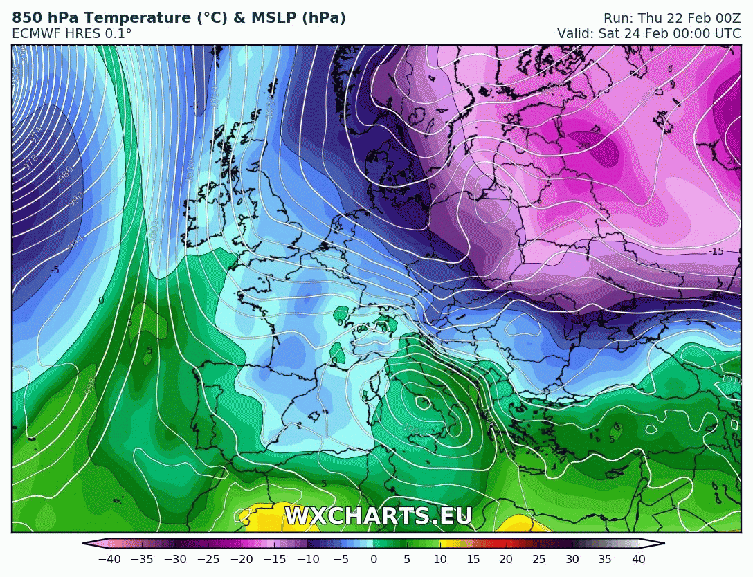
The start of next week will see bitterly cold air arrive all the way from Siberia, where temperatures are below -30C currently. We won’t see temperatures this low but they will like struggle to get above freezing during the day and in some places staying below, while overnight temperatures fall well below freezing, perhaps into minus double digits in sheltered areas where winds fall light.
Credit: wxcharts.eu
Snow showers will affect eastern coastal areas initially on Monday and Tuesday, perhaps forming bands of frequent snow showers that move further inland at times, a few disturbances in the easterly flow may bring more organised snowfall. Snow will readily settle given the low temperatures and very dry air. So there is potential for snowfall to become disruptive in places, particularly towards the east, though it’s too far away to pinpoint any detail to where.
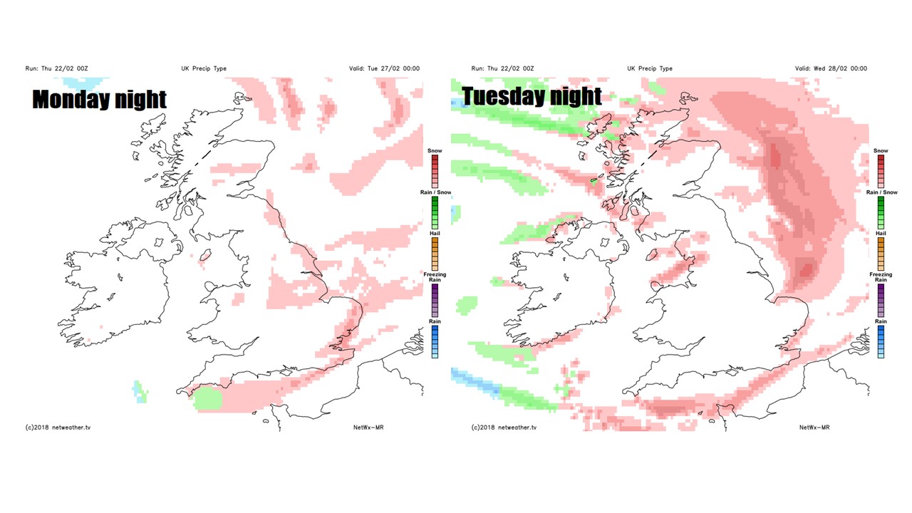
There is potential that later in the week, Atlantic low pressure systems moving in across France to perhaps drift far enough northeast to bring further snow along associated frontal systems across southern and central areas, but low confidence on this for now.