February is the coldest month in one of every three winters, and it's off to a cold start this year.
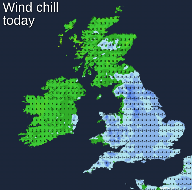
Despite the lengthening evenings and the somewhat lighter mornings, February is still the coldest month on average in one of every three winters. This'll probably be the case this year, so the old adage 'as the days grow longer the cold grows stronger' does have some truth about it. It'll certainly feel cold today, but on the thermometer, it won't be unduly so, with raw winds of North European origin making it feel colder than it actually is particularly over England and Wales.
The remnants of yesterdays rain, sleet and hill snow have largely 'petered-out', but there are still quite large areas of cloud over much of England, Wales and the East and South of Scotland. Temperatures are generally just above freezing, but there'll be a few icy patches first thing mostly in hilly areas and over East Anglia where skies have broken overnight. In the West, it'll be mainly dry through the day with sunny intervals, while central and particularly eastern areas keep more cloud.
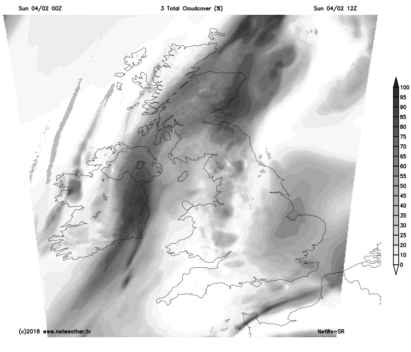 There'll also be scattered showers that'll be wintry on hills in a raw North to North Easterly wind, with temperatures generally getting no higher than 4 to 6C. Northern Ireland will be dry with sunny spells as will be the North and West Scotland, once a few wintry showers first thing have cleared from Caithness. Winds here will be mostly light making it feel more pleasant in the sunshine, but it will be rather cold, with top temperatures no more than 5 to 7C.
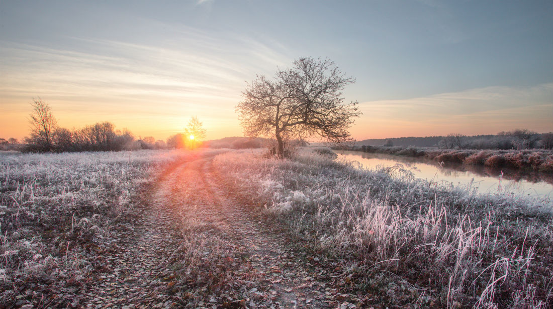
After dark, the East coast, East Anglia and the South East, continue to see a scattering of wintry showers. They are also more likely to fall as snow particularly on hills, with the North and South Downs and perhaps the Chilterns getting a slight covering by morning. There'll continue to be that raw North to North East wind, with lowest temperatures close to freezing. Elsewhere skies will break giving clear spells, and with light winds, a few mist and fog patches will develop in rural areas. There'll also be a widespread slight locally moderate frost as temperatures fall mostly to between -4 and 0C.
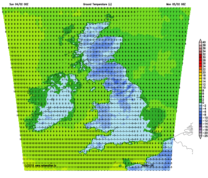 A raw North Easterly breeze continues to bring cloud and some mostly light wintry showers to East Anglia and the South East on Monday, that'll fall as snow in places at first particularly in hilly areas. For most though, the working week will get off to a fine but frosty start. Patchy fog will soon clear leaving a day of variable cloud and spells of winter sunshine. Away from the South East winds will be light, but across Northern Ireland and the North and West of Scotland, it'll cloud over through the day, with a southerly breeze developing to bring some rain, sleet and mostly hill snow later. It'll be another cold day, with maximum temperatures only 3 to 6C.
Remaining wintry showers towards the South East will fade after dark, allowing skies to break. This'll lead to a frost on Monday night, particularly over England and Wales. By the early hours the North West and perhaps Clwyd will be turning more cloudy, with the chance of some rain, sleet and snow in places by morning. Scotland and Northern Ireland will also see some rain, sleet or snow overnight, with amounts and the extent of any snow a little uncertain at the moment. This'll be followed by clearer skies that should have reached all but the East and South of Scotland by dawn. Much of southern England will lose that raw North Easterly wind overnight, with a South to South Westerly breeze over Scotland and Northern Ireland 'veering' North West or Westerly later. Lowest temperatures -2 to +2C.
While there's the risk of snowfall over England and Wales on Tuesday mostly on hills, as winds turn into the North West then South West through the week, it'll gradually become less cold. Pressure may rise in the South towards the weekend bringing mainly dry weather with the risk of patchy fog and frost overnight, while the North and West remain unsettled, milder and breezier.