Various parts of the UK will be subjected to brisk, bitter winds this weekend, others relative calm. There's rain and hill snow too with next week looking more wintry.
Today will be more settled with a lot of drier weather, just a scattering of showers and the cold NW wind will ease down later on. Saturday sees rain and hill snow from the west with chilly winds following for a cold weekend. There are signs of more widespread snow for Tuesday next week.
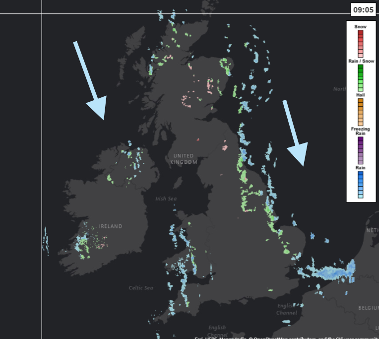
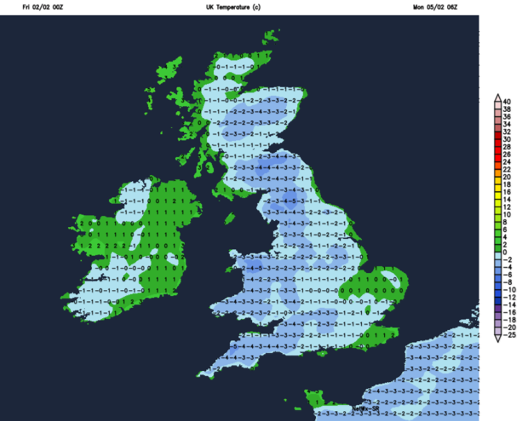
Temperatures this morning start around 3 or 4 and will reach 6 to 8C. The winds will still be brisk this morning for the south-eastern half of Britain and make it feel chilly coming down from the north and bringing the showers in the flow. There is a line through Wales into Devon and Cornwall, a few over Derry and Tyrone and more coming in from the North Sea. The eastern showers are more organised with wet weather passing over Norfolk into Suffolk, showers turning wintry as they move inland over the hills of northern England and eastern Scotland. There will still be a moderate/fresh N to NW winds over Kent and around the Thames later this afternoon but elsewhere will have light winds. Most of the showers will have faded by then and there will be clear spells ready for a chilly night.

There will be widespread frost over Britain with light winds and clear skies but further west an Atlantic front is heading in, bring cloud, strengthening NW winds and then a band of rain and hill snow. There maybe sleet, and wet snow down to low levels at the leading edge.
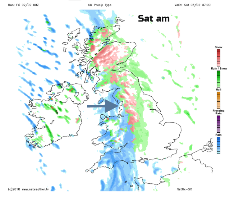
There will be a spell of wet weather from this front stretching north-south, heavy over north Wales and Cumbria. As it moves eastwards during Saturday the rain will become lighter and looks like it won’t reach East Anglia as it falters. Temperatures will be around 4C but a great contrast across the UK. Eastern areas will be calm with hardly any wind and the western half will have cold, chilly NW winds reminding everyone it is winter.
Look at the wind strength for your location, that is the key to how it will feel this weekend.
Although there will be a lot of cloud around the frontal band, Northern Ireland will see brighter skies and sunshine but also a feed of well scattered wintry showers from the NW. Rain and sleet will whistle past with a bit of snow settling on the hills and the risk of ice. Wales, SW England and much of Scotland looks wet and windy with snow settling on the top of the highest ground of northern Britain. By Saturday evening the wet weather will be over London, all the way up the A1 into NE England, Aberdeenshire
As the front fades, a lot of cloud will remain over England and Wales with clearer skies for Northern Ireland and Scotland, and a frost here with lighter winds. Cold, fresh north winds keep going for the West Country so a chilly night here.
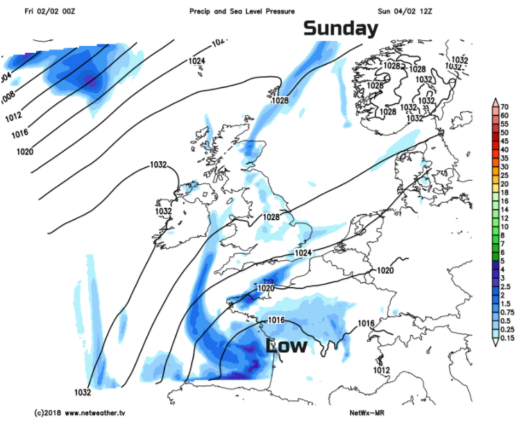
Overall there will be a lot of fair, bright and dry weather about on Sunday. A few sleet and hail showers will continue to feed in from North Sea coasts and with a low pressure over France there could be damp weather spinning off that and clipping SE England in the morning. Overall, not bad but just an old decaying occlusion bringing a bit more cloud and coastal dampness NE to SW across the UK, especially for Grampian. There will be brisk NE winds for southern England and this will make it feel cold, so although it won’t look too bad that wind will give a chill.
Overnight will be clear and cold with light winds so a widespread frost for Monday morning.
Monday looks fine, sunny but chilly before the southerly winds pick up and a cold front heads in from the NW. This will bring more cloud, stronger winds, colder air and precipitation which will turn to snow. Tuesday could be interesting, we’ll keep you posted.