The Six Nations kicks off this weekend, the UK weather is looking cold even wintry for some.
Plans for the weekend, going to be out and about? Don't hold out hopes for comments like "Isn't it warm, almost like spring" especially in the wind. It's thermals, hat, scarf and gloves weather, a reminder that February is a true winter month. If you don't have a ticket for the rugby, spending a day in front of the telly might be just the thing. (Other family members may not agree. )
It's the weekend
By Friday evening, the cold brisk winds should have eased down, taking their time over SE Britain and it will be a cold, frosty but dry evening.
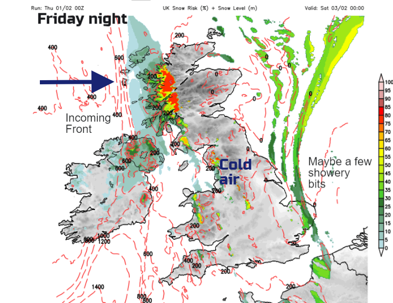
Things begin to change from the west overnight
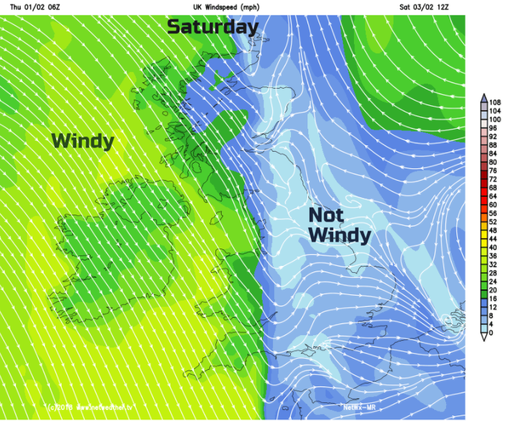
Saturday starts with cold, calm weather over much of Britain, especially in the east. Further west, it will be wet and windy and even wintry for Northern Ireland, Wales and bits of western Britain. A brisk NW wind will make it feel cold.
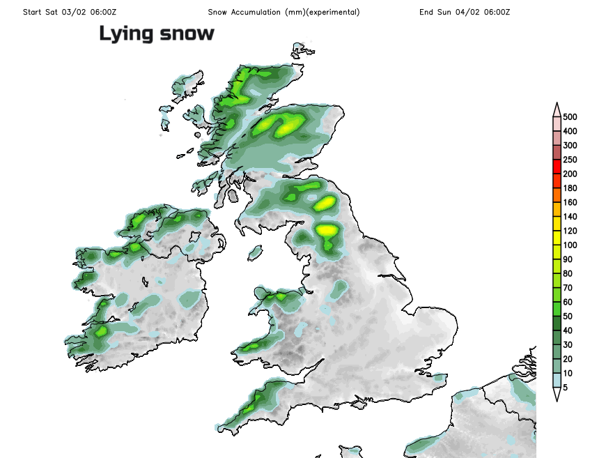
There is some uncertainty about the progress eastwards of a frontal band stretching right through the UK north/south. There will be a band of rain and hill snow, ahead to the east increasing cloud and behind to the west, brighter skies with wintry showers. So, do bear this in mind if you are just looking at hourly symbols on an app. If the frontal timings change a bit, your weather will be quite different. Parts of Scotland, Wales and western England could see quite high rainfall totals on Saturday if the rain band stalls. Keep an eye on the Radar to see the progress of the band, and blustery sharp showers following.
Temperatures will be around 5 to 7C but feeling colder in the brisk wind which picks up for Wales and SW England later in the afternoon.
Rugby
As the Six Nations starts: Wales play Scotland on Saturday afternoon with the risk of rain, and a damp chill in the air at Principality Stadium.
France v. Ireland at the Stade de France early evening, it looks cold and possibly wet, with the rain hopefully clearing later in the evening for the Women's Six Nations.
Sunday- Italy v. England looks fine and positively tropical in comparison at 12C with the men's match mid afternoon and women's early evening. Light winds and only 8C by the evening.
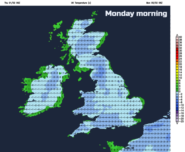
Saturday night becomes more settled with the winds easing, the wet weather stopping, any wintry showers fading and a frost taking hold dependent on cloud cover.
The wind will be from the NE on Sunday, still noticeable for East Anglia and southern England but light elsewhere. That brings a chill for SE Britain and a rawness by North Sea coasts and along the Thames. Best of the sunshine will be for north-western half of UK, over Northern Ireland and Scotland with lightest winds. Temperatures could be a degree higher but the feel of the day will depend on the wind. There will be more cloud for England and Wales with a little bit of sleet or hail in the morning but more settled to end the weekend.
Then a widespread frost overnight, so be prepared to scrape a windscreen on Monday morning
Saturday – cold. Windy in the west. Rain band with sleet and hill snow moving across the UK
Sunday – cold again, wintry flurries, brisk winds in SE. More settled and drier.
Risk of ice, hill snow, sleet to low levels, wind chill. Will it snow?