A mild Sunday on the way, but colder air will be filtering south behind a band of rain overnight and into tomorrow.
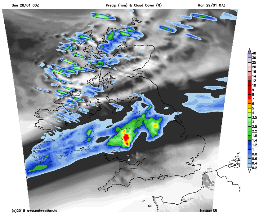
Winter has largely left us for the moment, with most of the country in a very mild West to South Westerly airflow. The air is also very moist, so there's lots of cloud around as well as some rain, with the heaviest bursts at first this morning over West Scotland. Through the day a slow moving front will bring further bursts of rain to central and southern Scotland, with somewhat brighter conditions giving a scattering of blustery showers further North. We also have showers over Northern Ireland, but these will move away, to leave much of the day here dry if though rather cloudy.
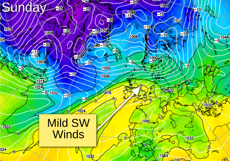
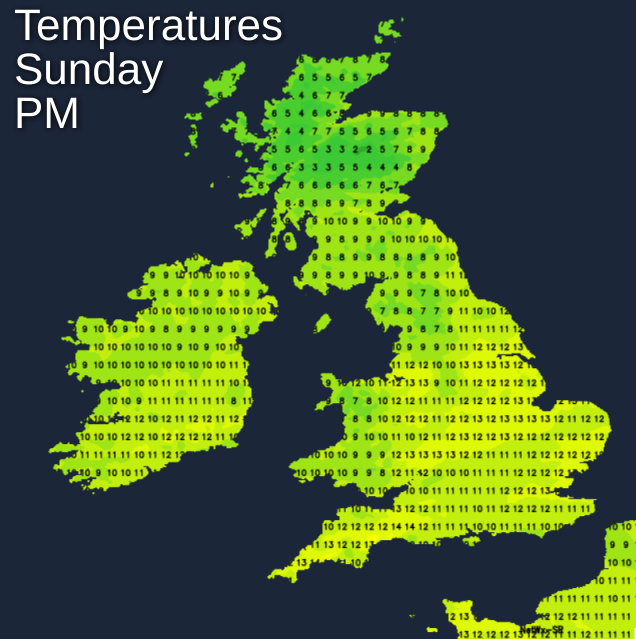
Across England and Wales there's also a good deal of cloud with patchy, drizzly rain, mostly over Cumbria and in the West making it occasionally misty on hills, but the emphasis today will be on mainly dry weather. Parts of the East and South East already have a few cloud breaks, and where you have shelter from a gusty West or South West wind that'll be strong with gusts to gale force in exposed areas, further breaks will appear. Most likely to see glimpse or two of the sun are to the lee of the Welsh mountains and in the East and South, but most parts will keep a good deal of cloud. It'll become very mild perhaps exceptionally so in the brighter spots with afternoon temperatures widely in the range 10 to 14C. Northern Scotland, however, will be a somewhat colder with 6 to 8C more likely here.
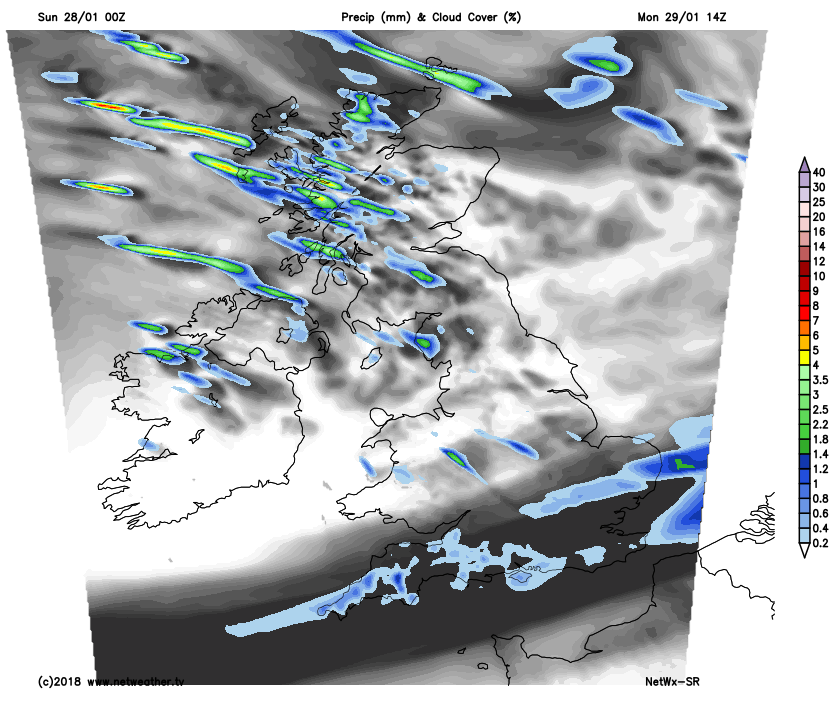
After dark, most of England and Wales continue mild and breezy, with many places keeping a good deal of cloud. Apart from a little patchy light rain or drizzle in the wind, it'll stay mainly dry, with further breaks in the cloud sheet in the East and South. Later in the night though, a front may bring heavier bursts of rain to Cumbria and the far North of parts of northern England. Northern Ireland and much of Scotland will have some rain into the evening, before somewhat clearer, colder weather although still with scattered showers spreads to all but Lothian and The Borders overnight.
A brisk South West wind will continue to be strong or gale force over exposed coasts and hills in the West, before 'veering' West or North West over Scotland and Northern Ireland into the early hours. This'll introduce colder air, with a touch of frost possible in some sheltered glens by dawn. Across England and Wales, however, it'll be a mild night, where temperatures are unlikely to fall below 7 to 10C.
 For Scotland and Northern Ireland, the working week begins brightly with sunny spells, especially over Down, Armagh and sheltered parts of central and southern Scotland. Here some places could stay dry on Monday, but there'll be a scattering of showers. These will be most frequent over northern Scotland and the Northern Isles, where some will be heavy and wintry on hills. After some rain, it'll also become brighter from the North over England and Wales. This will give some sunshine, but much of the day in the South will be cloudy, with patchy rain coming along later in the afternoon.
 A moderate or fresh West to North West wind will continue to be strong and blustery in the North, but somewhat lighter than of late further South. It'll feel colder though, with top temperatures 5 to 7C in the North and 9 to 11C across southern England.
The Channel Islands may stay mild and cloudy after dark, but for most, it'll be a dry evening and night with clear spells as showers wintry on hills in the North, become confined to the North and West of Scotland. Lighter breezes particularly in the South will allow it to turn quite cold, with a fairly widespread ground frost away from exposed coasts. There'll also be a touch of air frost in sheltered rural areas, as temperatures fall to between -1 and +4C. Towards dawn, West Scotland may see cloud increasing again ahead of the next Atlantic system moving in.
The remainder of January sees the driest, brightest weather in the South, but it'll remain unsettled with further occasional rain or showers. In the first few days of February, there's a trend for colder North Westerly outbreaks, but these shouldn't last much beyond next weekend.