Bit of a chill out there this morning but the mild air will return over the weekend, with brisk winds and rain from the Atlantic.
It’s colder out there this morning but not as windy. Many areas will have a fine, dry day with sunshine. There is a bit of fog and some frost about. Although the air temperatures will struggle during Friday, overall it will be pleasant winter’s day. There is a light northerly wind, brisk over SW England but it will ease down everywhere as pressure builds
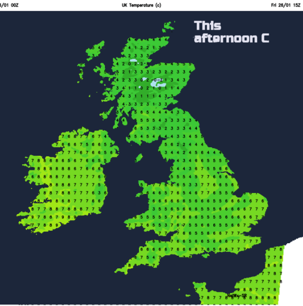
There are a few showers about first thing, but these will fade. Many areas are starting the day with temperatures around zero. Daytime temperatures will reach 5 to 7C for Northern Ireland and Scotland with England & Wales around 6 to 9C. We’ve seen 13 and 14C this week so quite a change. It will be a quiet day before changes arrive from the west this evening.
A spell of wet and windy weather will sweep across the UK Friday night into Saturday. Western areas will see a good deal of rain, especially NW Scotland this weekend and it will become very windy over the far north of Scotland later on Saturday. Sunday looks mild with rain in the north and sunshine further south.
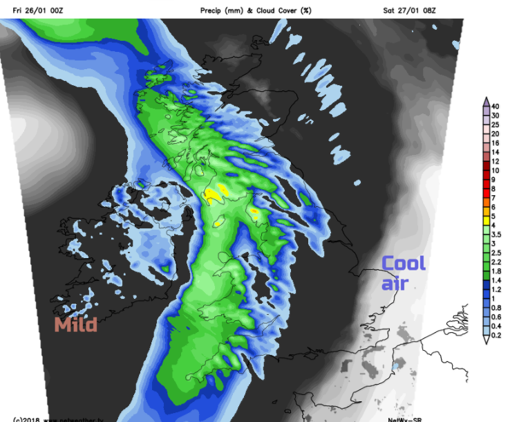
Tonight, temperatures will dip again but staying around 3C as high cloud arrives ahead of the frontal rain and the breeze picks up slightly from the SW. One band of rain will move over Northern Ireland this evening into western Scotland and across the Irish Sea before midnight. That then fades somewhat, and a warm front arrives over Ireland with more rain setting in before dawn.
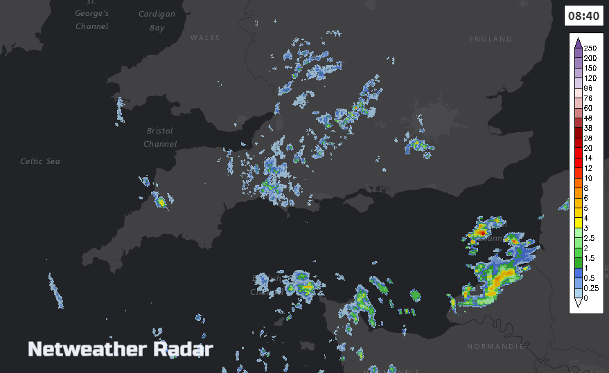
There will be another fine cool start for SE Britain on Saturday and Northern Ireland will improve and brighten up as the rain band heads east. It will be a blustery day and worth watching the Netweather radar to see the progress of the rain.
As the rain band clears, the skies will brighten, it will stay windy and there will be a few showers about. These will turn wintry for NW Scotland over the high ground. The mild air will return with temperatures up into double figures for the southwestern half of the UK. Westerly gales, even severe gales will affect the Northern Isles and the Pentland Firth on Saturday evening and overnight. The strongest winds head away from Shetland before dawn on Sunday as the low pressure moves towards Norway.
Sunday
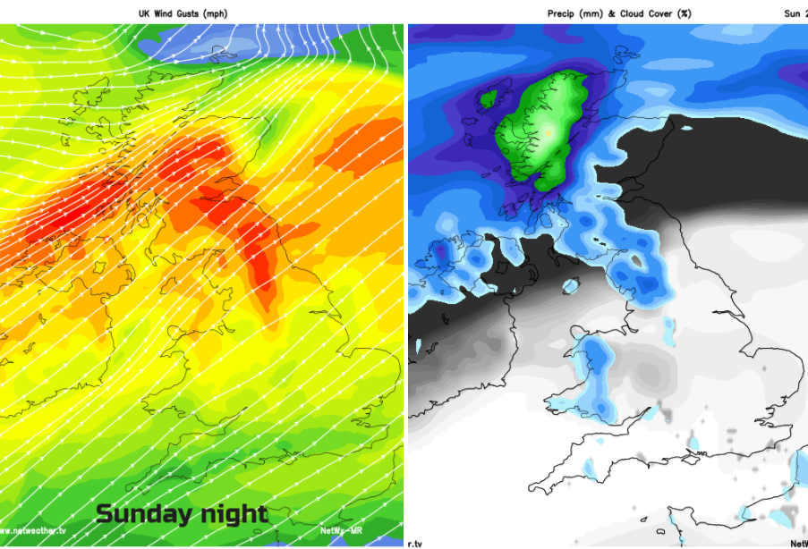
Sunday starts off fine for many, and again the mild air will lift temperatures. A warm front will bring rain in from the Atlantic over Northern Ireland into Scotland from the west and also for NW England. Wales and around the Irish Sea will be grey and damp and generally, there will be a lot of cloud about in the morning. Hopefully, the skies will brighten in the mild air over much of England, Wales and Northern Ireland. Cumbria and Lancashire could stay grey and damp as the frontal band of rain moves northwards through Scotland, bringing high totals to the NW Highlands. It will be windy overnight ahead of the rain band with gusts around 65mph.
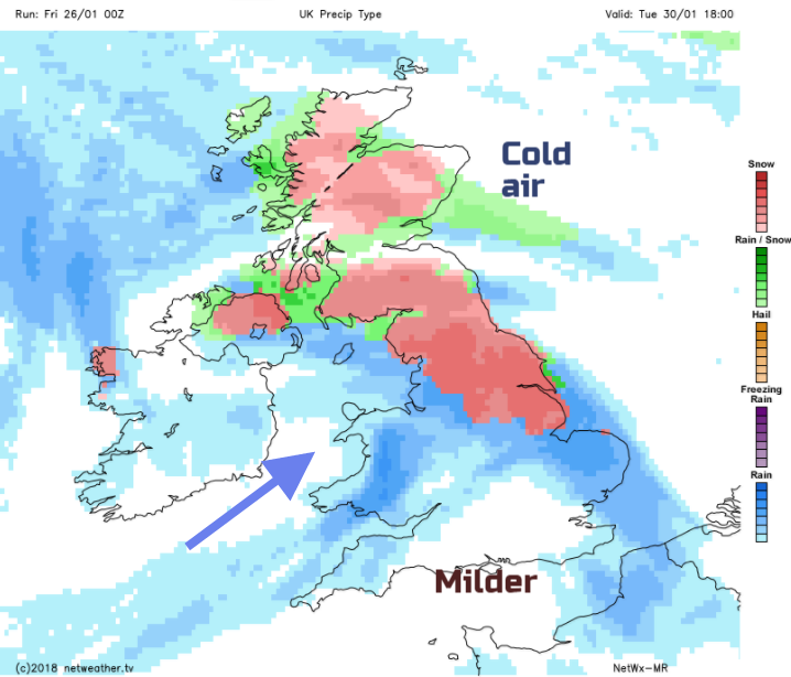
Next week
The frontal band then returns southwards during Monday, mild conditions ahead of it, cool air behind. This seesawing of cold to mild air continues, with a frost on Monday night and then the possibility of a warm front edging in from the SW on Tuesday. You’d be watching that kind of setup for hill snow at least, but there is more of a signal for snow later on Tuesday as the front heads north. That’s a fair few days away but looks like a low pressure to watch as it could bring strong winds over southern Britain too.