


A look back at the last 7 days, that brought disruptive snow and a few named storms bringing severe gales.
The weather in the UK this past week has certainly been in the news a lot, mostly because of the travel disruption caused by snow and ice that has affected much of Scotland, Northern Ireland and the higher routes across northern England, but also severe gales brought some damage and travel disruption to parts of England on Thursday morning, as a controversially un-named storm swept through before affecting Holland and northern Germany with damaging gusts during Thursday. Snow and ice continued to cause problems for Scotland, Northern Ireland and northern England for the rest of the week and into this weekend. But milder air will flood all areas to start the new week.
So, I thought I’d look back at an interesting week weatherwise across the UK, by analysing what was behind the disruptive weather and perhaps some interesting facts and figures.
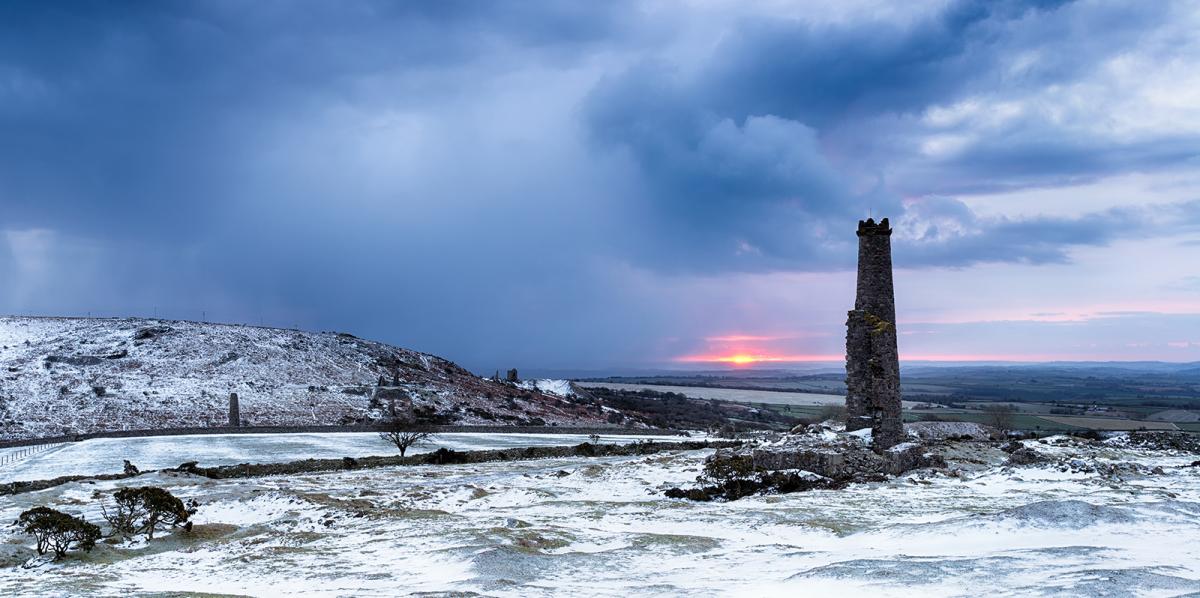
After a quiet anticyclonic spell of weather in the run up to last weekend, a big change occurred to start the week, as a strong Atlantic jet streak arrived off the Atlantic to end the weekend and ushered in wet and windy weather sweeping southeast last Sunday night. Sunshine and showers followed the rain on Monday, turning increasingly wintry across Scotland later in the day, as increasingly cold air sourced from a very cold NE Canada and southern Greenland filtered in. This cold polar maritime flow becoming cold enough across Scotland, Northern Ireland and the far north of England for snow to fall, settle and build up for much of the week. Further south there was snow in the showers, but because of greater modification of the polar airmass further south over the Atlantic, subsequent higher temperatures for central and southern areas meant snow unlikely to settle apart from overnight.
Tuesday saw frequent sleet and snow showers piling in across Scotland, Northern Ireland, northern England, Wales and SW England, even reports of ‘thundersnow’ in places in the west as far apart as Yeovil, Manchester and Glasgow. Frequent snow showers brought whiteout conditions on higher routes and a covering of snow in the north, increasingly to lower levels, particularly in the evening across Scotland and Northern Ireland – where motorists were struggling on some routes to complete journeys, as snow was settling quicker than it could be cleared, leading to vehicles being abandoned or roads closed. By the evening, 28cm of snow had fallen at Eskdalemuir in Scotland and 17cm in Glenanne in Northern Ireland.
The Irish weather service Met Eireann on Tuesday named a swathe of strong winds moving in from the west Storm Fionn, the forecast strength of the winds, particularly over western counties, meeting their criteria. Although the ‘storm’ wasn’t the usual area of low pressure seen on pressure charts, the disturbance brought a gust of 75mph at Mace Head in County Galway and large waves to SW England, with 50ft waves reported by a weather buoy off SW Ireland.
Further north, snow showers become frequent and heavy across Northern Ireland and southern Scotland Tuesday night, leading to problems for the morning commute in these areas on Wednesday morning. By Wednesday morning, 39cm of snow had fallen in Eskdalemuir in Scotland and 22cm in Glenanne in Northern Ireland.
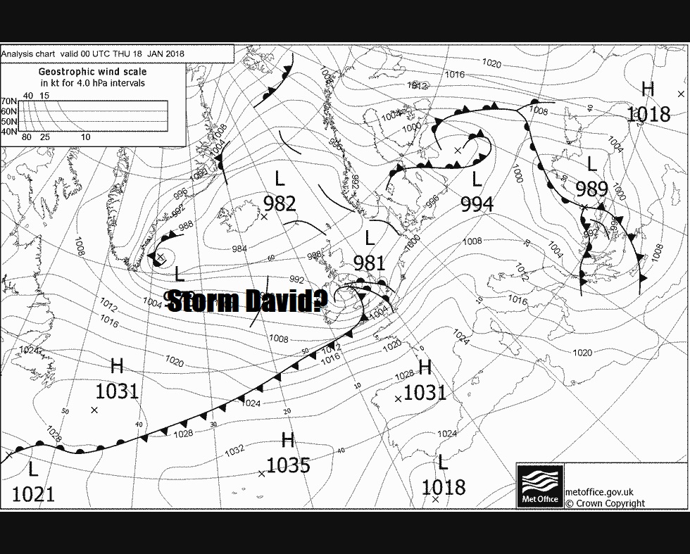
Sleet and snow showers slowly eased on Wednesday, with snow becoming increasingly confined to the north, with many areas dry and sunny away from the north and west. However, trouble was brewing in the Atlantic, as a low pressure system that had formed off the eastern seaboard of North America took a ride on a strong Atlantic jet stream and rapidly deepened as it neared the UK and moved on to the cold side of the jet stream.
The storm wasn’t named, despite it continuing to deepen rapidly as it raced across central Britain and bringing damaging winds gusts across England and Wales. The high winds brought down trees, some on to railway lines, caused power cuts to 28,600 homes and businesses across England and Wales, worst affected was eastern England on Thursday morning, caused damage to property and forced the closure of some bridges on major routes. Top wind gusts from the storm were 89mph at Capel Curig in north Wales, 83mph at Tibenham and 76mph at Mildenhall both in East Anglia. Given such high winds and the disruption is caused locally, I think it should have been named, given storms with lesser impacts in the past have been named by the Met Office.
Also, the same low pressure system brought some heavy snowfall on its northern flank, with an amber warning for snow issued by the Met Office for southern Scotland and NE England and yellow warning issued for Northern Ireland, the rest of northern England and western Scotland. Heavy snow brought 35cm to Eskdalemuir in SW Scotland, 25cm to Drumalbin in Lanarkshire and 20cm to Spadeadam in Cumbria.
The same storm continued to deepen as it raced east over the North Sea, deepening to 977mb, and brought damaging wind gusts across Holland and northern Germany during Thursday. A powerful dry air intrusion descending from the tropopause bringing damaging sting-jet type wind gusts from higher up to the surface and also responsible for the strong gusts in southern UK earlier on Thursday. The storm was named Friederike by the Germans and David by the French (even though it didn’t really effect France apart from the far north), perhaps confusing having all the European weather agencies giving the same storms different names and having different criteria to the Met Office and Met Eireann. Storm David brought 89mph gust to the exposed Hook of Holland on the Dutch coast, 76mph to Amsterdam Schiphol Airport – leading delays or cancellations to flights and the Dutch railways halted services for a time. Northern Germany also saw some violent wind gusts and is being hailed as the worst wind storm for 11 years, since Kyrill in 2007, after killing 8 people, a gust of 79mph was recorded at Munster, 69mph in Dortmund.
Further sleet and snow showers affected Scotland, Northern Ireland and northern England on Thursday and Friday, with wintry showers in other western areas further south. Further warnings were issued by the Met Office for snow and ice, an amber warning was issued for Friday between the central belt and SW Scotland for heavy snow showers.
Early Saturday morning saw a large contrast in temperatures between Scotland and SW England, it was 11C in SW England and as low as -6C in the Highlands of Scotland. Outbreaks of rain affected much of England, Wales and Northern Ireland, with hill snow in the west, especially N. Ireland, Scotland saw further snow showers in the west. A very cold night followed last night across Scotland and N England over the snow fields, the temperature fell to -13.5C at Dalwhinnie in northern Scotland, making it the coldest night of the winter and coldest night since February 2016.
Another Atlantic frontal system moving in today has brought a mixture of rain, sleet and snow, most of the snow becoming confined to northern Britain Sunday afternoon, as less cold air filters in from the west across southern areas, though there was snow initially for many central and eastern areas of England this morning, even as far south the southeast of England, bringing a dusting over higher ground.
Constant rain over recent days across SW England has caused a landslide and flooding in North Devon this morning.
Less cold conditions will move in across most areas from the west overnight, with many areas escaping a frost tonight. Milder air will flood much of the UK to start the coming week.


