An action packed week with strong winds, blowing snow and hail showers in from the west. A deep low later Wednesday bringing more gales, rain and snow. Feeling colder for everyone.
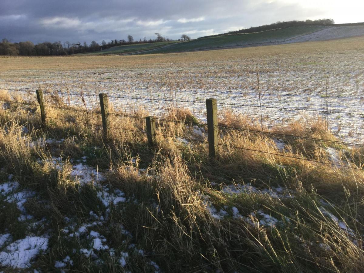
That was a wet and windy night. This week will bring more strong winds, gales and we are keeping an eye on a low for Wednesday night. As the UK sits in a colder flow from the NW, wintry showers will take hold, whistling in from the west. Snow showers will be more frequent from tonight, with accumulations over the hills, mainly of the north-western half of the UK. The Welsh mountains, Exmoor and Dartmoor will see some snow too. There will be snow even to low levels but its hit and miss with the showers. SE Britain and eastern Britain look to miss the showers as the winds come in from the Atlantic.
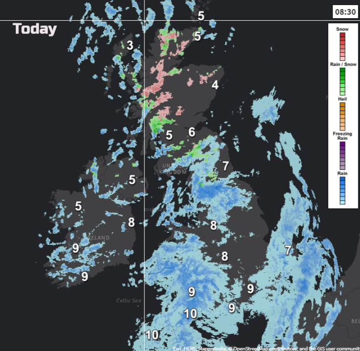
Overnight a frontal system has moved south-eastwards bringing wet and windy weather which is now over SE Britain. Those winds were noisy and there has been some heavy rain as the active cold front arrives. The temperature difference north to south shows 3 to 11C with milder warm sector air over southern Britain and the first signs of this week’s cold air taking hold.
This week there will be strong winds and gales, ice, heavy rain and snow and blizzard conditions.
Monday
Great start for the Monday morning rush hour, wind and rain over much of England and Wales, all adding to the busy, still dark conditions on the roads this morning. Gusts of 50 to 60mph continue as the frontal bands clears to the SE. Colder air with breaks in the clouds spreads down from the north and it won’t be as windy in the day. So, after early highs of 10 or 11C, temperatures will fall in the south. Further north dipping away after an early 7C
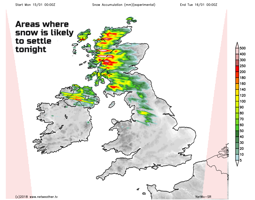
By this evening it will be cold with a freshening west wind. There will be clear spells and showers. These will be turning wintry and snow will begin to settle. The Met Office has a Yellow Be Aware warning over NW UK. Temperatures for northern Britain and Northern Ireland will drop below freezing; there will be a cold wind driving lines of showers inland. Snow will begin to accumulate over the hills and mountains, with blizzard conditions possible on higher level routes and drifting snow. Showers with hail and thunder are possible and icy conditions so for areas where this wintry weather reaches, conditions won’t be ideal. This feed of rain, sleet, hail and snow showers continues through Tuesday into Wednesday.
Strong winds will affect much of the UK from Tuesday afternoon onwards with high gusts and coastal gales (away from Scotland). Still the showers feed in, with further accumulations on the hills, flurries to low levels and even a slight covering for low levels. Other parts of the UK will have fair, bright even sunny conditions with a chilly wind. You may see a flurry of snow in the air or sleety showers or hail, but the focus is for the west, particularly northwest of the UK. The strong winds later on Tuesday could push wintry showers right across the UK
In the far south temperatures could still reach 7C but further north it could be only 2 or 3C by day.
Midweek
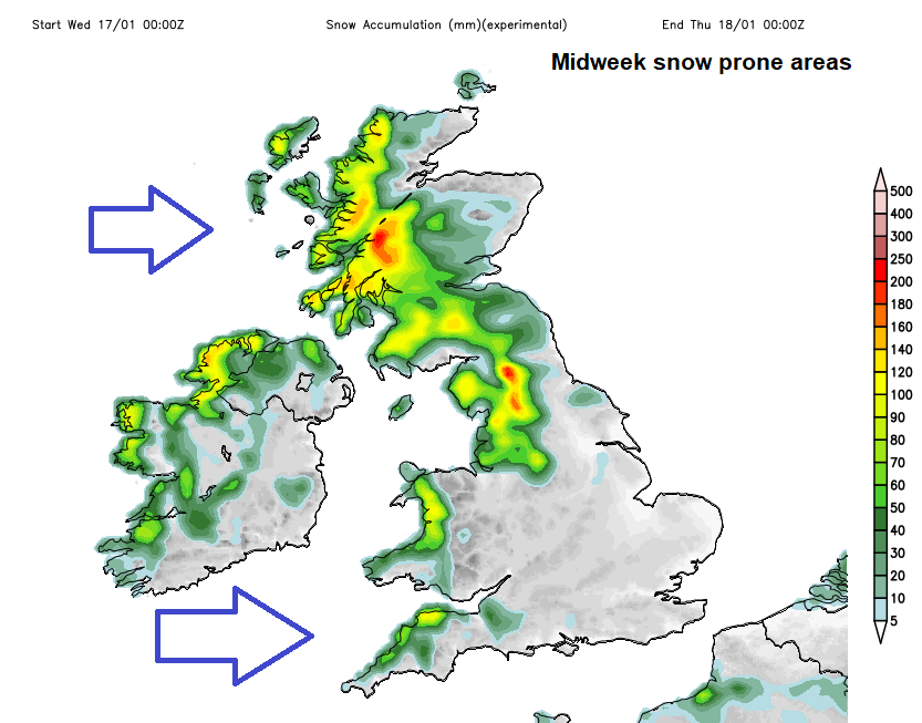
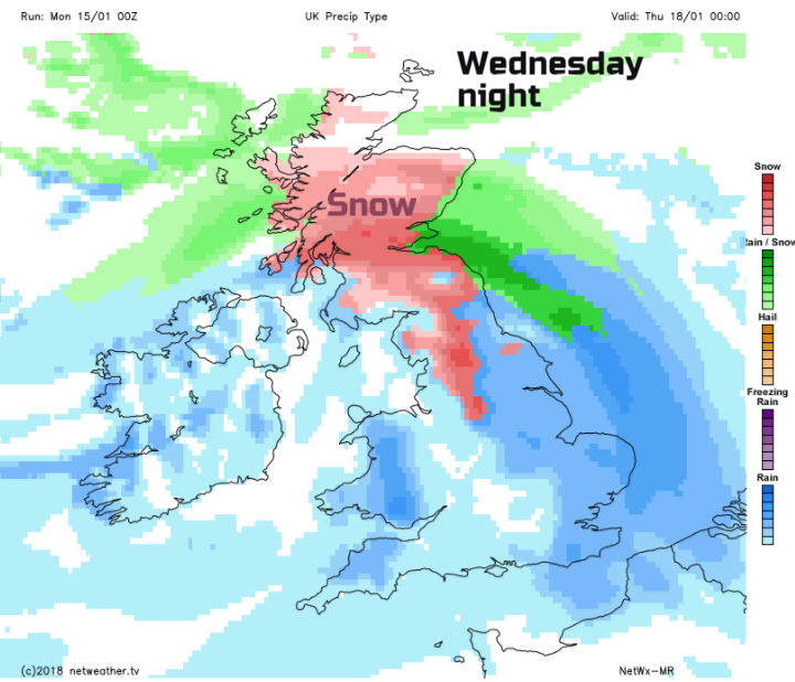
After a windy start on Wednesday, there will be a bit if a lull with a brief ridge of high pressure, few showers and sunshine. Then a developing low pressure is forecast to head towards the UK. This will bring strong winds, heavy rain and more snow to the UK
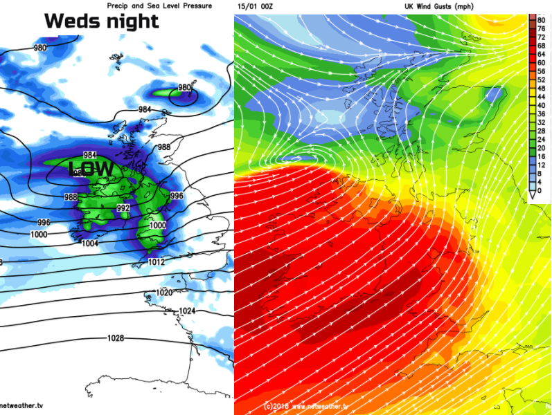
It looks like the strongest winds will move over Ireland, Wales and England on Wednesday night clearing away from SE and eastern England on Thursday morning. This will be something to watch. The low pressure will bring a spell of heavy rain which will turn to snow over the high ground of northern Britain. The low could track further north or south so take the snow areas with caution at the moment.
Once that low clears, we are back to the chilly westerly flow with fine bright skies and wintry showers from the west.