Our weather is still blocked for now, so little changing. Rain and wind will try to move into western parts later tomorrow, but it's the end of the weekend before more substantial change starts to arrive.
So often, the north and the west of the country are the places to bear the brunt of wind, rain or showers, but today it's again those spots which will see the best of the sunshine. Elsewhere, it's a murkier picture with mist, fog and low cloud hanging around for much of the day in many areas.
It's been chilly overnight, with some patches of frost to go with the fog. Those parts which keep the fogginess will stay cold all day, elsewhere 4-7c will be typical.
Another night of patchy frost and fog, along with plenty of low cloud follows, and then tomorrow sees a very similar start to the day to today. But change will be on the way in the west, as cloud thickens and winds strengthen as the day wears on. Further east though, it's definitely a case of as you were, with a lot of cloud, and mostly light winds.
With pressure still high to our northeast, the low bringing the wind, cloud and eventually rain into the west will really struggle to make inroads further east than across Ireland and into the western fringes of mainland Britain. Even so, it's going to bring a wet, windy evening and overnight for a good part of Ireland. The rain will creep into southwest England after midnight, reaching other western counties of England, Wales and Scotland by dawn.
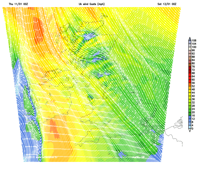 Gales, maybe even severe, are likely in exposed coastal spots of both Ireland and western Britain. Elsewhere, Friday night will be breezy, which should mean a lack of mist and fog, but still a fair bit of cloud around.
Into the weekend, the low bringing the wind and rain quickly loses its oomph and sinks down into France. The winds will ease back, and the rain in western parts will become a lot more patchy. It will throw a lot of its cloud east though, so another mostly dull day in prospect, with the best of any brightness in the east. With the keen southeast breeze, it'll not feel an especially mild day, but the thermometer will show 4-7c typically, perhaps 8-10c in the far southwest.
Sunday brings a change, with lots more sunny spells to be had. It also brings the start of a more substantial pattern change, with a deep low pressure system nearing Iceland, eventually throwing a front down from the northwest later in the day. The low itself is going to move east into Monday, squeezing the high pressure which has been over Scandinavia, further east into Russia, which in turn will unblock our weather as we start next week.
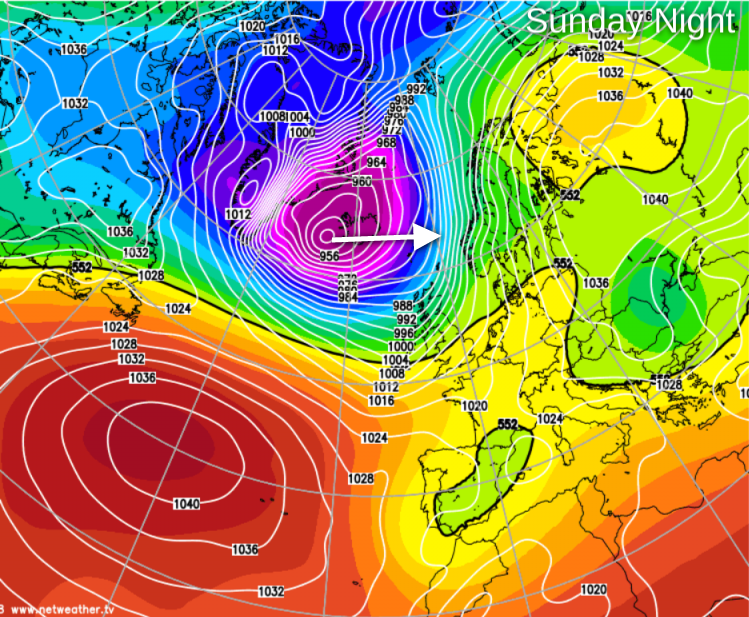
The front will bring a spell of at times, heavy rain, along with squally winds down through Scotland by the start of Monday. Moving southeast across the rest of the UK through the day - clearing the southeast corner after dark. Behind the front, a chilly 'polar-maritime' airmass moves in, bringing with it a rash of showers - many of them wintry, especially up over the hills of northern Britain.
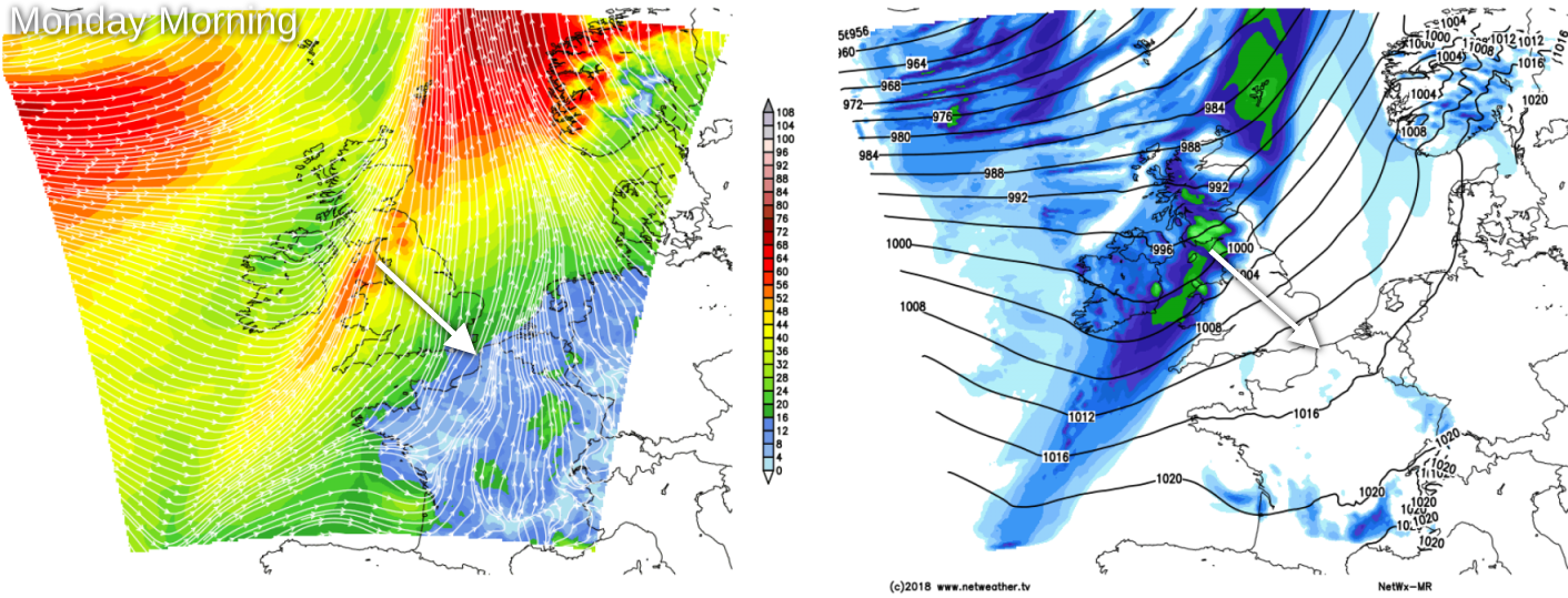
That then brings us into an unsettled period of weather next week, with high winds along with showers or longer spells of rain coming through. With winds often having a northern tilt to them, it'll mainly be on the cold side, with the risk of snow at times, especially in northern parts.