


It's going to get much colder for the end of this week with widespread frost and a scattering of snow showers. The brisk NE wind will make it feel bitterly cold.
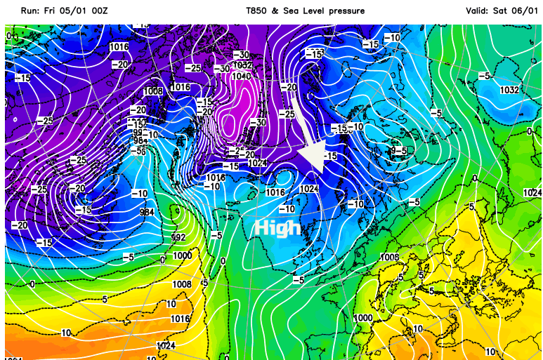
This week has been windy with a succession of low pressures nipping across the UK bringing rain. Things will change for the weekend as high pressure settles our weather down. It will become drier but the winds keep going and it will feel bitterly cold wind with night times severe frosts and a chill by day.
This morning temperatures range from +2C in the north to +8C in the south. It is murky and grey in places with several bands of rain and hill snow. It is raining over Scotland with snow inland for the Highlands as an occluding front lingers. This nudges southwards as more cloud and rain showers arrive from the North Sea. This northern precipitation will include sleet at low levels and bring more snow over the hills and mountains.
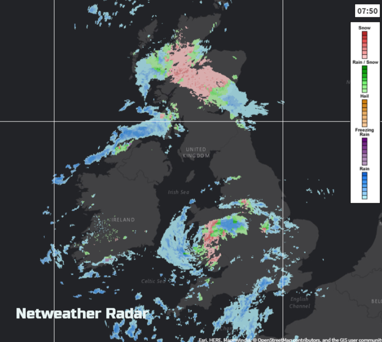
You can see on the radar a swirl over Wales, from a little low pressure. The model isn’t defining this very well, so beware of fine detail if looking at a weather app, or hourly forecast this morning. The swirl of cloud, rain and hill snow will head east, across to the Wash today. There are brighter skies for the SE and northern England at times with sunny spells, but heavy showers will also feed in on the brisk SW winds still affecting Channel coasts. Devon and Cornwall look set to get some hefty downpours today as lines of showers keep on coming. Most of Northern Ireland will fair quite well today and have a fine day with sunny spells, although there will be more cloud and damp weather along the north coast.
The strong SW winds for Kent and London will ease down this afternoon. Temperatures across England will be around 6 to 9C. At the other end of the country a fresh strong NE wind will set in for the Scottish Islands. In between winds will be lighter and temperatures will be lower than yesterday at 5 to 7C.
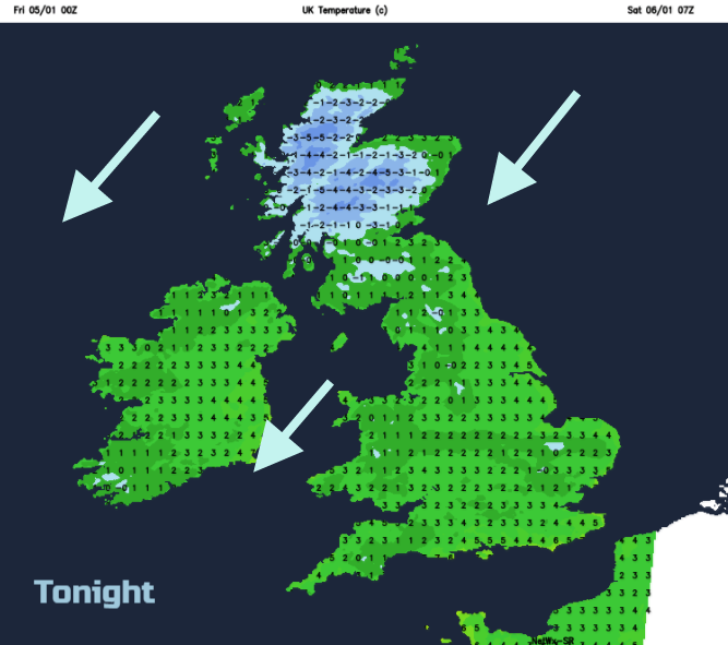
Tonight, the NE wind takes hold and so does the colder air. The northern band of rain and hill snow moves into northern England overnight with outbreaks of rain and sleet for Northern Ireland too. Showers continue to feed in from the English Channel into southern England and gradually these two areas merge by dawn with more cloud and damp weather over southern Britain. Further north will be clearer skies with sunshine and a real chill. There will be a widespread frost and the NE wind will bring snow showers into NE/eastern Scotland and NE England with some reaching the Pennines and down past the North York Moors.
This weekend's NE wind will make you pull your coat in tight.
The far SE of England will manage to reach 9C, but the cold air will reach into Kent by the afternoon. The brisk winds will ease off for northern Scotland later in the day as the high pressure builds in, but temperatures may not get above zero in places. Wales, the Midlands, East Anglia all look quite grey and damp on Saturday adding to the chill. There could be some sunny spells further south, but the cloud will feed in later.
This band of cloud will disappear southwards on Saturday night, leaving a cold, clear night. There will still be a feed of snow showers in off the North Sea, well scattered but giving a covering for a few prone spots. The bitter wind will continue over the south-eastern half of the UK and temperatures will plummet to the NW. Inland Scotland could see below -10C where the winds fall calm.

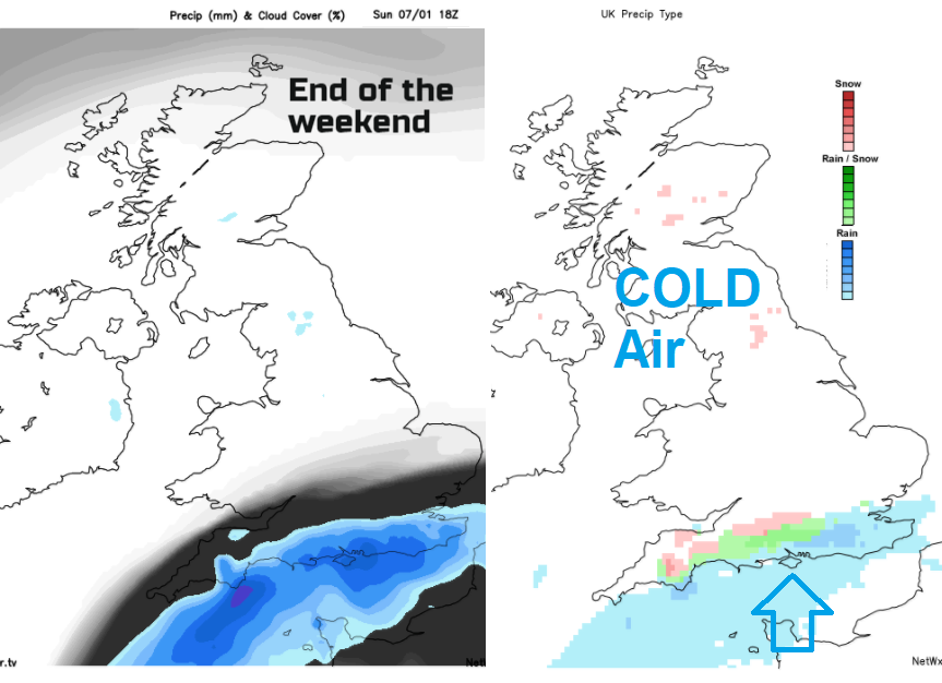
Sunday will start off cold, fine and sunny with ice and frost. England and Wales will keep the brisk bitter wind. Overall Sunday looks dry but there is a weather front lurking in the English Channel on the forecast charts. This looks to bring rain to the Channel Islands during Sunday but also edge northwards to southern counties of England. It will then come up against the cold air and so could turn to snow. There’s not much of a signal at the moment and there is lots of uncertainty, but it will be worth keeping an eye on as the next day will be Monday and back to school with all the extra traffic that involves.
It will be another cold night with a widespread frost away from SE Britain, with another cold windy day on Monday.


