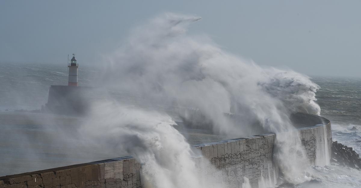
Low pressure systems frequently rattling in to start 2018, bringing spells of very wet, very windy weather with them.
The weather is welcoming us to 2018 with a special kind of party, and it's just low pressure systems which are invited. A steady stream of them will be turning up over the next few days, bringing plenty of wind and rain with them.
The first is moving through today, just nearby to southern England. That'll mean southern counties will see some persistent rain running through during the first half of the day - clearing the southeast by mid-afternoon. Elsewhere, showers are already affecting northern and western parts which are wintry up over the higher ground. These'll become more widespread as the day wears on, not all will catch one though.
It'll be a breezy or blustery day just about everywhere, with the strongest winds nearer to the low pressure, affecting Wales, southern and central England. Temperatures today will range from a fairly chilly 4-7c for northern England, Scotland and Northern Ireland to a milder 7-9c further south.
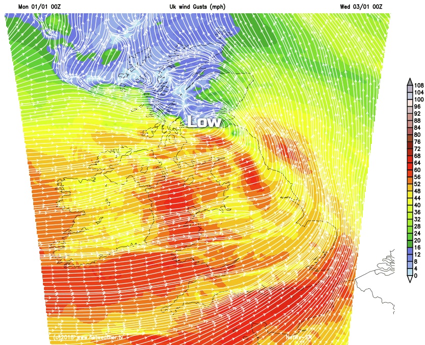
Overnight tonight, a lot of the showers will die back to leave clearing skies and a touch of frost in many places. That's only part of the story though as rain will be moving across Ireland during the early hours, reaching western Britain first thing on Tuesday. The rain, with sleet and snow over the hills of northern Britain, will zip east fairly speedily. But with a developing low hot on its heels, more rain and very strong winds will arrive during the second part of the day.
There's some uncertainty over the precise track and strength of this low. Currently, it's expected to cross southern Scotland, with the strongest winds affecting just about all parts to the south of it. So a wet, wild evening and night on the way Tuesday into Wednesday for many of us.
It stays very windy through Wednesday, with frequent, squally showers blowing in from the west. These'll be heavy at times, and wintry up over higher ground. The low pressure will eventually move far enough away into Scandinavia for the wind and showers to ease back, but we'll only be getting a very brief break as the next one will soon be moving in from the Atlantic.
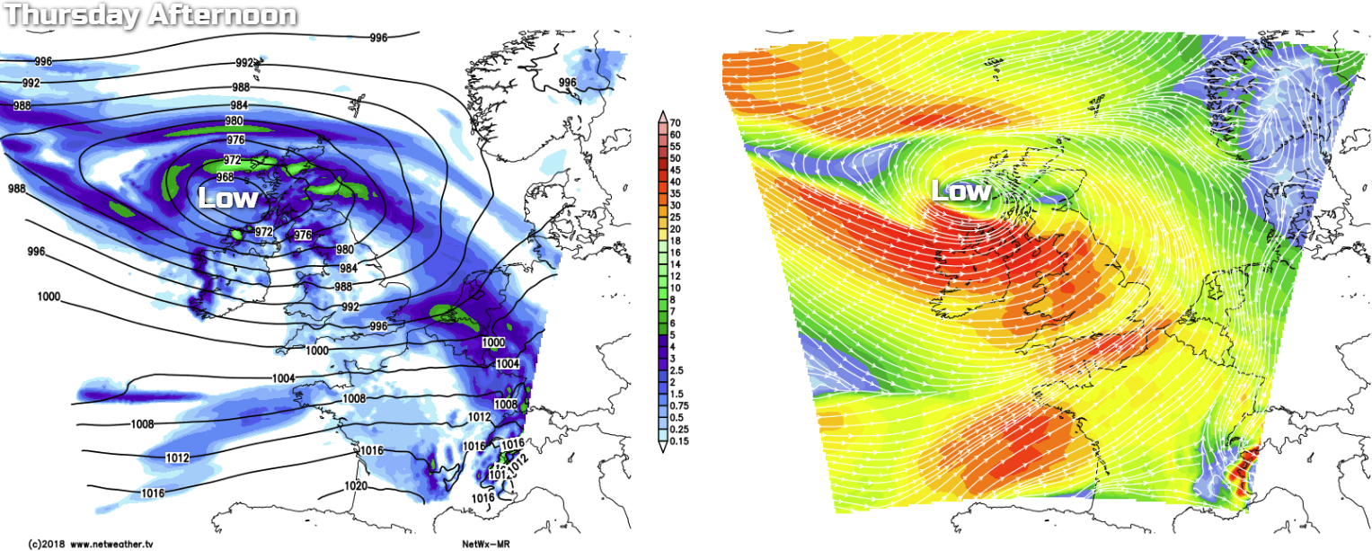
That means another spell of wet, windy weather moving in from the west into Thursday, with gales or even severe gales again likely. As ever with these Atlantic lows, nailing down the precise timings and track will be tricky, but this is how the Netwx-MR currently sees it for Thursday afternoon.
Friday will see the low moving out into the North Sea, but it'll stay windy for a time at least. There'll also be plenty of showers around, these likely to be turning increasingly wintry as winds swing more into the north.
Into the weekend, we're likely to see colder air making a move down from the north, with high pressure potentially putting in an appearance as well. So, we should at least see some more settled weather for a time at least, especially during the second half of the weekend. With perhaps just a few wintry showers nearer to coasts by this point.
That's all a long way off though. And with plenty of weather to come in the meantime, please do stay tuned to the latest forecasts over the coming days, as some weather-related disruption is possible.
Wishing you a very happy new year, from the whole team here at Netweather.