


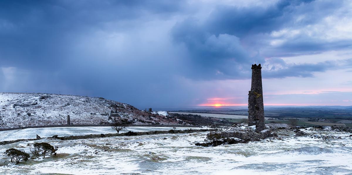
Cold & sunny for most today. Rain returns tomorrow, snow for parts of northern England & southern Scotland.
Parts of England and Wales experienced difficult conditions on Wednesday, as heavy snow, ice and flooding brought travel disruption and power cuts. Although the snow amounts weren’t particularly significant, certainly compared to what other countries experience regularly and deal with better in winter, the modest snow still caused the usual chaos. The worst areas affected were the West Country, central southern England, The Midlands, northern Home Counties and East Anglia, as overnight rain moving in turned to snow, as colder polar air undercut from the north during the morning, early rain washing away some of the salt applied to the roads that experienced problems.
The wintry weather cleared away east yesterday afternoon leaving behind clearing skies, which has led to temperatures falling widely below freezing overnight in the cold polar flow. So, there is a risk this morning of ice on untreated wet surface, particularly where we saw the rain, sleet and snow across parts of central and southern England, but also where we have seen wintry showers through the night across northern Scotland and also off the Irish Sea across NW England, parts of Wales and into SW England.
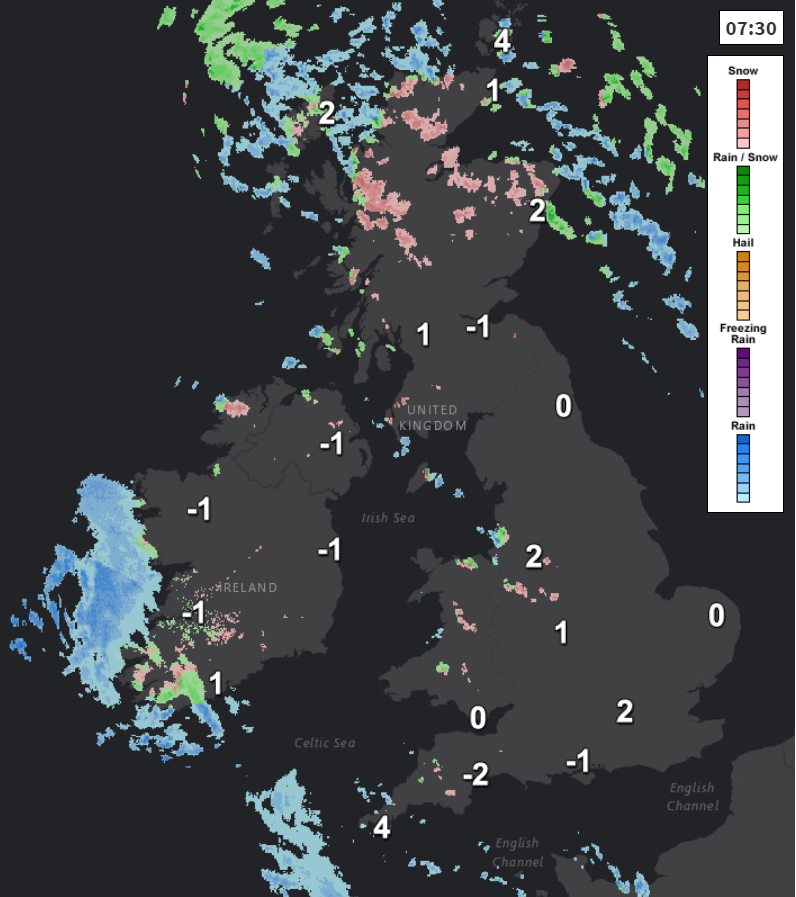
So, Thursday starts off on a bright but very cold note, particularly where we have snow cover from yesterday’s snowfall. There are also some freezing fog patches to watch out for across Northern Ireland, which maybe slow to clear through the day. But for many it will be a dry and sunny but col day after the cold and frosty start, there will be further wintry showers for NW England at first and northern Scotland, but these will slowly fade through the day. Some patchy rain may begin to affect the far SW of England. Temperatures reaching 0-3C across Scotland and Northern Ireland, 2-5C across England and Wales.
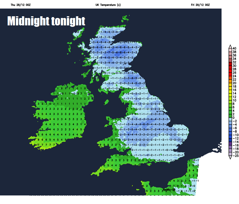
Many places ending the day with clear skies, which will mean temperatures will drop quickly after dark and lead to a widespread frost forming during the first half of the night. However, the clear skies and frost will become increasingly confined to eastern areas and eventually NE England, northern and eastern Scotland by the end of the night, as the wind picks up further west, with cloud and outbreaks of rain and hill snow moving in across southern and western areas.
So, Friday looks to start wet and windy across many areas away from the far north and northeast, rain across Wales, central and southern England to begin the day, with snow confined to higher ground of north Wales. But across northern England and southern Scotland we could also see snow falling to lower levels and lasting into the afternoon, bringing a risk of disruption. Drier and brighter but milder conditions moving in across southern areas after the wet start, temperatures reaching 7-9C. Mostly dry and sunny for northern Scotland but remaining cold across northern England and Scotland, where temperatures will reach 2-5C at best.
The milder theme gaining ground across the south on Friday will become more widespread over the weekend, as the jet stream that’s been to the south of the UK returns north and winds switch to a southwesterly direction. But, not before rain spreading in from the west on Saturday turns to snow for a time over northern hills ahead of the milder air moving in across all parts by Sunday. Rain will clear northwards during Saturday becoming confined to northern Scotland, where we may continue to see snow over the mountains. Drier for a time Saturday afternoon before wind and rain returns from the southwest in the evening and overnight into Sunday. Rain clearing northeast on New Year’s Eve to brighter and chillier conditions from the west, but still windy, with blustery showers. A chilly and breezy evening and night, with the odd passing shower, for those going out to see in the New Year.
The unsettled theme continuing next week, as a strong jet stream over the Atlantic directed at the UK brings further low pressure systems from the west. New Year’s Day starts bright and chilly, with perhaps a frost in the north, staying dry and bright in the north, but southern areas may turn cloudy and wet through the afternoon. Then the rest of the week likely to see a few low pressure systems roll through, bringing spells of wind and rain, with clearer but showery conditions in between these systems. Mild for much of the week, but it looks like turning colder later in the week, with an increasing risk of snow in the north and west.


