Another frosty start today, but milder air will be moving in from the west during the weekend.
It's another frosty, icy start to the weekend, but change is on the way as winds swing into the southwest by tomorrow, bringing a spell of milder weather with them. By tonight, the process will already be well underway, with only the eastern half of the country likely to see a frost, and that'll lift from the west as the night goes on too.
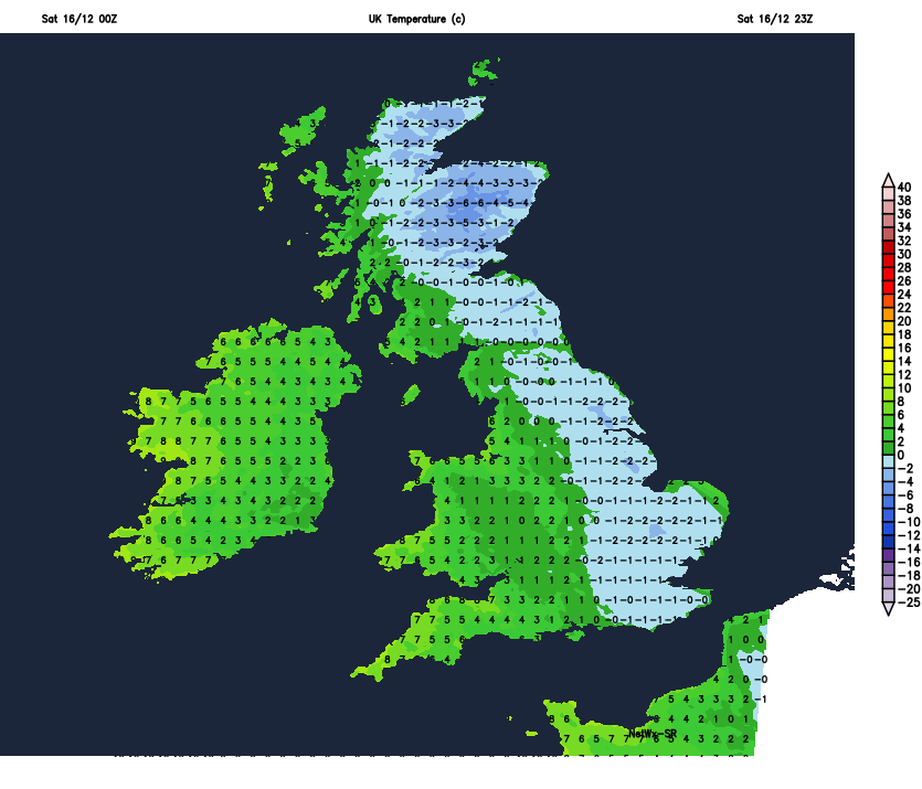 If you're braving the high street today, it's going to be a pretty chilly one, but with the sun coming out in many areas, it'll not be too bad. We do have some showers in the north and also running down from the northwest into Wales, the Midlands and later perhaps also southern England. But for the majority, it stays dry. Temperatures will peak at 4-7c for most, slowly recovering from the cold start, and quickly falling back down below zero across the eastern half of the country once the sun sets. The northwest wind will make it feel colder still - especially down the eastern side of the country along with much of Wales and southern England.
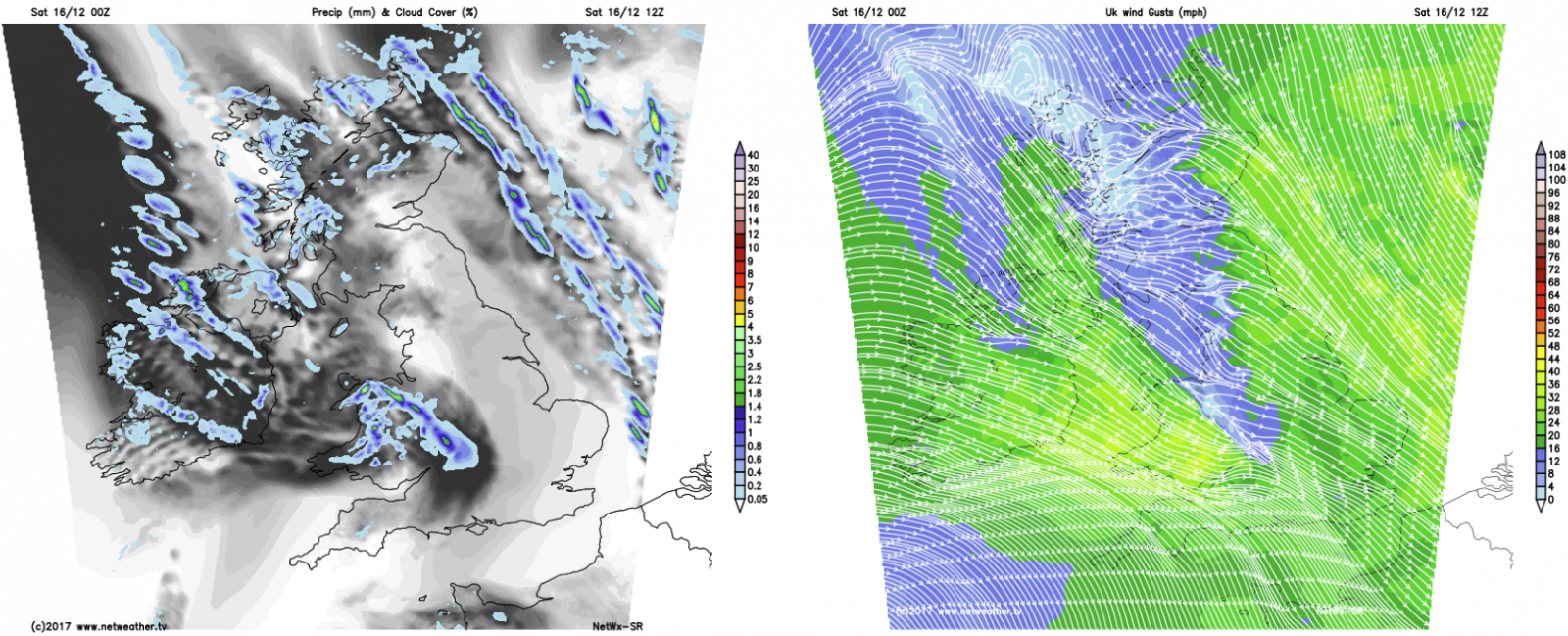
This evening and overnight, winds turn round to the southwest and strengthen across the north of the country. At the same time, the cloud will thicken and a band of rain will start to move down from the northwest, with some showers breaking out ahead of it into northwest England, Wales and Southwest England. By morning it'll be affecting a good part of Scotland along with Ireland, it then continues southeast during the day, reaching the southeast of England by early evening. Although by this point, it'll be mostly light and patchy.
Behind it, a few showers, plenty of cloud and milder air. Much of Ireland will see highs of 10-12c tomorrow, with the southwest of England joining it into double figures. Elsewhere it's a west to east split, 6-9c typically in the west, still 4-7c further east, after another frosty start here.
It'll still be chilly enough for some patches of frost in the north and east of the country overnight and into Monday morning. Then it's a fairly quiet day to follow, there'll be a fair bit of cloud and a few bits and pieces of rain in western parts, but for central regions especially, the sun should break through fairly regularly.
It's a case of more of the same on Tuesday as well, but with more cloud across all parts by this point. The southeast corner may stay cooler but it'll be a mild day just about everywhere else, with highs of 9-12c. Later in the day, a band of rain will turn up into northwestern Scotland - this'll be on a cold front, which after a bit of faffing around during midweek, will eventually introduce colder air across the country again.
As that front hovers around northern Britain from late Tuesday through to Thursday, there is likely to be some heavy and persistent rain at times. There's some uncertainty over this currently, but parts of western Scotland and northwest England could see upwards of 20-40mm during this period, which may be enough to create some issues with flooding and surface water.
Beyond that, the plunge of colder air is likely to be squeezed away east almost as soon as it arrives later in the week, with milder air quickly moving back in from the west during the weekend.