Staying cold today, despite sunshine. Wet tomorrow and mild in the south, then cold returning for all by Friday.
Last night was officially the coldest night of the year so far, with a very cold -13.0C recorded at Shawbury in Shropshire, with most of the UK widely below freezing at dawn this morning. However, if you are dreaming of something milder on your cold journey to work, you will be in luck, as milder conditions spread in off the Atlantic for tomorrow, though with it some cloud and rain. However, the cold air returns to the north later tomorrow and through Thursday, before cold conditions with a risk of frost returns across all parts for Friday and the weekend – as winds turn northerly.
So we start Tuesday on a very cold, icy and frost note, lowest temperatures of minus double figures over the snowfields of central, northern and western areas. Watch out for ice on roads and pavements on the journey to work, particularly where rain, sleet and snow has fallen over the last few days. Also watch out for some freezing fog patches across central areas. Many areas have clear skies, which have lead to the temperatures falling well below freezing, with just a few showers dotted around western and eastern coasts.
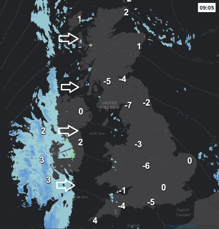
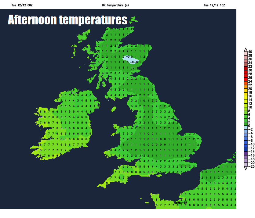
Through the morning and into the afternoon, showers will fade around coasts with most areas keeping clear skies with prolonged sunny spells throughout. But despite the sunshine, it will be very cold, with temperatures struggling to get above freezing where there is snow cover, elsewhere reaching 1-4C at best, perhaps up to 5-8C across the far west, where we will start to see a change as cloudier skies and outbreaks of rain and hill snow arrive from the west across N. Ireland this morning and eventually western Scotland by dusk.
Then through this evening and overnight, an occluded weather front will spread cloud and outbreaks of rain eastwards across all parts, less cold air arriving too, but not before some hill snow for Scotland, N. Ireland and northern England as the rain arrives. Skies may clear from the west for a time, as the rain clears eastern areas towards the end of the night, but likely staying frost-free, before more rain arrives across the far west.
Less cold air with rain moving in from the west tonight
So, a generally frost-free start to Wednesday. We lose one front with its rain from the far southeast first thing, however, after a brief dry and perhaps bright interlude, more rain and strengthening westerly wind will spread in from the west. The rain will be quite heavy in places, perhaps even with the odd rumble of thunder, falling as snow over the Scottish mountain but perhaps increasingly to lower levels in the northwest, as colder air returns. Gales developing across the southwest in the evening. Across southern England, Midlands and south Wales is will be a much milder day, with temperatures reaching 9-10C, but further north turning colder, with 4-6C at best by late afternoon.
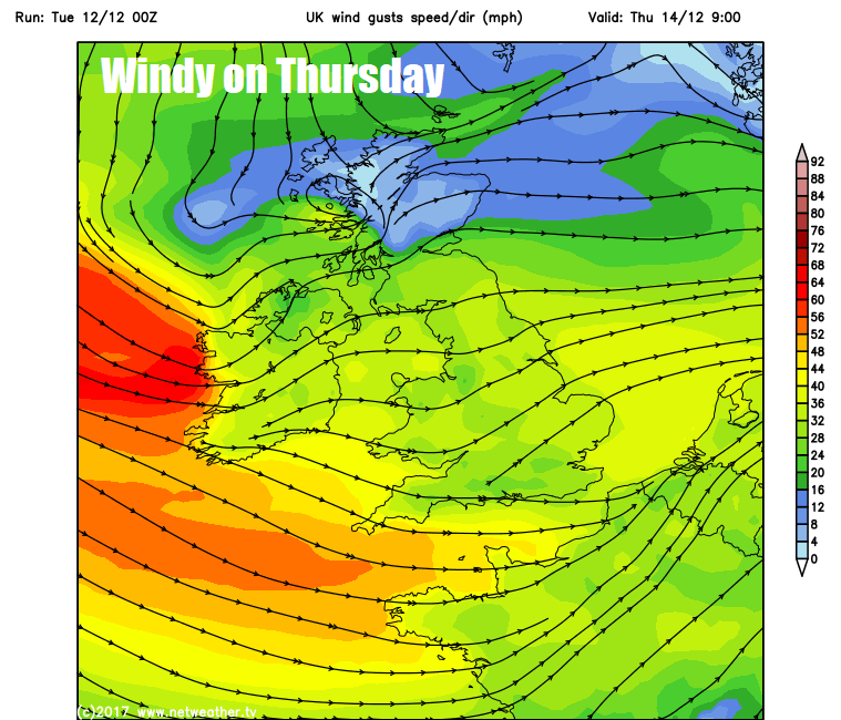
Quite a windy day and colder on Thursday, with the strong westerly or northwesterly wind driving in showers across northern and western areas and along southern coastal counties, falling as snow over the hills and perhaps to lower levels at times in the north. Gales around coasts in the southwest. Eastern areas perhaps staying dry and sunny. Temperatures reaching 6-8C across the south, northern areas reaching 3-5C at best.
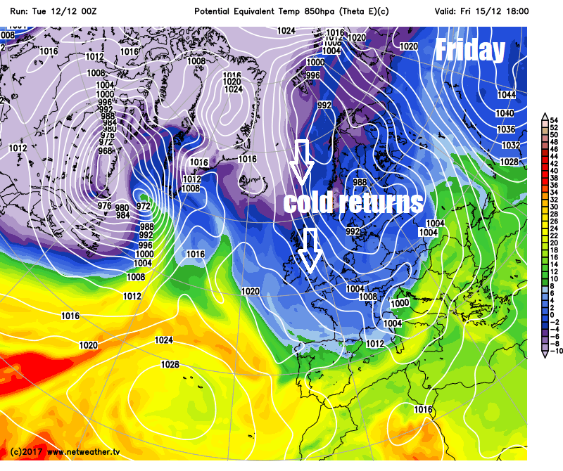
Then on Friday, winds turn more northerly with cold conditions in the north spreading south across all parts. Wintry showers affecting the far north and down along western and eastern coasts. Frost returning Friday night across most parts, as skies clear.
The northerly wind and coastal showers easing on Saturday, with most areas enjoying a dry, sunny but cold day. Another mostly dry, bright or sunny but cold day on Sunday, though perhaps a little less cold in the south. However, across the far west, we may see cloud and rain arrive off the Atlantic across N. Ireland, western Scotland and west Wales by dusk.