


Another mild day in the south today but a band of rain over northern England will be introducing colder air. Back to frosts by night and wind chill for the east coast. Gales in the far north.
It has been mild for much of England and Wales for the middle of the week, and that will continue today in the south. Yesterday Dorset saw temperatures above 15C, but it is cooler further north around 6C to start the day, and colder air will take hold. We have a band of rain, a cold front, making its way southwards today. As it moves through it brings rain and blustery winds, with heavy bursts for a time. You’ll notice it when it arrives for northern England and Gwynedd this morning. Ahead of the rain band is the milder air with more cloud and murky, misty conditions. Behind the front are clearer skies, brightness and a scattering of showers.
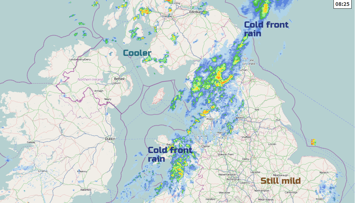
By lunchtime, the front will be fading somewhat, so bringing more cloud and patchy rain or just dampness. Temperatures for southern Britain will again be in double figures up to 13 or 14C; it won’t be that tomorrow. Behind the front, it will be cooler with Northern Ireland and Scotland only reaching 7 or 8C, and with a fresh/strong W/NW wind, it will feel cold. The far north of Scotland will have W gales even severe gales. For northern England and Wales, the temperatures will fall this afternoon, peaking late morning at 11 or 12C.
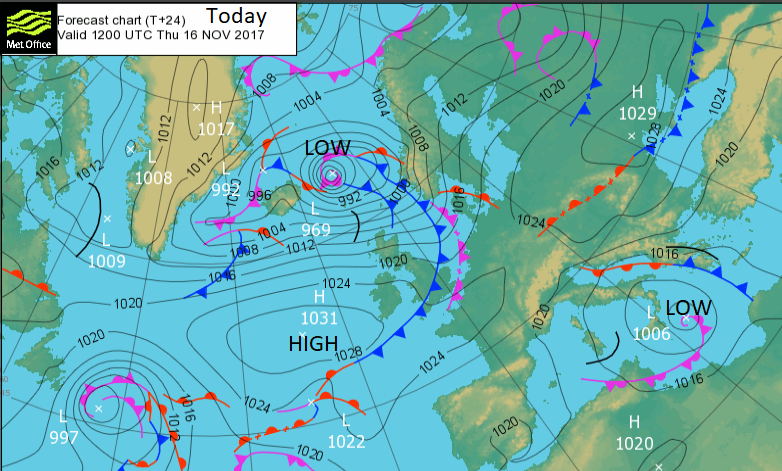
The band of frontal cloud and patchy light rain will reach east Anglia and southern England this afternoon, over SE England by this evening after a fine day. For most, the clear, colder sunny weather, behind the front, will be dry. There will be a scattering of sharp showers coming into NW Scotland with a mix of hail, thunder, sleet and hill snow, also affecting the Northern Isles in that driving wind.
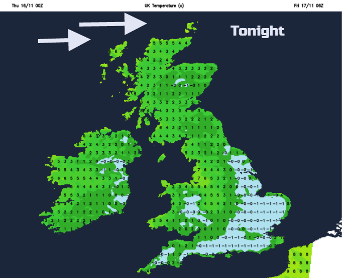
After a colder night, there is very little change for Friday. Most places will be dry, bright and cold with sunshine. It remains really windy for the Northern Isles so feeling raw here. Southern UK will have lighter winds closer to high pressure and further north there will be a nippy wind from the west. Temperatures reach 6 to 8. Another cold front pushes down from the north so that the showers will increase and a band of cloud, rain, sleet and by Friday evening hill snow will reach the north of mainland Scotland.
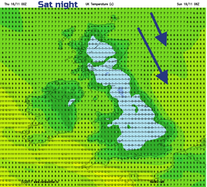
It will be another chilly night with a frost in the south, too windy in the north.
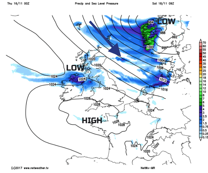
For Saturday there is a deep low over Scandinavia which continues to bring brisk cold winds to northern Britain and eastern coastal counties. The high pressure would be bringing a lot of fine settled, but still cold weather yet a small feature develops west of Ireland and looks like it will bring rain to Northern Ireland on Saturday morning and then could push over Wales, maybe more of southern Britain through the afternoon. Some of this cloud and rain maybe around for SW Britain on Saturday evening but overall Saturday night looks cold, dry and frosty.
Sunday starts off clear, cold and crisp but there is some uncertainty about how the day may end up. High pressure tries to hold on but there is a warm front which could spill cloud and rain in from the Atlantic. It may take until Monday, but this would be a band of wet weather coming up against cold air, maybe it could bring hill snow to other parts of UK (like Wales and northern England). Nothing is certain, just something to watch for the start of the new week.


