That cold north wind is easing with a frosty Monday morning, even snow for parts of Scotland. It will become milder by midweek but the cold air remains for northern Britain and will return.
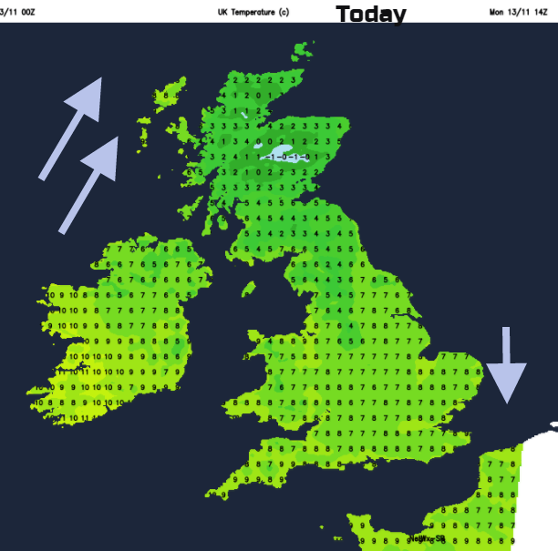
It’s a cold start this morning with frost for some. Temperatures have been down below freezing but for most that cold north wind has eased off, thankfully. It is still clipping the far SE of Britain so prepare yourself for that if you have a wait at the station or bus stop this morning.
At the other end of the UK, there is a strengthening southerly wind for western Scotland, with cloud and rain heading in from the Atlantic, which will turn to snow over the mountains. This could reach lower levels just for a time today in Scotland, before turning back to rain.
We do seem to be stuck in a weekly pattern of chilly, even frosty Monday then a milder Tuesday.
There was a bit of snow over the high ground at the weekend. Bookies are now slashing the odds on a White Christmas as a result, nothing to do with an actual forecast. For much of England and Wales we spend today in the cold air, with bright sunshine and just one or two showers clipping the east coast. There is increasing cloud for Northern Ireland and Scotland, with the rain and hill snow already over the NW Highlands and the Western Isles.
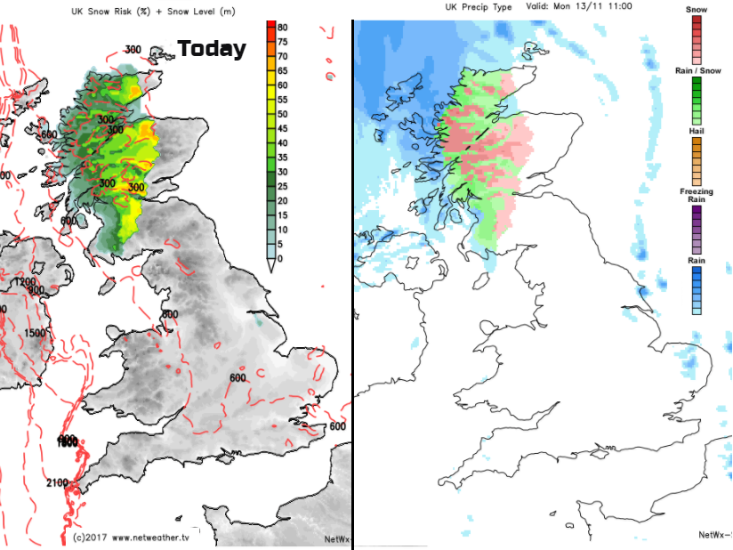
A cold, wet, sleety mix will head across Scotland today, making it feel quite miserable. There will be lying snow over the mountains, but rain will head to the Northern Isles later this afternoon and it will just e wet for Northern Ireland after a fair start.
Tonight, it turns colder. It won’t be as cold as last night, but still some parts of SE Britain could see a frost before midnight with light winds and clear spells. The rest of the UK will become breezy as the frontal band sinks southwards. This will bring rain over a central swathe of Britain, particularly Wales. It will be milder under the cloud and with the brisk SW wind. Scotland then turns colder with a touch of frost late in the night with clearing skies.
By Tuesday the frontal band of cloud and patchy rain will get stuck and begin to wave over England and Wales. In a more westerly flow, Northern Ireland, Wales and most of England (away from the far north) will reach into double figures and feel milder but remain cloudy. Scotland will see sunny spells, a scattering of rain showers in the NW but feel cool.
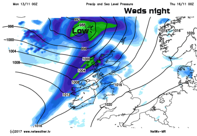
High pressure builds from the south midweek, weakening the old front, which still brings some cloud and a bit of dampness to western shores. Later on Wednesday, the SW winds strengthen as a low pressure skirts by NW UK. As the cold front moves down, early Thursday there will be heavier rain, gales, maybe severe gales for the coasts and colder air will take hold. This moves southwards during Thursday with wintry showers in the far NW, but plenty of fine, cold autumn weather behind the front. SE Britain will keep a fine day and stay at 12 or 13C.
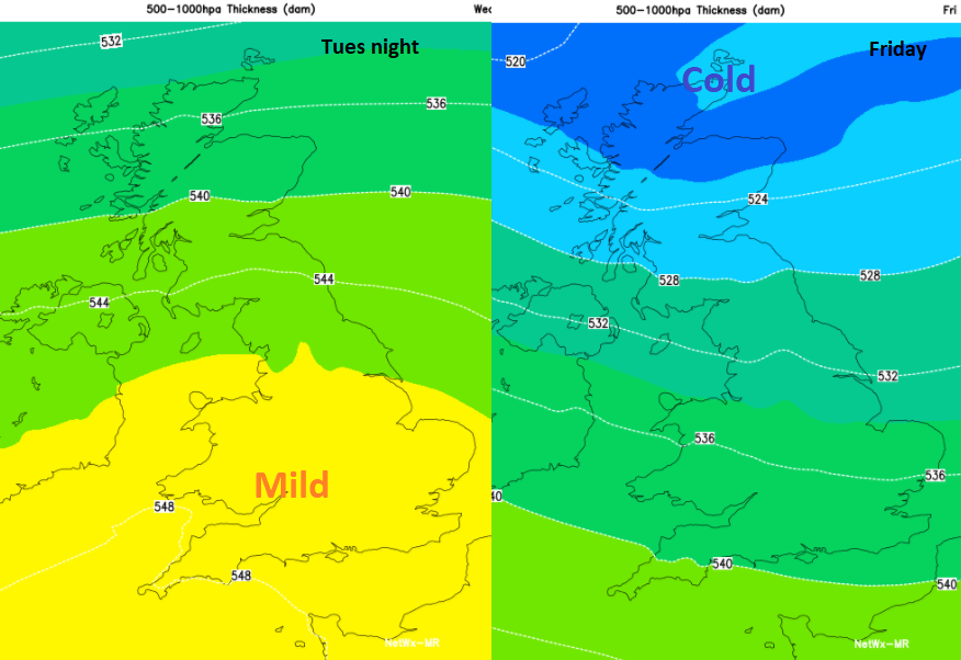
Then we will be back in a cold NW flow for the 4th Friday in a row.