Brightening up today, some rain overnight, clearing to a sunshine on Friday. Wind and rain early Saturday clearing to colder weekend, as winds veer northerly.
The weather will remain changeable today and tomorrow, as Atlantic fronts move through bringing cloud and patchy rain but some sunny weather in between. A low pressure system containing the remnants of Tropical Storm Rina will run across the south Friday night, bringing a spell of wet and windy weather. Then colder, drier and brighter weather setting in for the weekend, as winds veer northerly by Sunday, bringing air from the arctic.
For many of us, it wasn’t as cold last night, thanks to sets of weather fronts moving through overnight, bringing cloudier skies and patchy light rain. The exception is across Kent and Sussex, where skies stayed clear, which meant temperatures were close to freezing here at dawn, though the cloud is arriving here now and temperatures lifting.
For much of England and Wales it’s a dull and damp start, but we are seeing brighter but windier conditions move down across Scotland, Northern Ireland and the far north of England. Quite windy across northern Scotland, with gales across the far north along with some heavy showers.
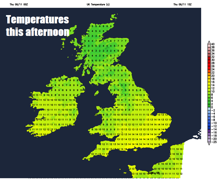
Gradually the dull conditions across England and Wales this morning will be replaced by the brighter skies from the northwest, though it may take a while for the sunnier skies to reach the far southeast of England this afternoon. So, most areas will end up with a dry and sunny afternoon, though windy across Scotland with showers continuing across the far north. Temperatures this afternoon reaching 9-10C across Scotland and Northern Ireland, 11-14C across England and Wales.
Mostly dry this evening, which will mean it will quickly turn cold after dark, however cloud will thicken from the west, with rain arriving across Ireland spreading east across Wales, central, southern and southeastern England during the night. Showers continuing across northern Scotland, wintry over higher ground. Dry, clear and cold in between.
Another cloudy morning with some patchy light rain for southern areas, before clearing to a sunnier afternoon. Elsewhere bright and breezy, with sunny spells, but also a scattering of showers feeding in across Scotland and NW England on the northwesterly wind, wintry across higher ground. Cloud thickening across western areas through the afternoon, heralding the arrival of rain moving in across Ireland, N. Ireland and eventually Wales during the evening. Temperatures reaching 6-9C across Scotland and N. Ireland, 10-13C across England and Wales.
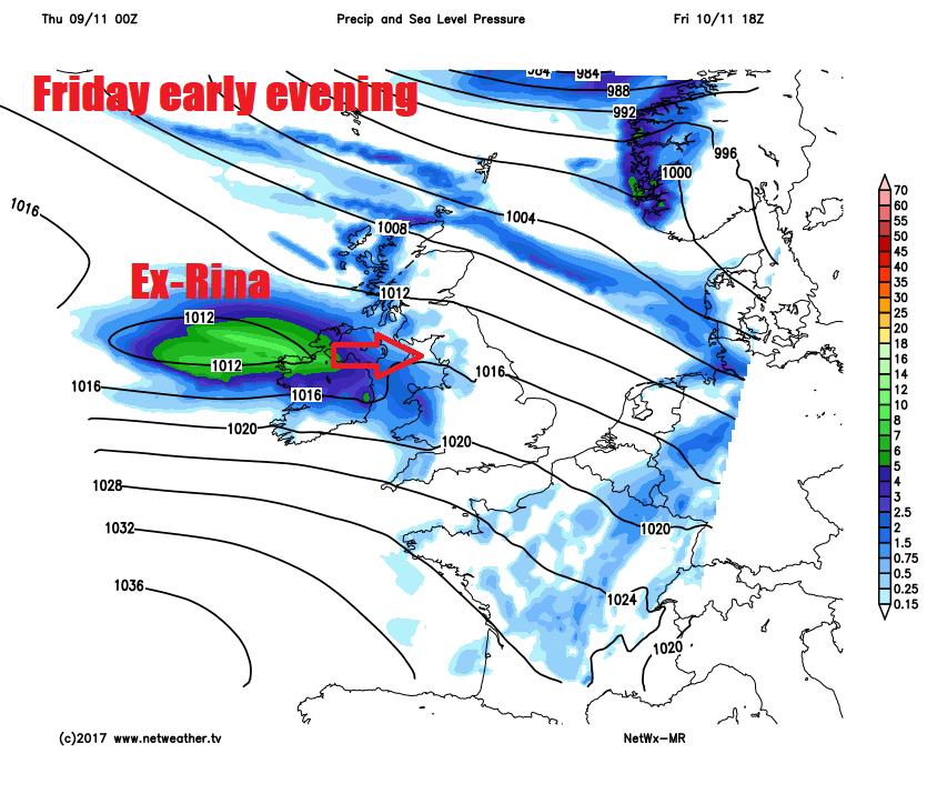
Low pressure system arriving from the Atlantic Friday evening spreading rain across the west is the remnants of Tropical Storm Rina and will quickly run across southern Britain Friday night, bringing a spell of wet and windy weather across England and Wales, with gales around southern and western coasts. This rain quickly clearing Saturday morning, to leave a mostly dry and sunny day, though chilly with a cold northwesterly wind – which will drive in some wintry showers across the northwest.
Turning colder from the north over the weekend:
Winds veering northerly on Sunday, so a cold but mostly dry and sunny Remembrance Day, with showers confined to northern Scotland, where they’ll fall as snow over hills and down along western and eastern coasts elsewhere. Temperatures ranging from 7C in the north to 10C towards the south coast. Cold and frosty Sunday night under clear skies.
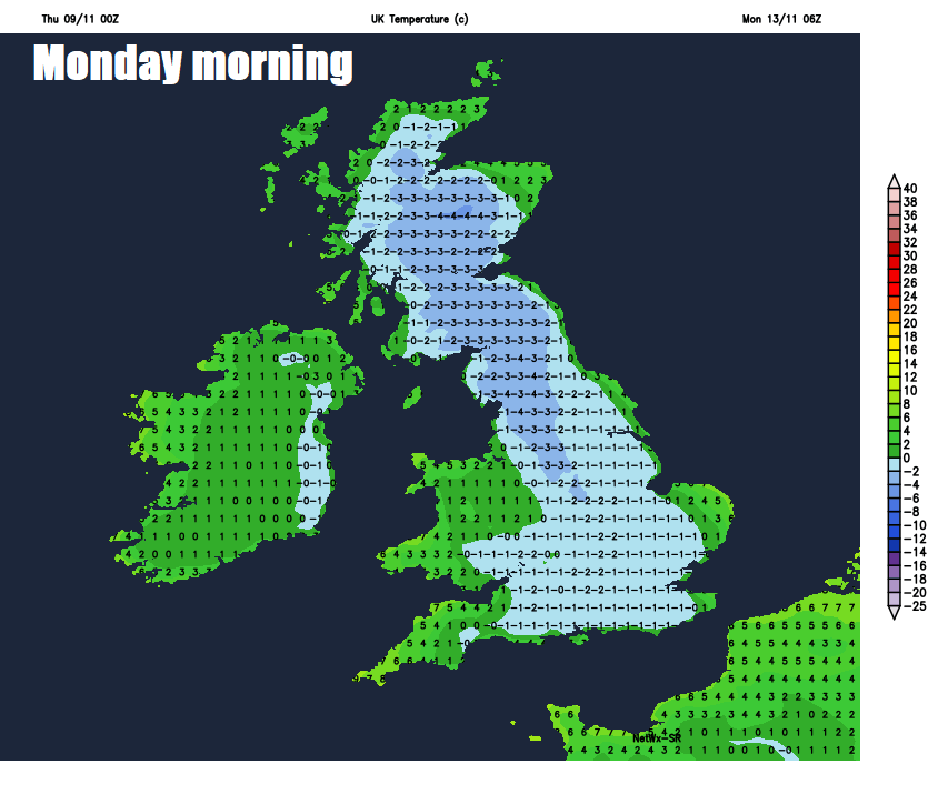
A frosty Monday morning leading into a cold but bright day, though cloud and rain spreading in across Scotland and N. Ireland through the day, before spreading southeast across other parts Monday night. Cloud and rain clearing the south Tuesday to drier and brighter conditions. A good deal of uncertainty from mid-week, with differences between weather models, the American GFS keeps it changeable for all, while the European ECMWF has a northwest – southeast split, with rain affecting the northwest and high pressure keeping it dry toward the southeast.