Rain clearing to colder and brighter conditions for rest of weekend, showers in north and west.
Rain to start across England will clear eastwards through the day, to be replaced by colder and brighter conditions from the northwest for the rest of the weekend, though with showers across northern and western areas. So, it should be mostly dry, though cold, for those watching firework displays this weekend away from northern and western parts. A strong Atlantic jet stream close to or over the UK next week looks to bring a succession of frontal systems, bringing changeable conditions with wind and rain at times across all areas.
For now, grey skies and outbreaks of rain affects much of England to start Saturday, which will slowly clear eastwards through the morning. Brighter, breezy, colder but showery conditions pushing in across Scotland, Northern Ireland, NW England, Wales and SW England this morning, the showers heavy towards the northwest, with hail and falling as sleet and snow over western Scottish mountains.
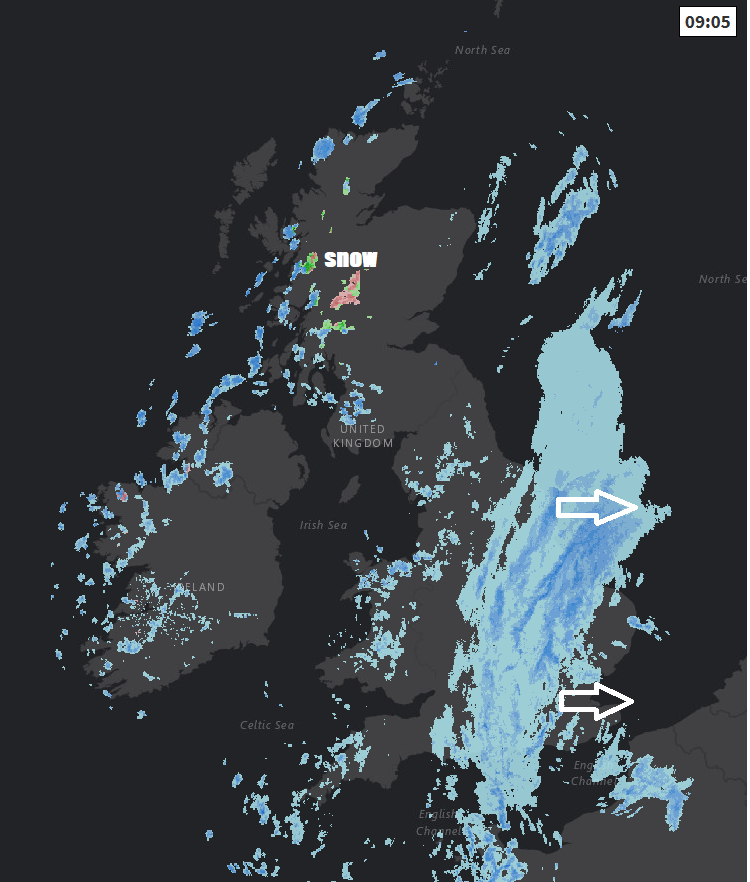
Cloud and rain eventually clearing SE England and East Anglia during the afternoon, with a drier end to the day. Sunny spells elsewhere continuing through the afternoon, but with blustery showers blown in on a brisk northwesterly wind which will be most frequent towards northern and western coastal counties, some of these filtering further east at times. As it turns colder from the northwest, temperatures this afternoon 8-10C at best across the north, 12-14C across the south.
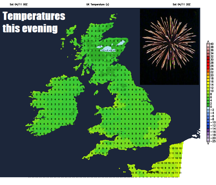
So it’s looking mostly dry for eastern areas of Scotland along with central, southern and eastern England this evening for those going outside to watch firework displays, but wrap up warm as it will be turning chilly under clearing skies. Showers continuing across western Scotland, N. Ireland, NW England, Wales and SW England though, so may be worth taking a brolly in these areas. Where skies stay clear overnight, a grass frost will form by dawn, an air frost likely across Scotland.
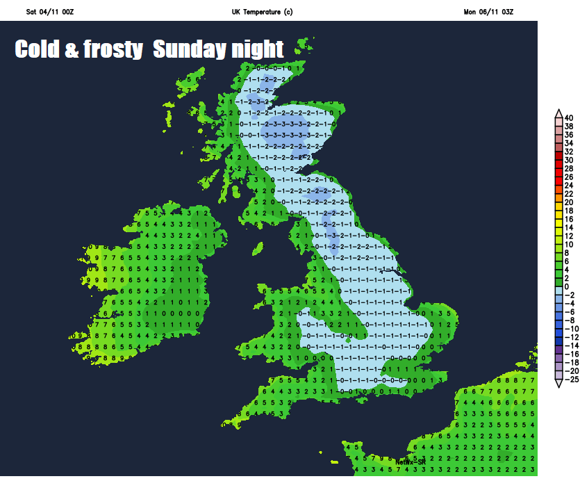
A bright but cold start to Sunday, with a touch of frost in rural areas, leading into a mostly dry and sunny day, some long spells of sunshine away from western coasts where we will see further showers and increasingly we will see showers affecting North Sea coasts, as a strong northerly wind develops here. A chilly and breezy day, windy across the north and down the east coast, so coldest across northern and eastern areas – where temperatures will reach 7-9C at best, across western areas reaching 9-11C. Showers then easing in Sunday evening, giving a mostly dry Bonfire night, but clears skies leading to a widespread frost Sunday night.
So, a cold, crisp and sunny start for the Monday morning commute, a scraper and de-icer will come in handy. Much of England and Wales will hold on to the sunshine for much of the day, but we will see a change across, Scotland and Northern Ireland, as heavy rain accompanied by strong winds sweep in from the Atlantic during the day.
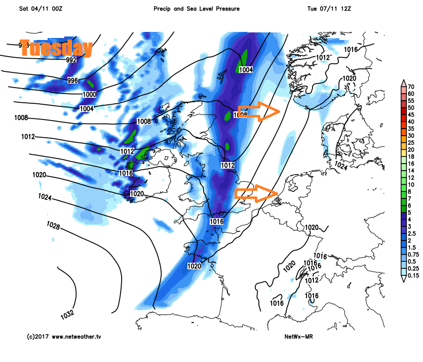
Band of rain and strong winds spreading eastwards during Tuesday, clearing Scotland and N. Ireland in the morning to brighter but showery conditions, which will eventually reach other northern and western areas in the afternoon, the rain perhaps not clearing the southeast until early evening.
Wednesday’s looking mostly dry, breezy and bright or sunny, though cloud, strong winds and rain looks like moving in across Scotland and N. Ireland to end the day. Cloudy skies and patchy rain spreading southeast on Thursday, drier, brighter but colder conditions following from the northwest across northern and western areas. After a bright but cold and perhaps frosty start on Friday, more wind and rain may push in across the north, though the south hanging on to dry and bright weather.