Sunnier & drier for many today. Windy & cooler on Saturday, with rain in the west. Cold northerly wind on Sunday.
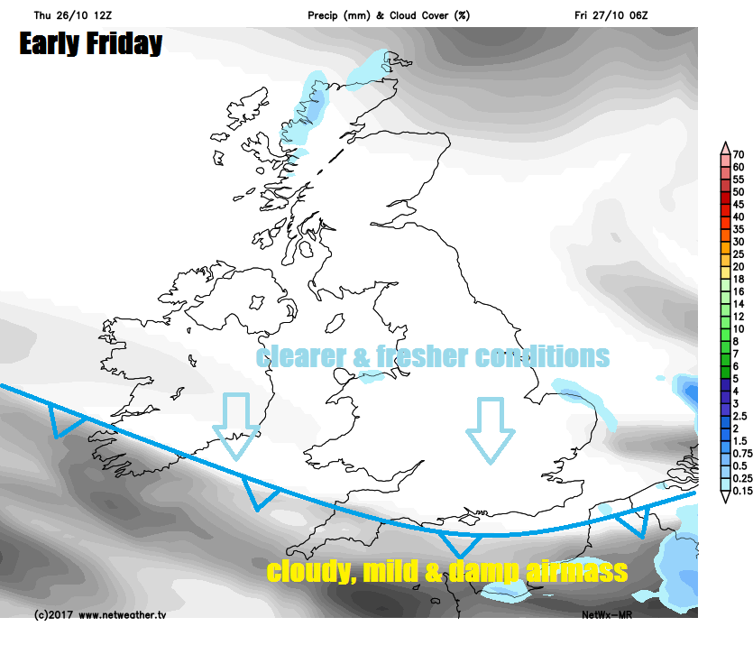
Thursday saw grey, dull and damp conditions across much of England and Wales, but the clearer and drier conditions across Scotland and N. Ireland yesterday have swept south overnight, which sets us up to a mainly dry and sunny day today. And it will stay mostly dry across the south this weekend. But the wind switches westerly tomorrow bringing cloud and rain off the Atlantic to northern and western areas. Then on Sunday, winds switch to a northerly direction, bringing down noticeably colder air from the arctic, though at least the day will be mostly dry and bright. With the colder air arriving to end the weekend, Sunday night will turn cold for many under clear skies, leading to a widespread frost to wake up to on Monday.
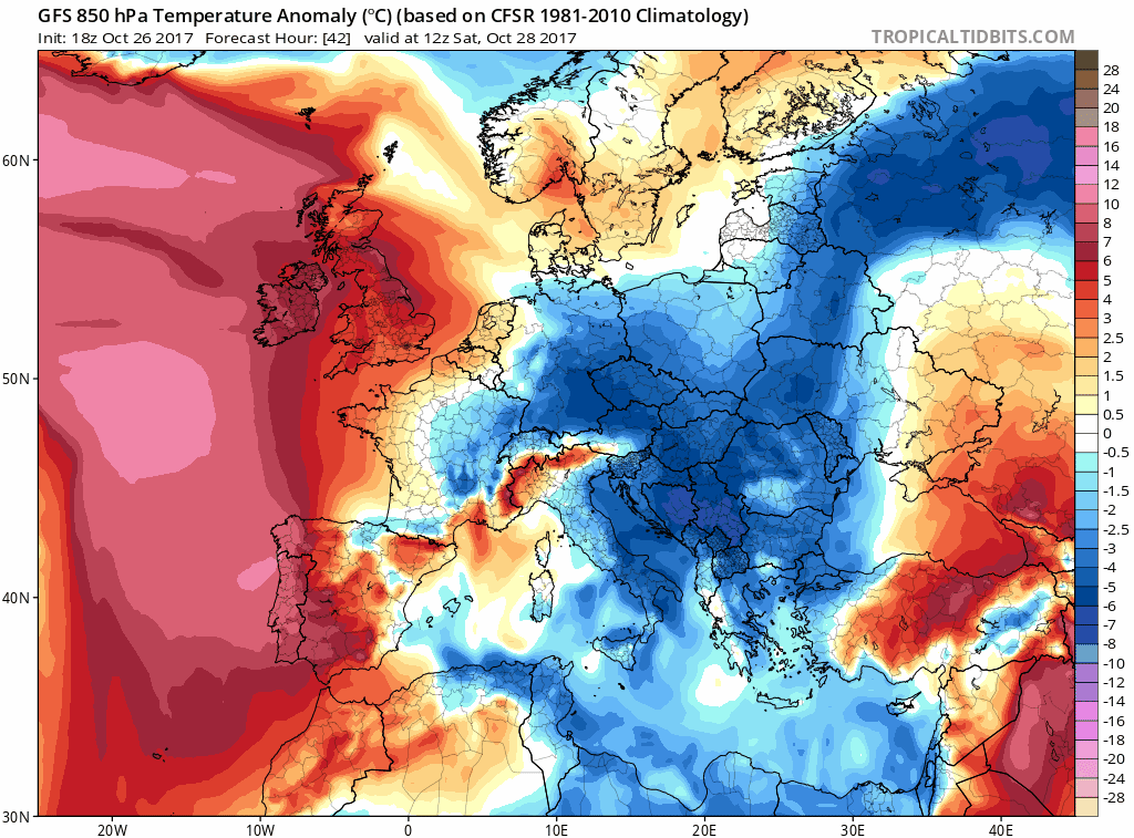
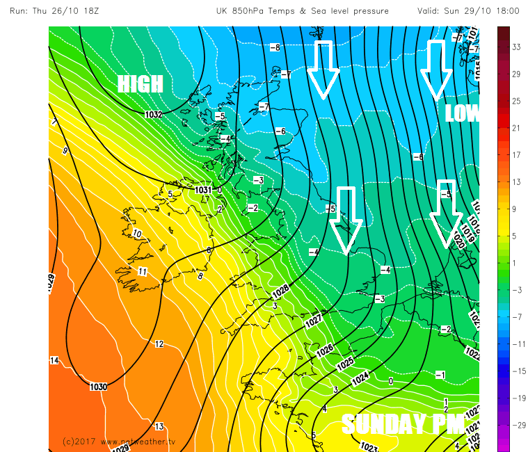
Colder air spreading south on Sunday, bringing widespread frost risk Sunday night
The weather front that brought the damp and murky conditions yesterday slipped back south overnight toward the south coast, with clearer skies following on behind across most parts during the night. Which means it’s a fine and clear start for many, though a chilly start in more rural areas in the north, with sheltered parts of Scotland and the far north of England falling close to freezing and seeing a touch of frost at dawn this morning. There is still a legacy of yesterday’s cloud and drizzle, across the far SW of England to start the day though and in other areas yesterday's dampness still in the air is leading to some mist and fog patches.
The cloudy and damp conditions across the far southwest should clear this morning to leave most of the UK dry with some decent sunny spells, so a much better day for many than yesterday. It will be cooler and fresher all, particularly noticeable across the south. There will be a brisk wind across northern Scotland though, making it feel chilly. Temperatures down on recent days, reaching 11-12C across Scotland and N. Ireland, 13-15C across England and Wales.
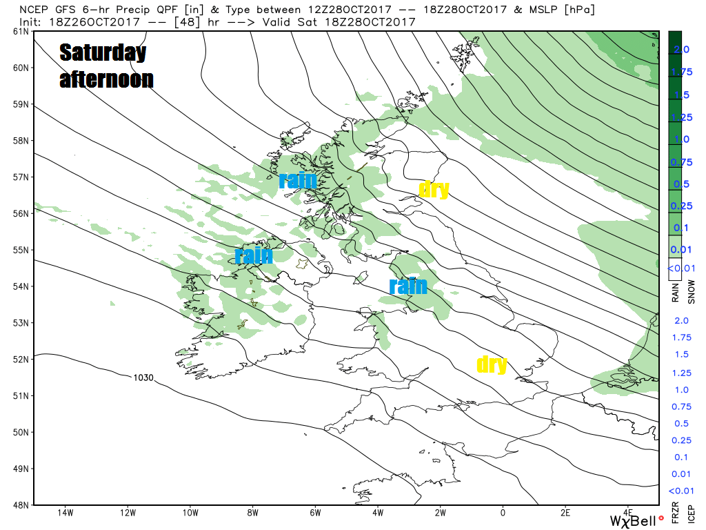
High pressure centred over Ireland today, bringing fine and dry weather for most, slips south during Saturday, allowing weather fronts to move in off the Atlantic on a strengthening westerly wind, bringing cloud, hill fog and showery rain to western Scotland, N. Ireland, NW England and west Wales. But with shelter of high ground to the west, eastern Scotland and NE England should stay dry with some sunshine, as will much of central, southern and southeast England. Temperatures reaching 14-16C where we see some sunshine, 12-13C in the cloudier western areas.
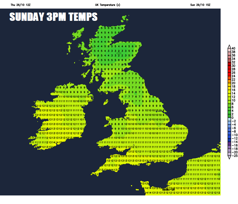
The wind swinging round to come from a northerly direction on Sunday, which will drive cold air from the arctic down across northern and eastern areas. So despite most areas having a dry day with sunny spells, temperatures only reaching 9-10C at best across Scotland and northern England, 11-14C across eastern England. Lighter winds towards SW England and Wales will mean it will be the mildest areas of the UK with 15C the highs here.
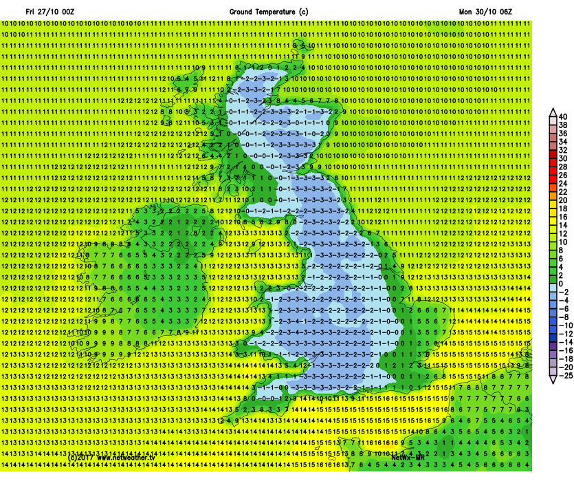
Staying on the chilly side as we head into Monday, the day starting with the first widespread frost of the autumn. But staying predominantly dry and bright, though turning increasingly cloudy from the northwest, with patchy rain spreading southeast across the north during the evening. The cloudy skies and rain spreading southeast across England and Wales on Tuesday, drier and brighter conditions following across Scotland. Wednesday may turn out mostly dry and bright, before winds turn northerly again on Thursday, bringing another surge of cold air and risk of overnight frosts to end the week, but other than some showers in the northeast, perhaps wintry over higher ground, it should stay mostly dry and bright.