If you got soaked yesterday, you'll enjoy a fine Thursday. Tomorrow looks blustery but very warm air will be arriving from the south and staying at the weekend. Just watching Hurricane Ophelia
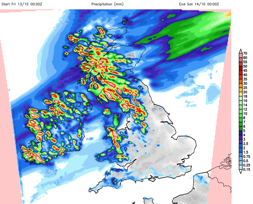
Much better today after all that rain, 211mm (over 8 inches) recorded on the hill tops of the Lake District. It will get windy for a time, with more rain in the north but southern areas stay fine and get very warm. Temperatures reaching into the low 20s C with even more heat possible by Sunday and Monday. However, Hurricane Ophelia looks like she will head north for the start of the new week and her extra-tropical remains, still as a deep low pressure, will keep forecasters on their toes.
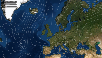
It’s been clear and cool overnight so many places will have a fine bright Thursday. There has been more cloud over eastern England, a little bit of murkiness about and one or two sharp showers for Scotland, even with lightning in the far north. Overall today will be fair and bright but with a freshening SW wind.
There will be a more cloud about this afternoon with patchy rain for Northern Ireland and N&W Scotland as a warm front heads in. Temperatures ahead of the front will be between 13 and 18C.
Through the evening the winds strengthen in the far NW, with gusts around 60mph. It will be windy overnight for N.Ireland, Scotland, northern England, particularly the Pennines and around the Irish Sea into north Wales.
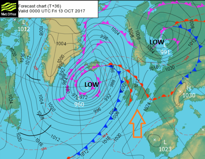
Friday
Heavier rain arrives from the NW, along the cold front tonight. Again, wet for W Scotland and maybe Cumbria as the rain just continues to feed in from the Atlantic. Southern and eastern Britain will be bright and breezy and warm, up to 20 or 21C. Behind the cold front, skies will clear and it will be crisp.
Friday remains windy with strong gusts through the Irish Sea and for northern England. The winds also strengthen for the Northern Isles by Friday evening, something to note for anyone getting the ferry as October holidays start for some in Scotland.
The trailing front divides the UK north/south and remains a feature right through the weekend. It will waver, heading quite far north, pulsing more rain in from the west and bringing a band of cloud. To the south of this, we will experience the mid October warmth, maybe 23 or 24C Sunday or Monday. Quite stunning and notable for this time of year, could break a daily record for this part of October. To the north of the front, it will stay cooler with some nippy nights.
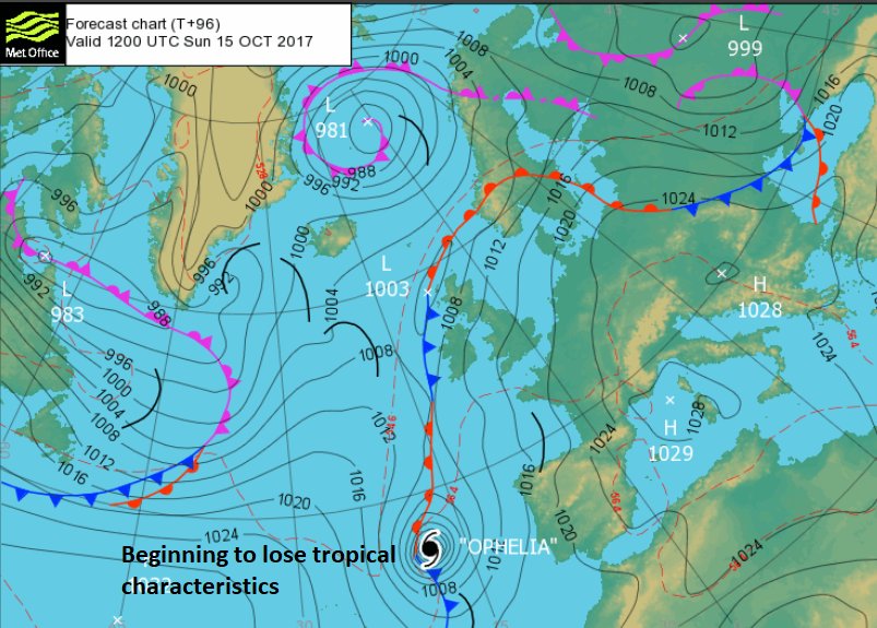
The start of the new week looks more uncertain. Hurricane Ophelia is in a very unusual part of the Atlantic and forecast to head north from the Azores Sunday into Monday. She will begin to lose her tropical characteristics as she moves over colder seas, undergoing extra-tropical transition. However, with the baroclinic contrast of very warm air over Europe and colder north Atlantic air, there is still plenty of energy to keep this cyclone going.
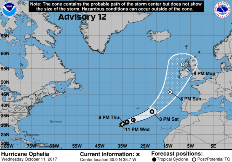
So, whatever Ophelia is by the time she nears Ireland and the UK, there could be a spell of very wet and very windy weather. How severe this will depend on the track; it could go well west of Ireland and just give an autumnal blustery soaking to western areas with large waves, or be closer and cause severe weather.
We will have to watch how it develops and its progress north. Very interesting. More chat on the forum.