A real Autumnal mix of weather on the way this week.
We have an up and down week of weather coming up. The north and west will be most prone to the wet and windy stuff, with gales at times. Whereas those further south and east will see more in the way of settled weather, and the mildest temperatures.
Talking of mildness, the latter part of the week, and into the weekend may well become very warm for the time of year across the southern half of the UK at least. Highs will potentially be into the low-twenties for some. Obviously, it's a long way off, but I think that would safely be into the realms of an Indian Summer - although at this stage it looks like being brief as the less settled, cooler weather further north eventually spreads south.
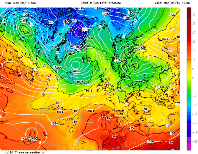
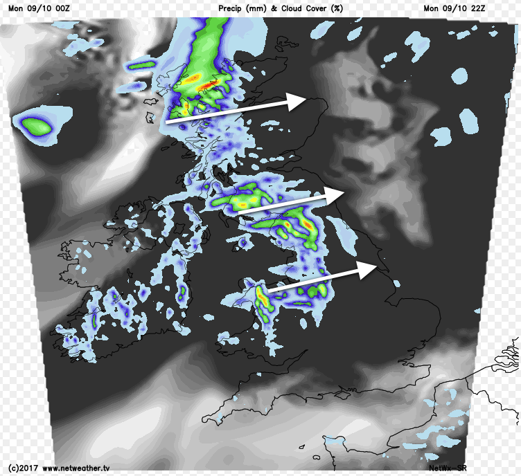
For now though, we have a murky, grey start to the week. There are some bits and pieces of drizzly rain around, especially into the Midlands and parts of southeast England, these moving slowly southeast. There are also a few more meaningful showers about, down close to the south coast, into northwest England and through parts of Scotland, along with Ireland, but beyond that, it's a mainly dry picture.
Through the day, the showers or drizzly rain in the east will slowly clear, with the best shot of seeing some reasonable glimpses of the sun likely to be in eastern and southern regions. Further west and north, the showery rain affecting Ireland will begin to organise itself before making a push further east later this afternoon and overnight. That band, some of which will be heavy will then nip quite quickly across the country. It'll clear during the early hours of Tuesday, after affecting most regions from the north of Wales and the Midlands northward.
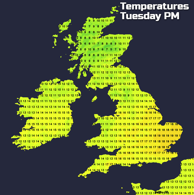
Into tomorrow, with the rain having cleared, we'll be left with some showers in western regions, a few of which may drift further east during the day - especially in the south. Elsewhere though, it's dry with varying amounts of cloud. Temperatures will vary widely across the country, with many central and eastern parts warmer than today, with highs perhaps approaching 20c, but cooler in other regions.
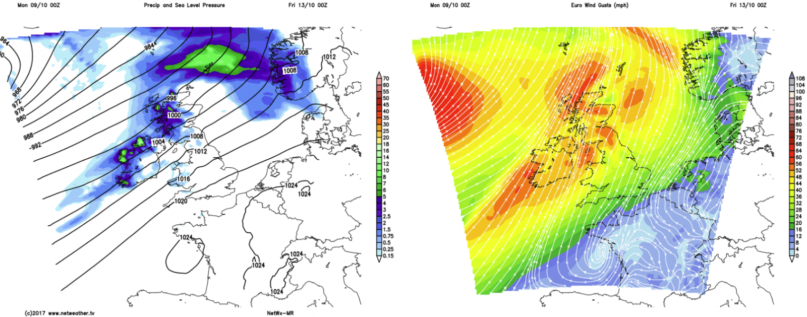
Later in the day on Tuesday, with an Atlantic low moving nearby, rain and increasingly strong winds will arrive into the northwest of Scotland. Gales, perhaps severe, are possible in exposed locations. The strongest winds will ease away to the north and northeast overnight, but the rain will dive southeast to be across England and Wales for Wednesday morning and may take a fair bit of the day to clear through.
Behind the rain, it'll be a breezy day with sunny spells and showers, these affecting the west in particular. The rain band will be along a cold front, so behind it, there'll be a fresher feel with a chilly evening and night to follow.
Thursday should start dry and quiet for most, but the next batch of rain and wind won't be far away. This is expected to affect the northern half of the UK and much of Ireland from the second half of Thursday onwards. With gales again possible, along with heavy rain. Further south, it's drier with bright or sunny spells, and with winds blowing up from the south it's at this point the very warm air moves in.
This pattern of unsettled, often wet and windy weather in the north, and settled very mild conditions in the south will continue into the weekend before eventually, the less settled weather takes hold everywhere.