A rather cloudy and damp day today, but drier and, overall, bright for many areas by Sunday.
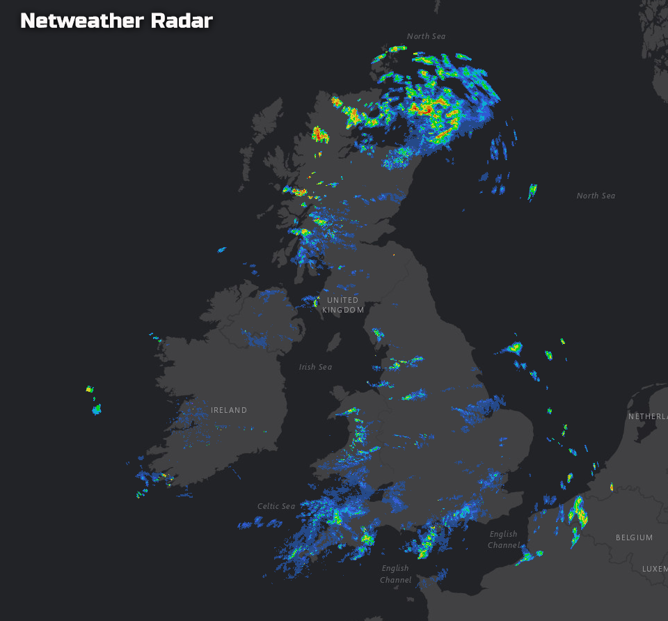
It’s a mostly cloudy and rather damp start to the weekend. If you’ve not opened the curtains yet, it is looking rather October-like out there! Overnight weather fronts have steadily moved south-eastwards, but have left behind a legacy of showers along with some regions of rain and drizzle, as our rainfall radar imagery, from a little earlier, highlights well.
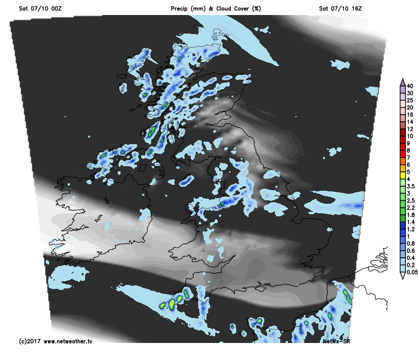
Saturday will undoubtedly be a different day than compared with yesterday. So if you’re hoping for plenty of sunshine, as per Friday then, unfortunately, you’ll be disappointed. A rather blustery NW’ly wind across many areas will maintain a risk of some showery conditions, perhaps with regions of light rain and drizzle as well. At the moment it’s likely to be across more western areas of Scotland, down into parts of NW England, Wales and SW England where the most significant risk of some wet weather will be today.
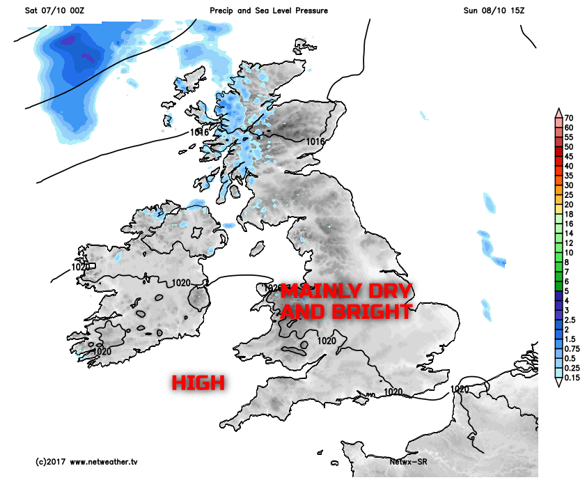
However, it won’t be a washout. Also, to the east of high ground, so across parts of E Scotland and E England, then some cloud breaks will bring some sunny intervals. Overall though, the emphasis is on a cloudy, damp day.
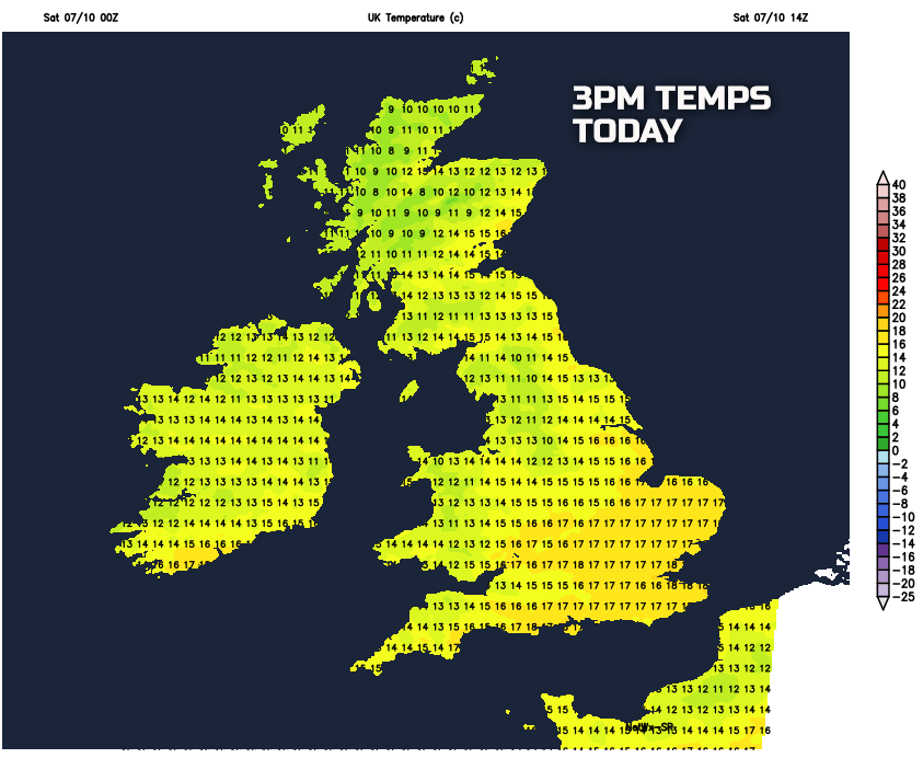
Temperatures through the afternoon will be a little higher than they have been of late, but the blustery NW’ly wind and the lack of sunshine will still mean a cool day. In any brighter intervals and perhaps especially across SE England more generally, then temperatures will rise to 16°C or 17°C which is indeed respectable for the time of year.
Into Saturday night not a great deal of change in the weather is expected. The NW’ly wind will continue to bring in a lot of cloud across many areas, with further patches of showers, or, at times, light rain and drizzle, mainly across more northern and western regions. Turning quite chilly, locally at least, but compared with the last few nights then temperatures tonight will be higher, so not that cold really.
As we move into Sunday and the good news is that a minor ridge of high pressure will try and make an appearance from the south-west. As a result, it should mean something of a drier day across the British Isles. Perhaps except N Ireland and W Scotland where further patchy rain or showers are possible as the day progresses. A few showers can’t be ruled out, almost anywhere, but compared with Saturday, it’ll be a drier day, with more cloud breaks too.
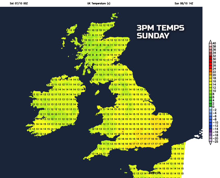
Winds will be lighter as well during Sunday and in some brighter intervals temperatures are likely to reach 16°C or 17°C once again. So it’ll feel quite mild, if not locally warm across some areas of England and Wales. A little cooler further north and west, across N England, Scotland and Ireland, but, even here temperatures will be a little higher than of late.
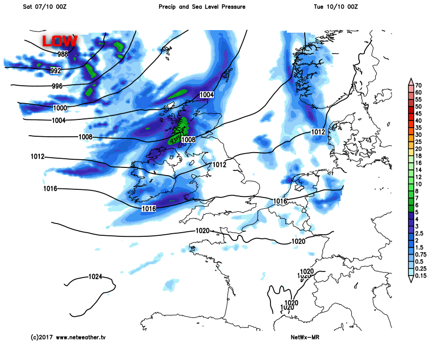
As we look further ahead into next week, the somewhat changeable October conditions are forecast to continue. Monday may well be another reasonable day, but the emphasis is on more weather systems arriving into Tuesday and Wednesday of next week. As a result, showers or longer spells of perhaps heavy rain will develop across Scotland, Ireland and N England in particular. It will, however, be drier across more southern areas.