


Strong winds and gales are affecting northern areas today with a blustery trip to work or school. Pressure will rise this week bringing some fine weather but it's not straightforward.
It’s a windy start today for the northern half of the UK and western coasts. There have been gusts of 50-60mph and gales as a low pressure continues to edge north of Scotland. The strongest winds are expected through Monday morning rush hour along the Central Belt of Scotland; a westerly can rattle through the lowlands. High winds are clipping Northern Ireland, with lively crossings in the Irish Sea and then to NE England & SE Scotland this morning with gusts along the exposed parts of the A1 and to the lee of the Pennines by this afternoon.
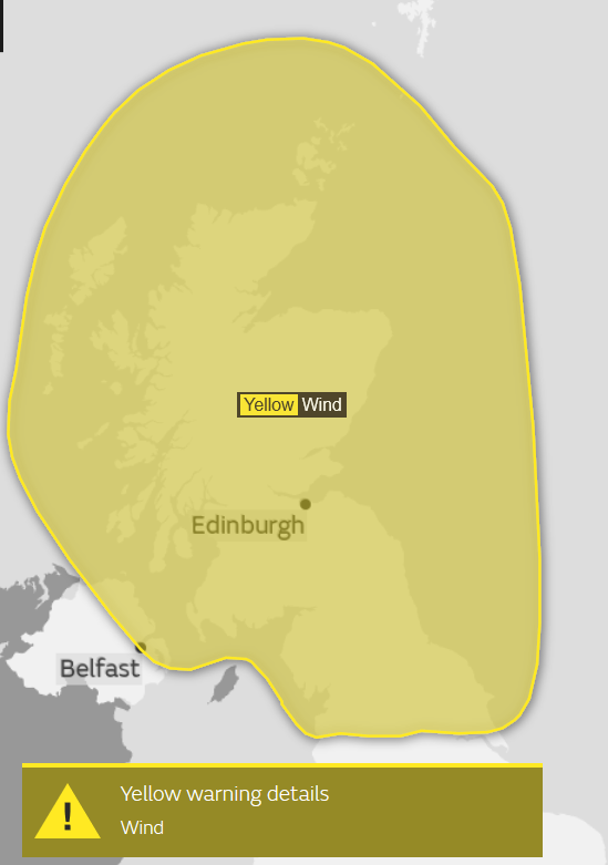
The new Forth Road bridge wind shielding gets its first test as it is claimed the bridge would not have to close due to High Winds. By this afternoon, it will be the Northern Isles seeing the strongest winds with severe gales for Orkney and very rough seas. Further south there will be brisk westerly winds for a time but not as strong as the area covered by a Met Office Be Aware Yellow warning for Strong winds. The strong winds are bringing sharp showers in from the NW. These whistle through quickly, darkening skies, a hefty downpour then back to bright sunshine. For much of the UK, it is just bright and blustery.
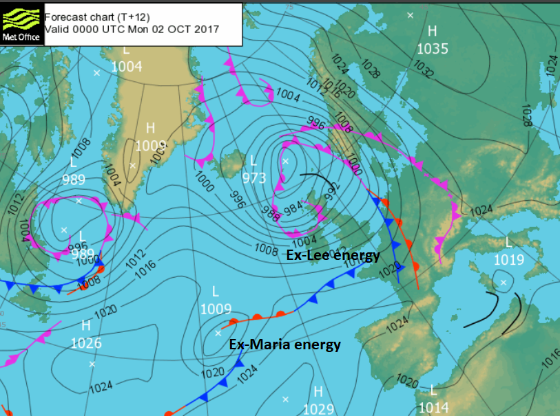
Its still mild with most places in double figures and yesterday the top temperature was 20.5C for Hereford. East Anglia and Gt. London could see 16 or 17C today. Most places stay in the mid-teens. We have tropical air mixed up in this low pressure, the remnants of ex-hurricane Lee. That is adding a bit of oomph into the weather system and away to the SW of the UK is ex-hurricane Maria. This is forecast to just brush SW England today as a flat wave. It will bring some rain but currently no warnings or concerns. Old hurricane energy in the Atlantic mix doesn’t have to mean destruction across the UK. It will be wet overnight for the Channel Islands, and the blustery showers continue to feed in for NW UK. Elsewhere, it will be clear and a bit cooler than last night. The gales continue for the Northern Isles tonight.
Tuesday
Pressure begins to rise from the SW, so winds will be easing. It will still be blustery for northern Britain but it looks like being a fine morning. The cloud will increase for Northern Ireland and western Britain but it will be dry. For the south and east there will be brighter skies and sunny spells. Once again it will be the NW Highlands and the Islands seeing a scattering of showers. Temperatures will struggle again, only into the mid-teens, so cooler for eastern England tomorrow. As the high builds in from the south bringing more fine settled weather, a low pressure will move south of Iceland and bring rain to the far north as another low develops in the Atlantic to join that system. High pressure is trying to take hold but there will be interruptions for the rest of the week.
Rest of the Week
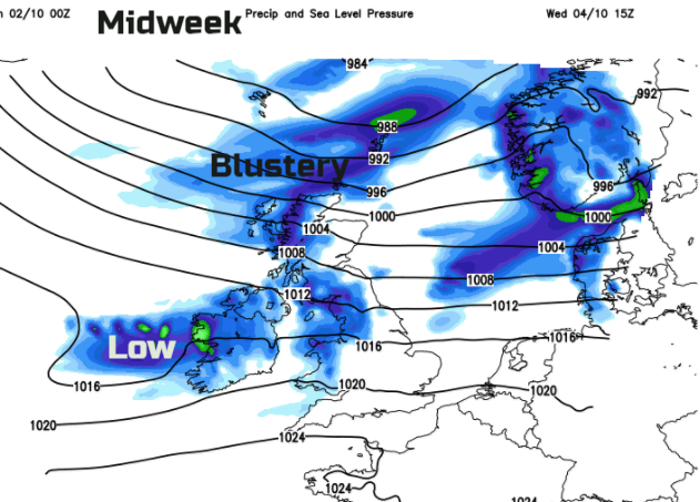
Wednesday could see spells of blustery or windy weather with a period of heavy rain. Thursday sees the brisk winds veering to the NW, so it will feel cooler and then pressure rising again for Friday.


