
Rain is moving east today, with fresher, cooler air behind it. Patchy rain arrives from the west again tomorrow, but a mostly dry Saturday follows as high pressure to the east and low pressure to the west, face-off.
The west and north of the UK, along with Ireland have had quite a soaking during the last 24 hours, with 25-35mm falling in places. The band of rain responsible has just about cleared Ireland now, but it's a wet start to the day across a good part of Scotland, and down through NW England, West Wales and SW England.
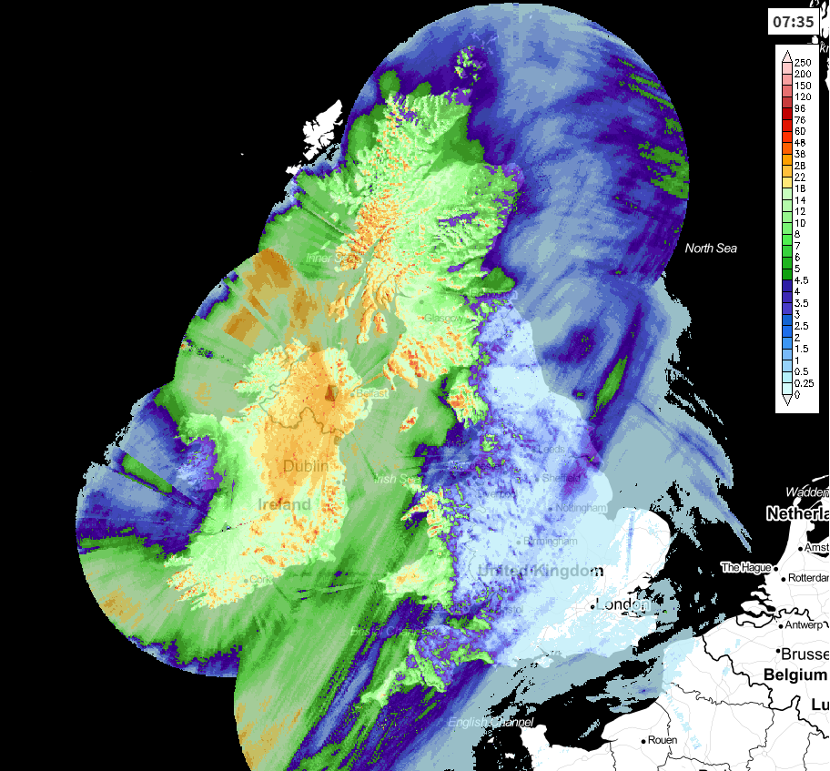
Rainfall totals over the last 24 hours - up to 7 am today.
Through the rest of today, the rain gets a bit more of a move on and makes its move east. It'll reach northeast England this morning, southeast England by the evening. Ahead of the rain, eastern England will enjoy a fine start to the day with some sunny spells. East Anglia and the Southeast will be warmest with highs making it into the low-twenties, the mid-teens are more likely elsewhere.
Behind the rain, there will be clearer skies, the odd shower and fresher, cooler air. That'll make for a chilly night tonight, with temperatures dipping comfortably into single figures - cool enough for a touch of frost in some parts of Northern Britain.
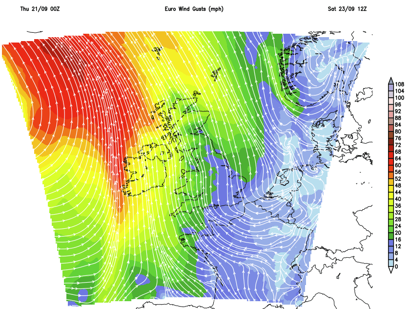
Friday will dawn dry and bright for most, but the next band of rain will already have crossed into Ireland during the early hours and will be into the fringes of western Britain. Thanks to a small area of low pressure, it'll be turning windy too, with gales possible for a time for Ireland, up through the Irish channel and into southwest England and Wales.
The rain itself will tend to fragment as it moves further north and east, but it may still bring the odd heavier burst at times. A milder, breezy night follows, with a fair bit of cloud and some patchy, light rain in places.
Into the weekend, and we have an east vs west battle getting into gear. To the east, high pressure. To the west, quite a doozy of a low pressure system.
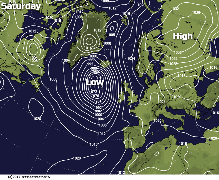
For Saturday, that all leaves much of the country with the fine, dry and quite warm weather. There will be varying amounts of cloud drifting around and some patchy rain drifting north on what's left of Friday's weather front though, so not 100% dry or 100% sunny. It'll be a breezy day, and for western Ireland, and later northwest Scotland it'll be more than that with gales or even severe gales possible for a time, thanks to that Atlantic low.
Sunday sees the low moving away, so lighter winds in the west. In the east, the east to southeast breeze will be noticeable though. There'll be a weather front trying to make a move in from the west during the day too, bringing some rain across Ireland and up the western side of Britain. Elsewhere though it's dry with sunny spells again. It'll be warm too, with temperatures into the high-teens or low-twenties for many, away from what will be a chillier east coast.
Into next week, the east-west battle continues, with the high pressure in the east doing what it can to block Atlantic systems from bringing rain and wind across the country. So it'll be western and northwestern parts most likely to see the bulk of any rain, whereas further east it stays drier.


