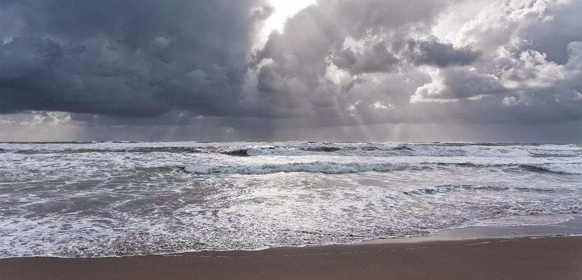
Rain is moving in from the west today. A murky start to next week then follows, before clearing to sun and showers by midweek. Next weekend is a period to watch as a potentially deep low will be on the scene.
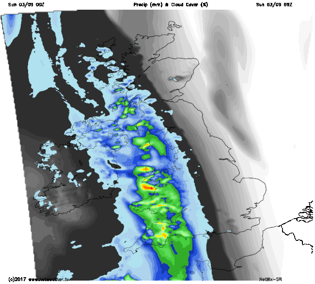
Sunday has arrived with a west-east split in the weather, but with rain marching in from the west, the drier eastern part is going to shrink to nothing by the end of the day.
The rain in the west this morning is heavy in places, but it'll break up as it moves east, so many eastern parts will see no more than a few spots of drizzly rain by the time it arrives. Behind the rain, we'll be into muggy air, with plenty of cloud, clag, drizzly bits, mist and fog behind it. Sounds glorious, doesn't it?
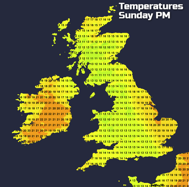
Another feature today is the quite brisk southerly wind, that'll ease for a time into tomorrow, before being replaced by stronger a strong southwesterly. Temperatures today will be warmest in the far east, ahead of the rain, and the far west behind it (chiefly Ireland). Here, 20-21c is likely, under the rain it'll be cooler with the mid-teens more typical.
A mild, breezy, murky, misty night follows. There'll be some drizzly bits of rain about, with everywhere is likely to stay in double figures temperature wise. Into 'back to school' Monday, the mostly cloudy skies will hang around. It'll be warm and humid with temperatures rising into the high-teens or low twenties, warmest in spots with some shelter from the southwest wind.
At times the cloud across England and Wales will be thick enough to produce some light rain, particularly on western facing hills. But it's Scotland who'll be seeing more of the action in that respect as a cold front moves down from the northwest through the day. It'll bring a spell of potentially heavy rain with it, but once it's cleared through, the cloud will lift, and the air will be fresher.
There's some uncertainty over the detail and timings, but the rain is going to be moving east overnight and into Tuesday to reintroduce the cooler air to all parts eventually. That brings us to a familiar sunshine and showers type of pattern for a couple of days. With the majority of the showers affecting the north and west, as those further south and east enjoy plenty of dry, often sunny weather.
Thursday sees another change taking place though, with wet, windy weather making its way into Scotland during the day. For England and Wales, it'll be another mostly dry, bright day, but the rain and blustery winds will sink south later. Making it into the south of England by the end of the day on Friday.
This leads us into a potentially very Autumnal weekend as low pressure moves over, or at least very close by to the UK. There's low confidence regarding the details at this point, but there is the potential for gales or even severe gales in places.
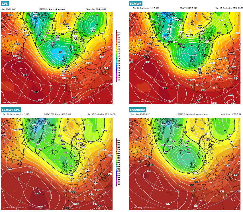
The image above is a few of the forecasting models take on what's likely to happen. All have low pressure in the vicinity, but each slightly different. The details will firm up nearer the time though, so stay tuned for updates.