Milder air is on the way with heavy and persistent rain bringing a risk fo surface water flooding, even high river levels. There will be snow for a time over northern hills later Wednesday and overnight.
As the risk of snow and ice retreats, milder air is accompanied by heavy and persistent rain from the Atlantic. It is going to be very wet in places, with snow melt adding to the risk of flooding. It’s been a mixed week already with mild air and spring sunshine. Sunday saw temperatures over 14C and Cardiff reached 15.4C on Monday. There has also been cold air moving down from the Arctic. Shetland fell to -8.4C earlier in the week and there has been more snow and ice.
For Wednesday, there are more weather warnings. Shetland has had a snow warning since Monday evening in the coldest air but the snow showers are now easing as pressure rises from the Atlantic. The wintry showers over the far north and west of Scotland are also forecast to fade this morning. The Southern Uplands saw snow on Tuesday with an ongoing feed from the west and then the risk of ice overnight.
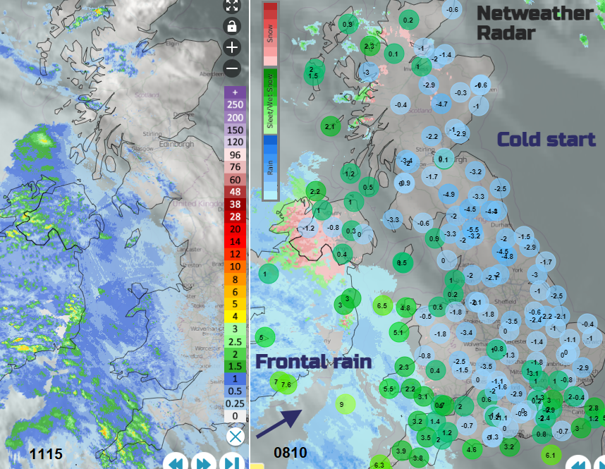
Check the progress of the incoming rain (and #UKSnow with weather type ON) using the Netweather Radar
We have a fine, chilly start over Britain this morning in a ridge of high pressure. There are light winds but already there is frontal rain over Ireland with high cloud streaming ahead. An incoming warm front will bring milder air, fresh southerly winds and rain. As this rain hits the cold air there will be snow for a time. The Highlands and Western Isles look to be the most prone to see accumulations with several more cms forecast. A yellow warning for snow from the Met Office extends down through inland Scotland into NW England, particularly the Pennines and Cumbrian Fells. This is from late afternoon on Wednesday (as people head home from work) and into the night.
“Spells of snow likely to cause disruption, mainly over higher transport routes.” MO
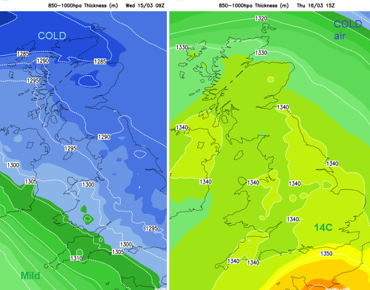
A change in air mass this week
The frontal bands will bring hill snow, sleet and then heavy rain. The rain from the first front is already over Ireland, the Isle of Man and into Cornwall. Northern Ireland has a warning into Thursday morning due to the persistent rain and possible impacts to travel as surface water increases.
“Persistent rain, which will be particularly heavy over southwest facing hills, is likely to cause some difficult travel conditions” MO
Parts of western Britain will also see a lot of rain with warnings for Thursday. There has already been rain here, there is the snow melt and there will be plenty more low pressures with weather fronts heading in from the Atlantic this week. Do keep an eye on local flood warnings for western areas
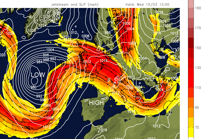
The Jetstream has been further south with northern Europe across to Greenland seeing high pressure and the UK feeling the effects of colder Arctic air. The Jetstream is now meandering over the UK and we will see further low pressures and rain from the west into the weekend.
The frontal rain reaches across to SW Britain, more of Wales and Stranraer by early afternoon with a freshening southerly wind. By Wednesday evening the rain will be over more of Britain although not east coast England nor northern Scotland. Southern England will be grey and damp but with only patchy light rain. The breeze will pick up everywhere and rain keeps going for Northern Ireland
Early on Thursday, the wettest areas will be Northern Ireland, SW Scotland up to Strathclyde, NW England, particularly Cumbria. By mid-morning, much of western Britain will be wet as the cold front pushes through and brighter skies appear for Ireland with some sharp showers.
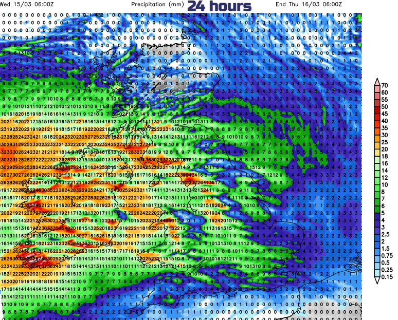
Some of the Met Office forecasts could be affected by strike action today, so check the date issued. If you are travelling over higher level routes later today do be aware that hill snow is forecast for northern Britain. Also for a wider area, heavy and persistent rain with the risk of flooding for NW Britain and Northern Ireland.