The busy weather continues into next week and with milder and colder air masses clashing and alternating, there will be the threat of further snow at times.
After a long spell of generally uneventful weather, that has all changed this week, with wet and, for some, snowy conditions arriving onto the scene.
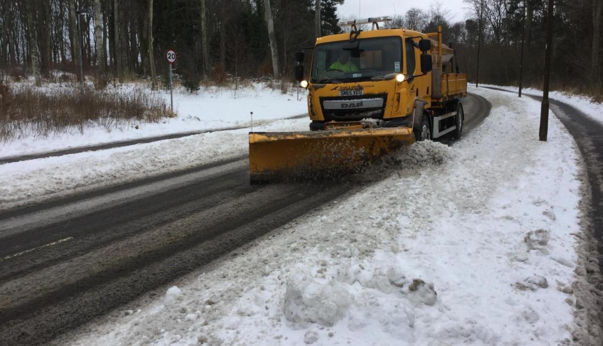
Through Thursday and Friday, heavy snow particularly affected the higher ground of northern England and the north of England. The Sheffield area was heavily affected on Thursday and Friday, with 30cm measured at the Weston Park weather station. Elevation made a large difference in many parts of the affected area. Places near sea level saw nothing more than a thin coating of slush on the grass, while areas more than 100m above sea level saw considerable snow accumulations.
With the warming of the UK climate, we can increasingly expect these sorts of snow events to see significant accumulations reserved mainly for high ground. UK snow has always tended to be marginal at low levels, and even a small amount of warming can make the difference between sleet and significant accumulations of snow. Substantial snow events are still possible near sea level today, but as time goes on, they are becoming fewer and further between.
Similarly, although the general tendency is for months to become warmer relative to the long-term average, colder-than-average months are still possible. In the long-running Central England Temperature series, March is currently running 2C below the old 1961-1990 average. Over the upcoming week, the weather looks set to see alternating warm and cold spells, with spring very much coming in erratically and in fits and bursts. Some much warmer air will be associated with low pressure systems coming in from the Atlantic, but as these lows move into the North Sea, Arctic air will keep heading back southwards.
Tonight, a band of precipitation will continue to extend eastwards through the country. In Scotland and north-east England, a spell of snow is expected to penetrate to low ground before milder air and a thaw set in during the early hours of tomorrow morning. It will generally be a frost-free night due to cloud cover and much warmer air moving in from the south-west. In Northern Ireland and in southern England, temperatures towards the end of the overnight period will become warmer than during the day today, generally rising to between 7 and 9C. However, temperatures will stay below freezing for much of the night in many inland parts of northern Scotland.
Sunday will be a much milder day than of late, with maximum temperatures generally between 10 and 13C. There will be some sunshine in eastern areas, but it will generally cloud over from the west as the day progresses, and rain will spread into most of Scotland and south-west England during the afternoon, reaching other parts of the UK during the evening. This warmer air will not make it into the far north of Scotland, where, although precipitation will tend to turn to rain at low levels, temperatures will only reach between 3 and 5C.
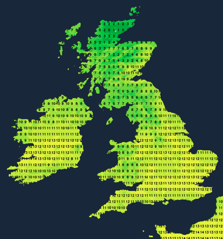
Colder air will return southwards through Scotland and eventually into northern England on Monday, with the potential for further significant snow on high ground on the northern flank of the frontal system as it pushes south and some wet snow to low levels for a time as well.
On Tuesday, we can expect a mix of sunshine and wintry showers, with showers widely falling as snow or hail to low levels from the Midlands northwards. It is looking probable that milder air will return from the south-west towards the end of next week, but again this may be preceded by a spell of snow, particularly in northern and eastern parts of the UK.