Back to cold frosty air with a risk of ice before another frontal band brings the threat of sleet and snow as it heads northwards later on Saturday. Mild on Sunday but cold again next week.
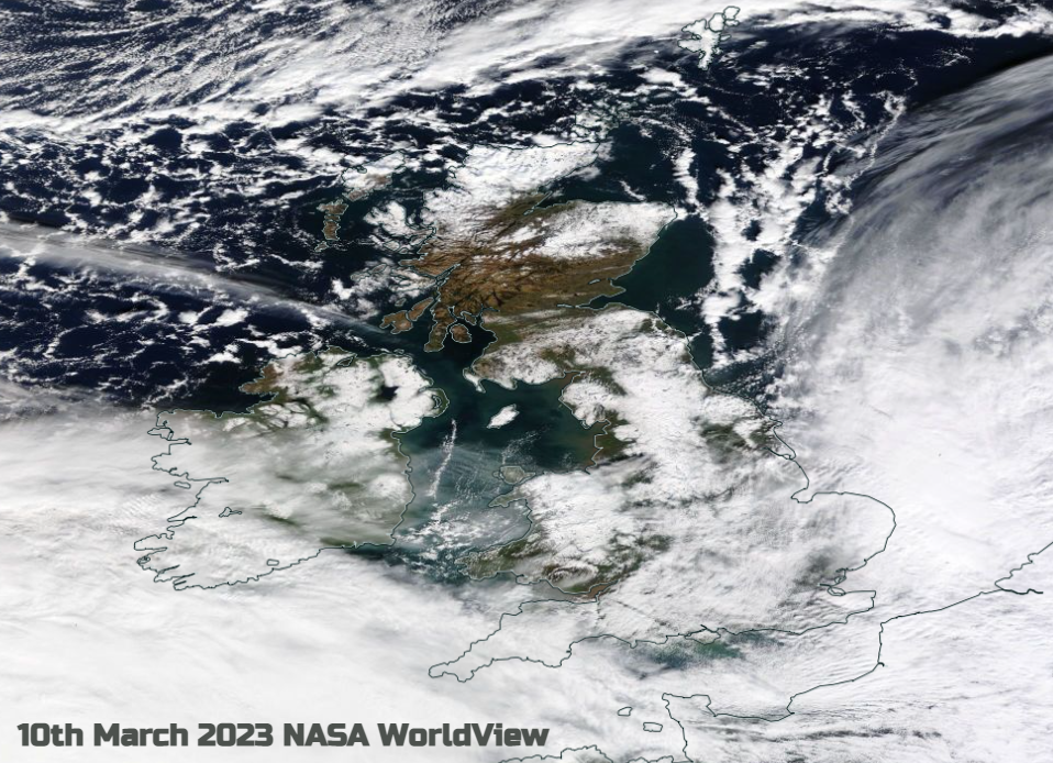
It’s been quite a week with many parts of the UK seeing snow. It has felt very cold in the wind but as soon as sunshine appears and the melt begins, we are reminded that spring is nearby. This weekend there will be another cold night with frost and ice, and then a temporary shift to milder air follows for Sunday with a flow from the southwest. Again, there is a frontal boundary in-between which will bring a spell of rain, sleet and snow but not the travel disruption and wild conditions of Thursday night. We have seen frontal snow a few times this week where dividing lines between mild air in the south and cold Arctic air to the north have resulted in a mix of precipitation. There has also been a feed of snow showers from the north.
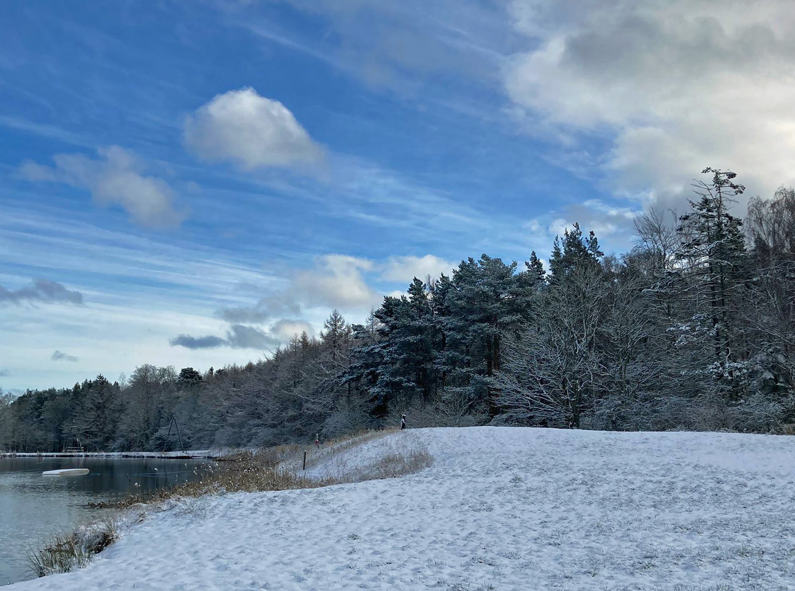
East Lothian snow K.Robertson
Even colder air will reach northern Scotland during Friday night and there will be a further scattering of snow showers for the far north and northwest. There are warnings for ice for the areas that saw snow in the week. The low, that brought the heavy snowfall and amber warnings, is pulling away over Germany and Poland. It was named Storm Larisa by Meteo France. Behind this low is cold air with clear skies and sunshine for Friday and then frost by night.
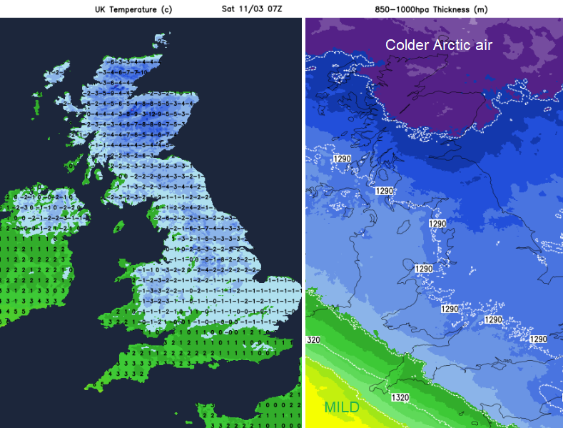
Much of the UK will start cold and sunny on Saturday with very light winds. Southern Britain will see high cloud to start the day and the incoming frontal band will already be over SW Britain by dawn on Saturday. So grey and damp here with a south-easterly breeze picking up. The air will still be chilly on Saturday but any March sunshine will make it feel cheery.
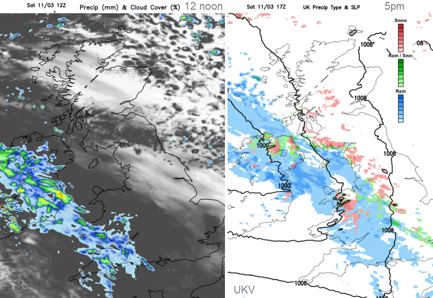
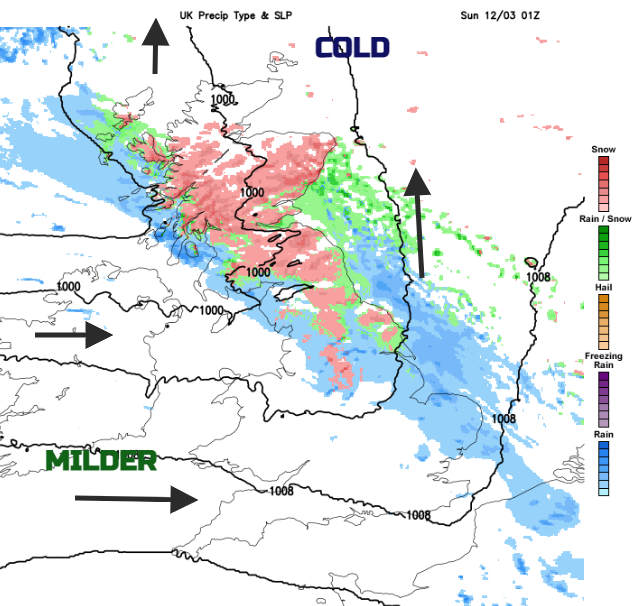
There are concerns about more wintry weather along this frontal band with a yellow warning over northern England and Scotland. This runs from Saturday afternoon and overnight as the band moves northwards. The front pushes up against the cold air in the north, there will be more snow but again there is uncertainty about where and how much.
“Further snowfall has the potential to cause disruption Saturday evening into Sunday.” MetOffice
The front edges northwards on Saturday afternoon and snow is likely over the Welsh mountains and higher ground. As it falls dark there will be sleet and wet snow to lower levels and bursts of graupel and then falling as snow over northern England and Scotland through the night.
However, if you are hoping for sledging on Sunday, the mild air is following behind and it will be a fine balance of late rain or a snow top-up for northern Scotland as the frontal band reaches Orkney for dawn on Sunday.
Ice will be a hazard over northern Britain with the falling sleet and snow but also a risk of freezing rain which can create treacherous conditions on the roads.
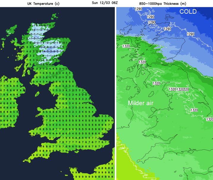
Heavier bursts of showery rain will affect western Scotland, Northern Ireland and NW England on Sunday. The frontal band edges up towards Shetland with sunny spells appearing behind and there will be a moderate south-westerly breeze. Temperatures on Sunday will reach double figures for many parts. The winds will strengthen during Sunday evening.
Looking ahead there is another incoming Atlantic low. Sunday night will be wet and windy with more snow over the Scottish mountains. There will still be the mild SW flow for many but through Monday a cold northerly will take hold as the low pulls away to the east. Temperatures plummet the frost returns for Monday night and there looks to be more snow and ice in the forecast for next week.