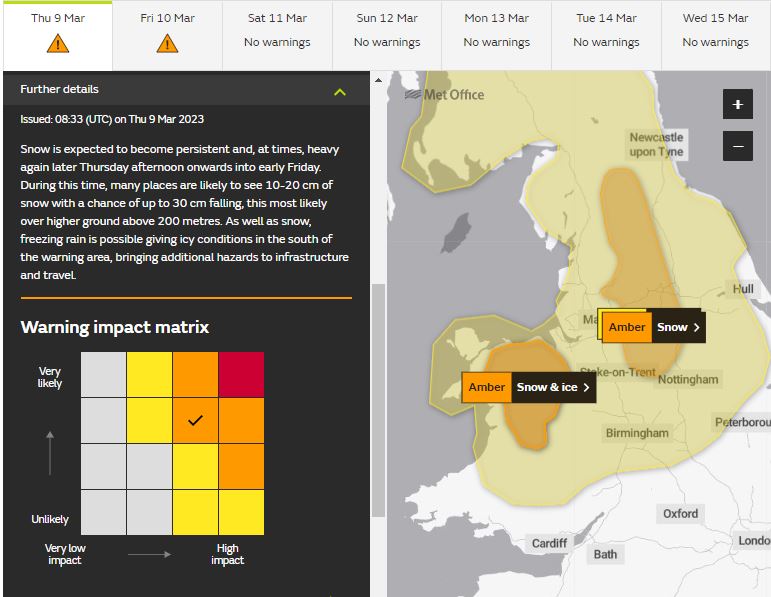
Prolonged snowfall is forecast across N. Ireland, mid-to-north Wales, northern England and north Midlands through today & overnight into Friday morning. Yellow warnings in force for these areas, but two separate amber warnings for N Wales and Pennines - where 25-40cm could fall. Greatest disruption could be Friday morning.
Snow has set in this morning across Wales, The Midlands and northern England since the earlier hours. The snow will move north in across N. Ireland as well, with outbreaks of snow continuing here over north Wales and northern England throughout today and overnight into Friday, before finally clearing away eastwards tomorrow morning. So some parts of north Wales and northern England could see over 24 hours of snow falling, N. Ireland not far behind.
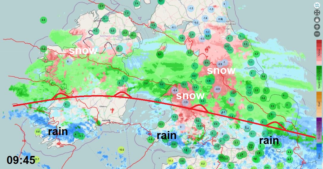
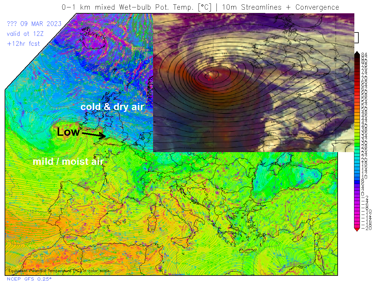
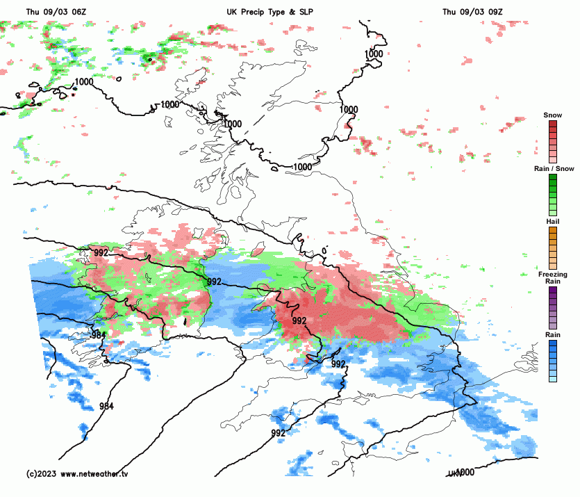
A warm front, associated with an area of low pressure to the southwest of Ireland, has pushed outbreaks of rain eastwards across southern England, snow across inland Wales, Midlands and northern England – where there is cold arctic air holding on. The low SW of Ireland has quite a lot of Tropical maritime moisture wrapping up into its circulation on its journey east over the north Atlantic and this relatively warm moist air bumping into the stagnant cold arctic air across central and northern Britain and being forced to rise will feed continuous snowfall across the aforementioned areas. Snow will be heavy locally, especially over higher ground, on the northern flank of the low tracking east across southern England tonight before moving into the Low Countries tomorrow morning.
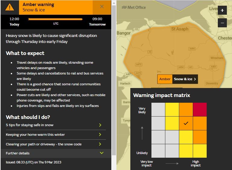
Two Met Office amber warnings are now in force for the snow. One issued yesterday for the Pennines area of northern England and this morning another amber area was issued for north to mid-Wales. The Pennines Amber warning mentions “10-20 cm of snow is expected to fall quite widely, with some places seeing 30-40 cm. Strong easterly winds are expected to accompany this snow, leading to blizzards and drifting of lying snow.” The Wales Amber warning mentions: “many places are likely to see 10-20 cm of snow with a chance of up to 30 cm falling, this most likely over higher ground above 200 metres”
Snow has been falling in these areas for a while now this morning, so there is already a covering of a few centimetres at least, more over higher ground across Wales, Midlands and northern England. As a result of today’s weather, schools have been closed across Wales. Although the snow is not causing widespread problems on the roads at the moment, snow looks to continue throughout today and overnight into Friday morning across N. Ireland, north Wales and northern England just to the north of a slow-moving warm front separating cold arctic air to the north and milder air to the south. A continual supply of moist air lifted along the front will feed the snowfall, which could be heavy at times, especially for higher ground.
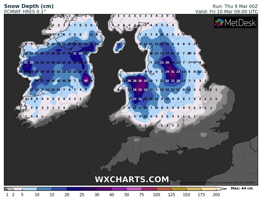
00z ECMWF model suggest 30cm+ before snow clears tomorrow for parts of mid and north Wales along with the Pennines and Peak District. Some higher ground areas could see more than this, with up to 40cm.
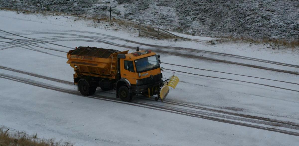
These kinds of accumulations are likely to bring widespread travel disruption, with roads becoming treacherous as gritters and ploughs fail to keep up with keeping roads clear, while some higher routes over the Pennines, Peak District and North Wales may become impassable, exacerbated by a strong easterly wind developing which will lead to drifting of snow piling up into deep drifts. There is potential for some rural communities to become cut-off as a result. It is advisable during Amber Warnings that the general public do not travel in these areas unless absolutely necessary, as vehicles could easily become stranded in such conditions expected. Trains travelling through these areas are also likely to face major disruption with tracks covered in drifts in exposed areas.
Elsewhere across Northern Ireland. northern England, north Midlands and Wales where snow will fall in the wider yellow warning areas running concurrently, at lower levels there will also be snow falling, it may struggle to settle in towns and cities, with temperatures hovering above freezing. But there is potential in the yellow warning areas of accumulations of 2-10cm locally where snow is heavy – more especially over hills. The snow this morning may turn back to sleet or rain for a time this afternoon across north Wales and the North Midlands, but as temperatures fall overnight and precipitation turns heavy tonight, it is likely to turn back to snow at lower levels across these areas to join northern England – where it will likely remain as snow through today.
Higher ground of north Wales and northern England will be most prone to highest accumulations – as temperatures here will stay at or below freezing, while at lower levels temperatures will rise above freezing during daylight before falling close to or below overnight.
Tomorrow morning could see the most disruption in the Amber and Yellow warning areas, given the snow will be continuing to build up overnight. So in these areas it may be best to stay at home in the Amber Warning areas, with widespread travel disruption likely. However, the sleet and snow will clear east through the morning, followed by a drier and brighter afternoon, with a thaw likely away from high ground, despite the cold northerly wind developing as the low bringing the rain and snow clears into the Low Countries.