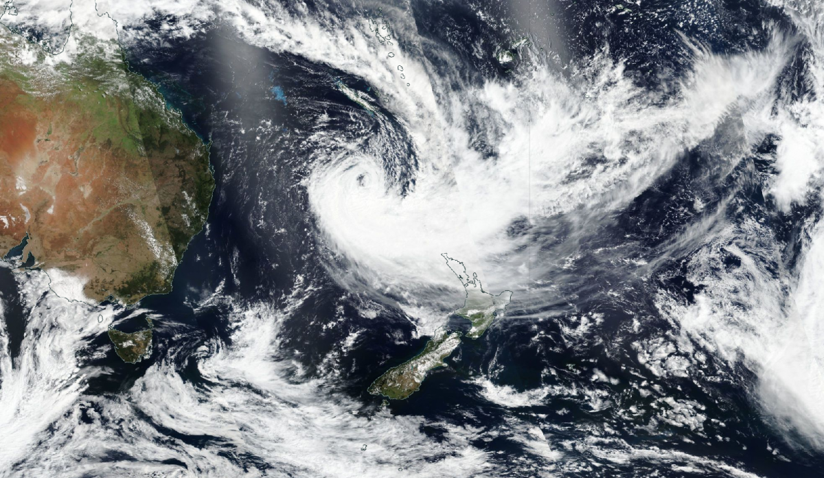
New Zealand has had its share of severe weather lately, with Cyclone Gabrielle looking likely to create further issues. Nearer to home, the weather is still quiet, but there are goings in the stratosphere which could help bring about a change in the not-too-distant future.
New Zealand's climate has a reputation for being moderate and mostly without dangerous extremes, but parts of New Zealand's North Island have been having serious problems recently. At the end of January 2023, severe flooding affected the city of Auckland in New Zealand's North Island, after record-breaking daily rainfall, leading to widespread damage to properties and transport disruption. Some other parts of the North Island, such as the Coromandel Peninsula, were also affected.
Through tonight and into tomorrow, named Cyclone Gabrielle is forecast to hit New Zealand's North Island and exacerbate the recent problems with flooding. Residents in areas that are prone to flooding have been told to be prepared to evacuate, and Air New Zealand has cancelled some domestic flights. Cyclone Gabrielle has recently been downgraded from a category three storm to a category two storm, meaning that while there is potential for serious disruption, it will probably not be as serious as some forecast model outputs had previously been suggesting. However, the recent flooding and saturated ground will tend to add to what impacts do arise from Gabrielle.
Here in Britain, in contrast, the weather is remarkably quiet and benign, with a large area of high pressure dominating the weather across most of Europe. This high pressure looks set to stick around for at least another week, too. This will, however, continue to increase the concerns over the potential for drought conditions to return into the spring.
Long-range forecast models are now suggesting that a sudden stratospheric warming event is likely, which increases the likelihood of us seeing blocking anticyclones developing at high latitudes towards the end of February and into March, and sending cold northerly and/or easterly winds over to Britain. Contrary to what some media outlets are reporting, this doesn't necessarily mean that we will see a "Beast from the East" - the two easterly blasts in late winter and early spring of 2018 were very much at the extreme end of the range of possibilities that arise from sudden stratospheric warming events.
It's also worth mentioning that occasionally sudden stratospheric warming events can result in blocking highs forming in places that result in Britain seeing warm weather. A stark example was in February 2019, when, after a sudden stratospheric warming event in January, parts of North America and Canada saw exceptionally cold weather, but, in contrast, Britain lay on the western and north-western flank of a large blocking high over Europe. This resulted in mild and sunny weather for most of the country mid to late month, which eventually brought daytime temperatures as high as 21C in the south-east.
Again, the warm sunshine of late February 2019 is an extreme scenario, and a sudden stratospheric warming event does tend to be correlated on average with colder weather. Many medium-range forecast runs are suggesting that our high pressure will increasingly become centred to the west of Britain in about ten days' time.
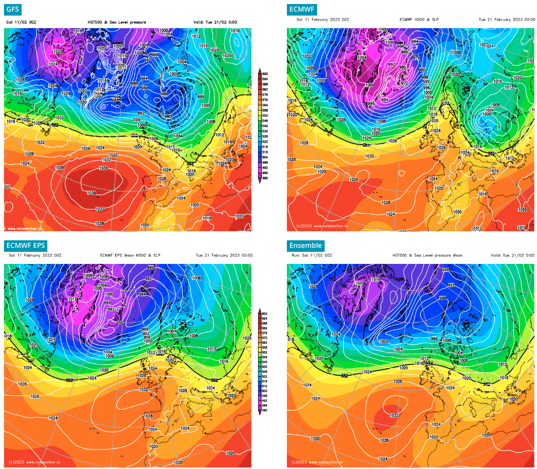
Especially with the addition of a sudden stratospheric warming event, this could see the high pressure ridge northwards towards Greenland and Iceland, setting us up for some cold northerlies towards the end of February and into March. However, this is a fair way off and subject to considerable uncertainty.
The weekend has started mild and dry but generally cloudy, although parts of eastern Scotland and eastern England, particularly eastern coastal counties from Norfolk northwards, have been seeing some sunshine. This pattern generally looks like continuing during the rest of Saturday, though bright or sunny intervals are expected to develop more widely during the day, particularly in south-west England. Temperatures will generally reach highs of between 9 and 12C, which is rather above the long-term average for February.
Looking further ahead, the high pressure will push north-eastwards and bring in some drier continental air from the south, so it looks likely that the weather will turn sunnier over the next few days, while remaining mild by day but turning colder by night. The weather looks set to turn more unsettled from midweek onwards, but still staying mostly dry in the south for the foreseeable future.
Satellite image from NASA worldview