


It will feel much colder across the UK and western Europe this week with air from the north. Two named storms will bring rain, sleet and snow as northern Scotland sees snow showers for days.
Two low pressures, which will move just to the south of Britain in the next few days, have been named by France and Spain. With a colder flow from the north, any UK precipitation linked to these could include snow.
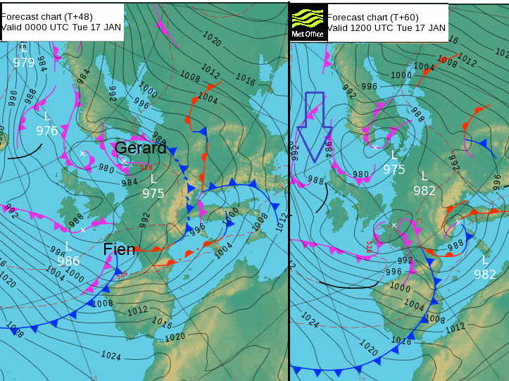
Firstly (Tempête) Gerard, named by Meteo France which will deepen in the English Channel on Sunday night. Secondly (Borrasca) Fien named by AEMET passing by early on Tuesday.
The UK, along with Ireland and the Netherlands has yet to name any storms so far this season. France and Spain belong to another storm naming group for SW Europe and these low pressures will bring strong winds, heavy rain and snow. Also, the drop in temperatures and flood of much colder air this week is being highlighted right down through western Europe.
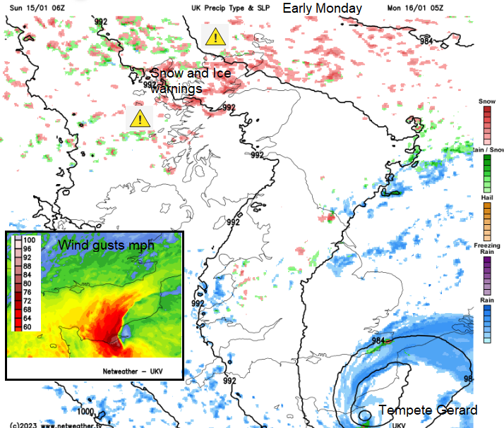
The UK is already feeling colder with ice on Sunday morning. Northern Scotland has a long-running yellow warning for Snow & Ice from Sunday afternoon through until Wednesday. And the snow showers look to continue through midweek as the cold air holds on into Thursday. The SE of England has a low likelihood yellow warning for snow but if the rain does turn to snow on Monday morning, the impacts will be high.
This snowfall and associated wintry conditions of ice and frost, take hold in a cold Arctic flow from the north.
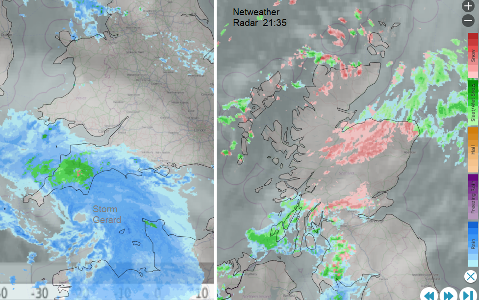
Netweather Radar Sunday evening - Snow for parts of Scotland tonight and turning wintry up on the Moors of SW England.
Other parts of the UK are less likely to see snowfall but as the cold air deepens, or by night, any rain could turn to sleet or wet snow, and even settle over the hills further south. If this happens say for SE England during the Monday morning rush, or early on Tuesday for southern Britain, there will be impacts on the roads with an icy slush on the pavements.
To some, this will be seen as just usual wintry weather but this upcoming cold spell brings the likelihood of more slips and falls, which in turn has impacts to health services.
“This weather could increase the health risks to vulnerable patients and disrupt the delivery of services.” Current alert level: Level 2 - Alert and Readiness forecast for parts of England
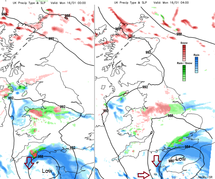
Storm Gerard is forecast to move west to east along the English Channel during Sunday night with very rough seas and strong winds for the Channel Islands. There are some differences in the model output about where will see the strongest winds and highest gusts. Mostly this will be over the north coast of France but could affect Dorset on Sunday evening and the Channel Islands overnight, if the low is slightly further north. This would also bring more precipitation to southern England and more interaction with the cold air. This highlights snow over the Moors of SW England and as the frontal band clears SE England on Monday morning. The Kent Downs, South Downs, High Weald could see a covering to start the working week but there is plenty of uncertainty.
Netwx SR model showing low Gerard impacting south coast Britain with strong gusts, heavy rain and possible snow tonight. Also gales for the Channel Islands.
Gerard - Meteo France ‘Strong winds will not be the only meteorological risk of the disturbed sequence. Snow may fall at low altitude over the entire terrain.’
The UKV model keeps the low slightly further south with vicious gusts for Normandy overnight and wintry precipitation clipping Kent
Linking back from Strom Gerard will be another low centre. Spain will feel the effects of Gerard, with stronger winds, rough seas off the north coast and heavy rain with hill snow. However, Fien was named as the most impactful part of the winter storm. This forms in the early hours of Tuesday and ‘will be accompanied by snowfall at low levels in the centre and northern half (of Spain), where snowflakes could even be seen at sea level.’
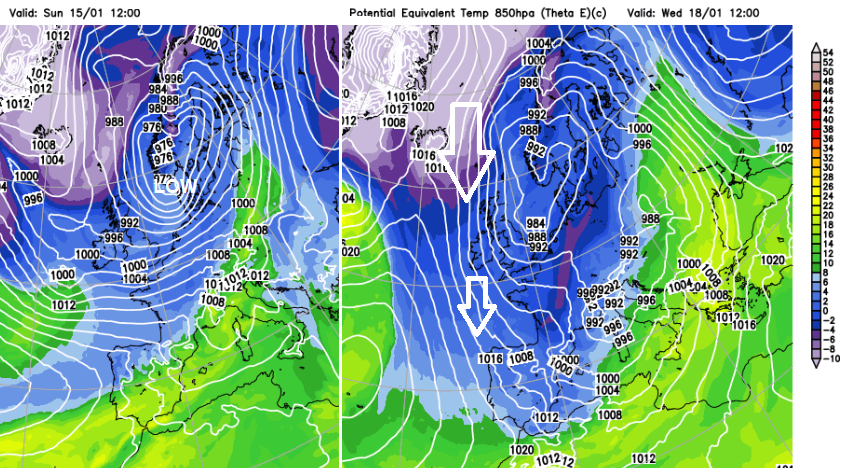
The plunge of cold Arctic air finally reaching right down through Spain midweek
AEMET Fien ‘will affect a good part of the northern half of the peninsula, which will remain for a good part of next week. This situation will peak on Tuesday. The flow, from the northwest of the peninsula, a very cold air mass of origin maritime-polar, which will spread in subsequent days to the rest of the Peninsula and the Balearic Islands.’ There will be intense, cold NW Winds and widespread rain accompanied by snow, even to low levels by midweek.
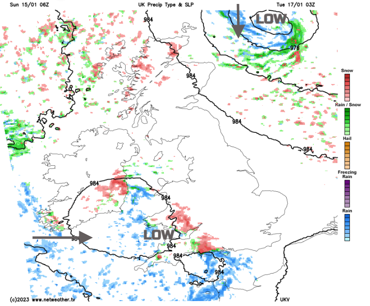
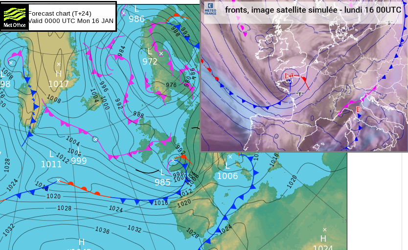
Although the main thrust of Storm Fien will be over mainland Europe, another low centre will follow along to the north. This moves across the Celtic Sea to the English Channel as a small non-frontal low develops in the north North Sea. Both of these could bring snow to Britain. Again, there is uncertainty. Does the low moving out of southern Ireland just pull away over northern France leaving fine weather for southern England on Tuesday, or it clips the south and brings a wet, wintry mix. The low off NE Scotland could interrupt the ongoing snow shower feed or, get closer to Aberdeen and bring gales with more persistent snowfall to Grampian midweek.
There will be plenty of low centres moving by, or swinging about, combined with the colder air and gradual setup of Arctic air from the far north managing to reach right down through western Europe. The NW Highlands, Moray and Aberdeenshire and the Scottish Islands will all see snow this week. Elsewhere, it will be cold but the likelihood of snow is much lower but there is plenty to keep an eye on.


