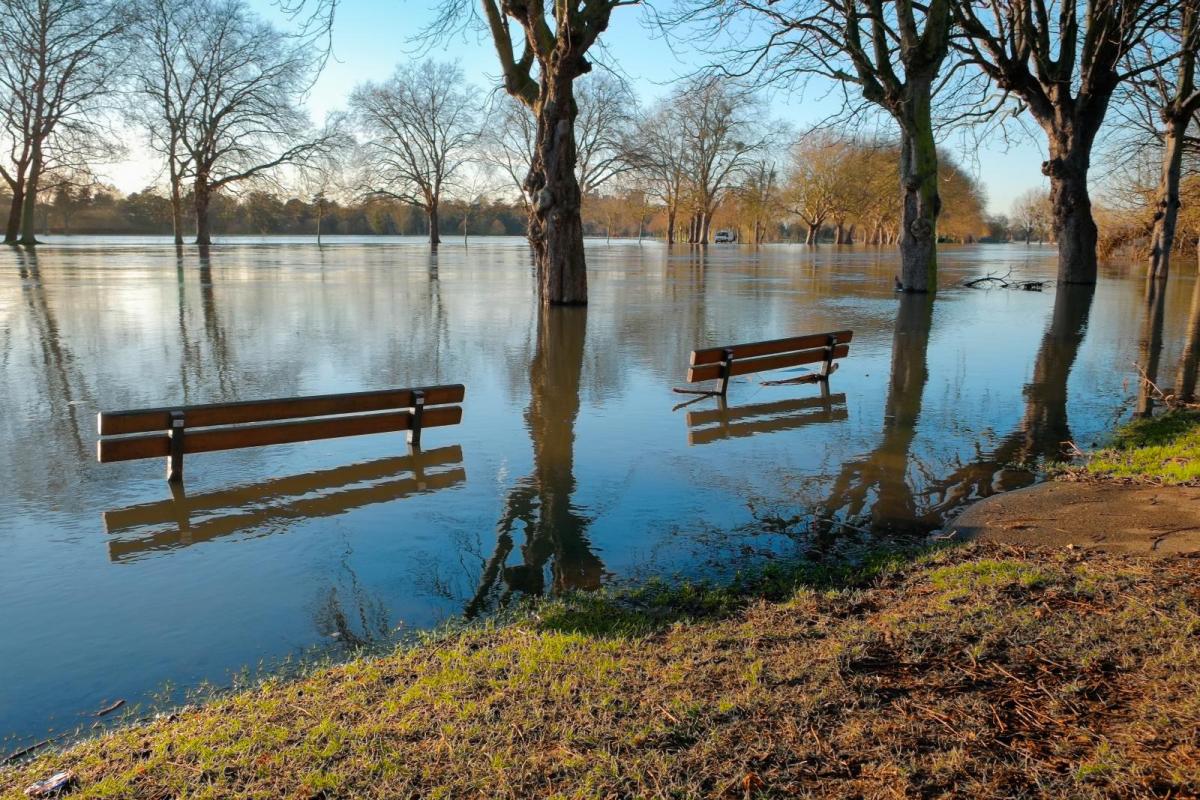
Strong winds and high gusts during Thursday night but there is more rain forecast as flooding concerns grow. The threat of river, surface water and groundwater flooding continues in a very wet January.
Even though it is not especially cold at the moment, the mild January is producing different winter weather issues. There are already numerous flood warnings across Wales and England due to river and surface water flooding. This is expected to continue over the next few days with more heavy rain on the way for western Britain. Some rivers respond quickly. Others, like the Severn, take longer with the risk sometimes increasing days after the main rain has fallen. During Thursday evening and night there will also be wild weather with gales and high gusts.
“Slower responding rivers, particularly in parts of the West Midlands and North East England, are likely to remain high through the next five days leading to further river flooding impacts.” EA
Do be aware that some of the usual online flood and river data is not available and the flood messages are being automated at this time.
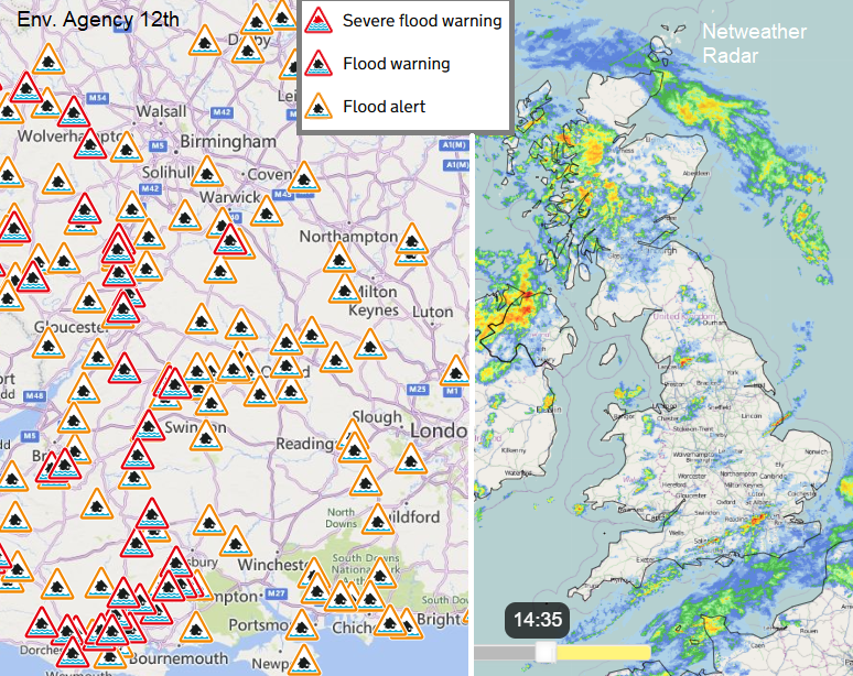
Flood warnings from the EA and Netweather Radar showing current rainfall
Parts of southern England also have groundwater flooding concerns with more flooded fields, blocked roads, high rivers and huge puddles.
“Following three months of above average rainfall, groundwater levels in the area have risen considerably, and with further rainfall forecast over the next ten days are set to rise yet further.” Environment Agency Dorset
The rain and flooding warnings are generated between the Met Office and the Environment Agencies, using the forecast rain amounts, radar data and weather models but also river response and flow modelling. Like the weather observations, there is ongoing rain gauge data and river flow measurements being recorded. Often the colours of the warnings are similar but it could have stopped raining and yet the threat of serious flooding remains, waiting for a mass of water to flow down off hills and mountains. It has already rained a lot recently and the rivers are high. There has already been plenty of preparation and barrier building for the most prone areas and people are encouraged to continue their own responses and planning.
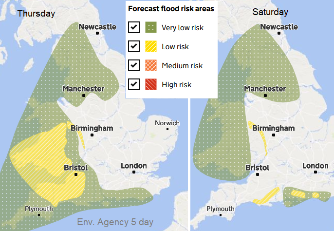
Forecast flood risk areas from the EA 5 day forecast
'Demountable defences' have fixed foundations and the locally stored pillars and slats are moved to places like Bewdley, when required, and slotted into place. Other 'temporary defences' are more mobile. Council roads teams and the Fire & Rescue services will continue to collaborate with the flooding teams this week. The plea from all of these, is for people to stay out of flood waters. To not take a chance with driving, cycling or wading through.
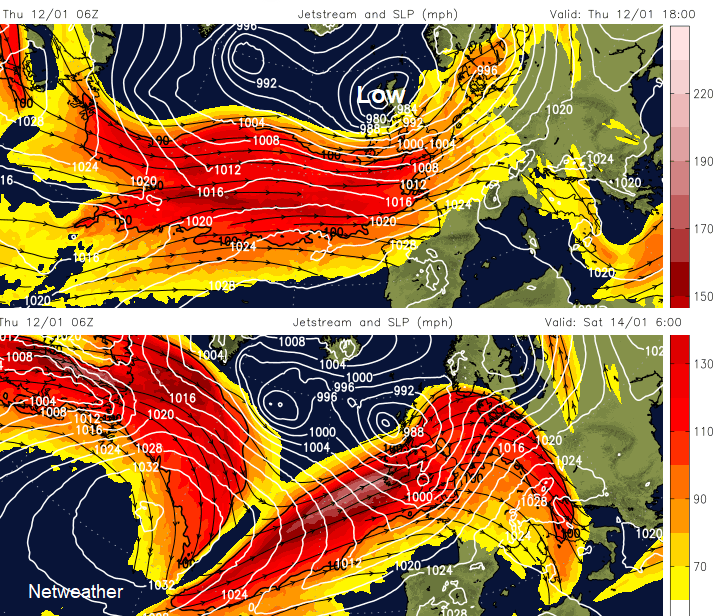
There is more rain in the forecast over the next few days as the Jetstream continues to power more low pressures towards the UK. There will be heavy rain off the Atlantic and strong winds from the west or southwest before an interruption to this barrage during the weekend. Finally, the zonal, direct Jetstream flow begins to buckle and shift. That means different areas will see the main focus for any precipitation, which with the introduction of colder air, will include snow.
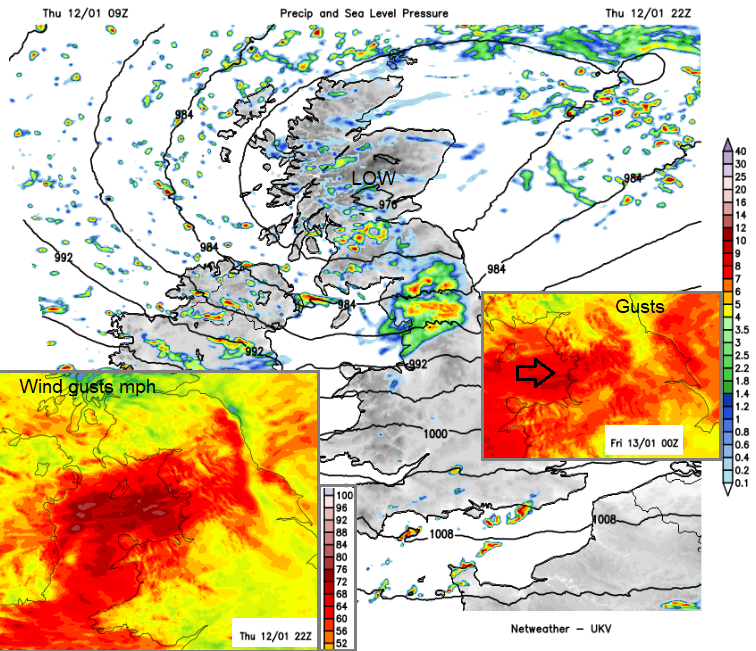
However, we still have a developing low moving across Scotland later today. There are wind warnings for Northern Ireland and around the Irish Sea across to NW England for later Thursday and overnight with concerns about disruption to travel. Gales, even severe gales in exposure, are forecast for Northern Ireland on Thursday evening. The focus moves across the Irish Sea to coastal areas and then northern England early on Friday. Gusts of 70mph are forecast for exposed coasts and hills with hefty showers making driving conditions difficult. There will also be large waves and the Isle of Man has a warning of severe gales tonight.
The Met Office rain warning over SW Britain comes to an end but the ground remains saturated and the threat of flooding continues.
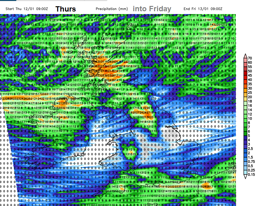
Heavy rain will swirl around the low centre over Northern Ireland and western Scotland as heavier bursts of frontal rain clear SE Britain this evening. There will then be a lull. A drier interlude as any remaining showers fade on Friday. However, by Friday evening, the next area of frontal rain will arrive for Wales from the west as a new developing low pressure heads in.
24 hour forecast rainfall totals UKV
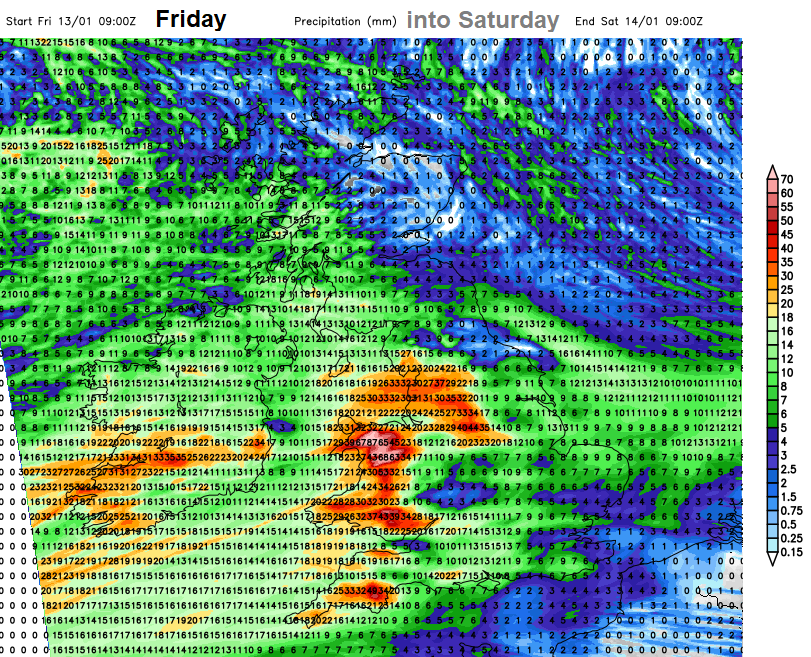
This looks to affect the northern half of Wales, NW England and western Scotland before midnight on Friday and then become much more widespread over Wales, England, Northern Ireland and SW Scotland by early Saturday. However, there are differences between the various models regarding the development, timing and path of this low pressure. The UKV model shows a very wet Saturday morning for all the areas with flooding issues already. Like Shrewsbury, Somerset, Worcester and Tewkesbury.
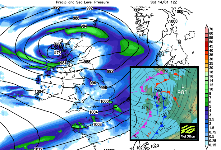
Once this is through, there will be another lull, through Sunday until the next Atlantic weather system comes in from the west on Monday. After the wet Saturday morning, it’s not a completely dry picture but it won’t be heavy and persistent frontal rain for at least part of the weekend.