It snowed in the south and in London on Sunday. This caused excitement but also disruption to airports, buses and trains with people stranded overnight in the snow. Was a Yellow warning enough?
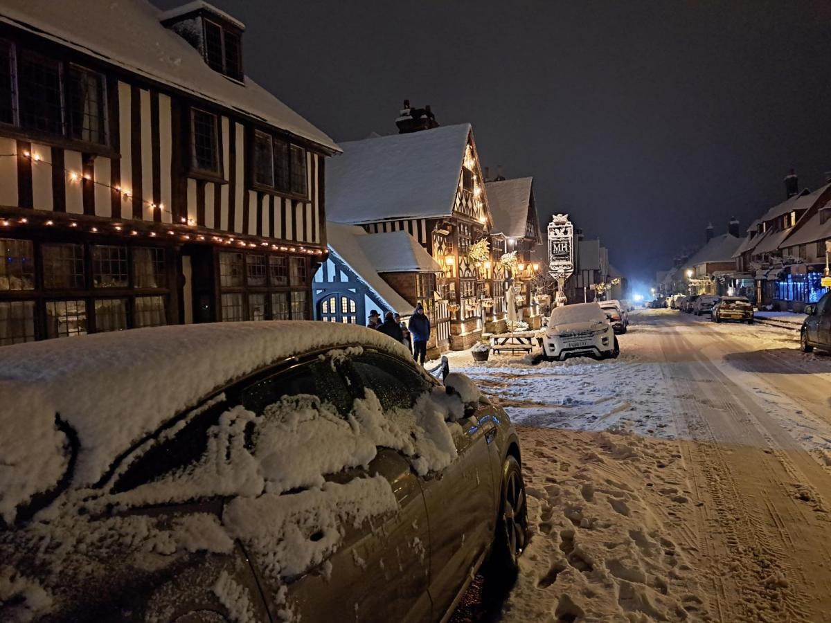
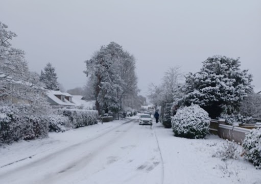
Sunday 11th December saw proper snow for the south. Central London saw fat flakes falling and there was a satisfying covering of snow for the Home Counties with reports of 2 to 12cm inland. For those who'd been watching the models, then the radar and lampposts, finally there was snow joy. For people driving home at the end of the weekend, there was disruption and woe as road conditions soon deteriorated. Several major roads came to a standstill as the snow kept on falling and couldn't be cleared and there was disruption at London Gatwick and Heathrow with Stansted airport closing for a time.
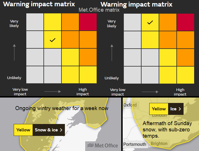
The UK Met Office had issued a yellow warning of severe weather for Snow and there has been a lot of debate around this. The Met Office warning system is Impact based rather than numerical. So not, the amount of snow, nor how much rain or reaching a certain wind speed. It adds many things into the warnings pot to consider the likelihood of the weather event and the potential impacts.
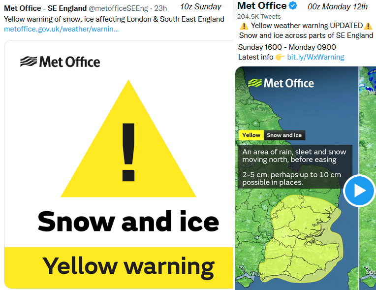
Warning from Met Office for Sun 11th/Monday 12th Dec
We start with snow, which is tricky to forecast. Any UK forecaster will shudder about snow forecasting most of the time. This event, which was highlighted, was over the highly populated SE of England including London. Lots of people and infrastructure to be impacted. Someone commented that one of our forecasts was only focusing on the southeast snow earlier this weekend. If the southeast and London are forecast to see disruptive snow but nothing much elsewhere, then that is the main focus. Due to the huge population centre, potential travel issues and that there hadn't been any snow here so far in this cold event. It was a huge wintry change. Northern Scotland just keeps on going with their snow showers, frost and ice. Everywhere else was staying cold and quiet with more frost. It's not about being London-centric, it's highlighting the most impactful weather.
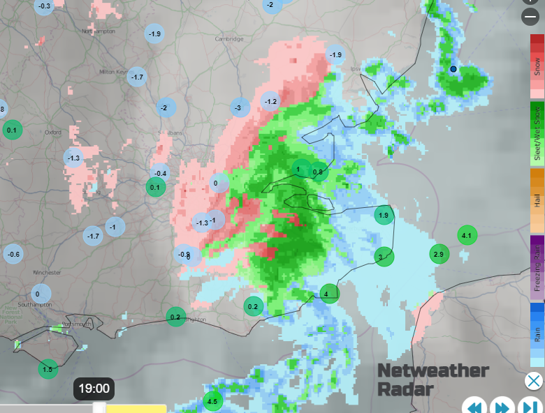
Netweather radar showing freezing conditions with rain, sleet and snow over London and SE England on Sunday 11th Dec.
"The weather models didn’t handle the potential for a snow event in SE England too well even just 24 hours in advance. However, after a day of hoar frost, outbreaks of heavy rain and sleet, that had been gathering along the south coast in the afternoon, moved inland. This readily turned to snow as it moved into freezing air. East Sussex and Kent bore the brunt initially before snow, locally heavy, moved northwest across London and the Northern Home Counties. I was on the fringe of the heavier snow, but managed to get about 5cm leading to winter wonderland scenes as it stuck to tree branches in the calm winds. Further east and north some places saw 10cm or more, which I think warranted a Amber Warning from the Met Office, given the travel disruption it caused." Nick Finnis - Netweather
The timing was Sunday afternoon and evening. It's not the busiest time of the week but people would have been travelling home from trips and shopping. The southeast and the M25 are rarely quiet. For councils and road teams, it’s the weekend, budgets are tight and once the snow starts falling it will soon be impacted and turn to ice. Once traffic began to struggle and stop then the gritters and snow ploughs could not do their jobs. For the airports, how often does southern England see heavy snow and sub-zero temperatures, how are their cold weather response teams?
How is the public supposed to know how much of all this is going into the warnings pot? If the warnings are about impacts, for the people stuck overnight in their cars on a snowy main road they were huge. For those diverted from Stansted or not able to get home on Sunday evening, again those were major.
If there had been a timely Amber warning would people have not travelled on the roads, would they have left earlier? That would then have helped those who had to travel at a set time, like shift workers. It’s no good having a warning when the snow is already falling. The government is trying to add personal resilience to all emergency responses. Flooding in particular. So, did you follow the winter travel advice and pack essentials before setting off on a December evening with snow forecast? Or think, it will be okay even it never snows here? Do we assume that the main roads will be cleared and yet how many people have ‘all weather’ tyres that can cope with the snow and ice, just in case.
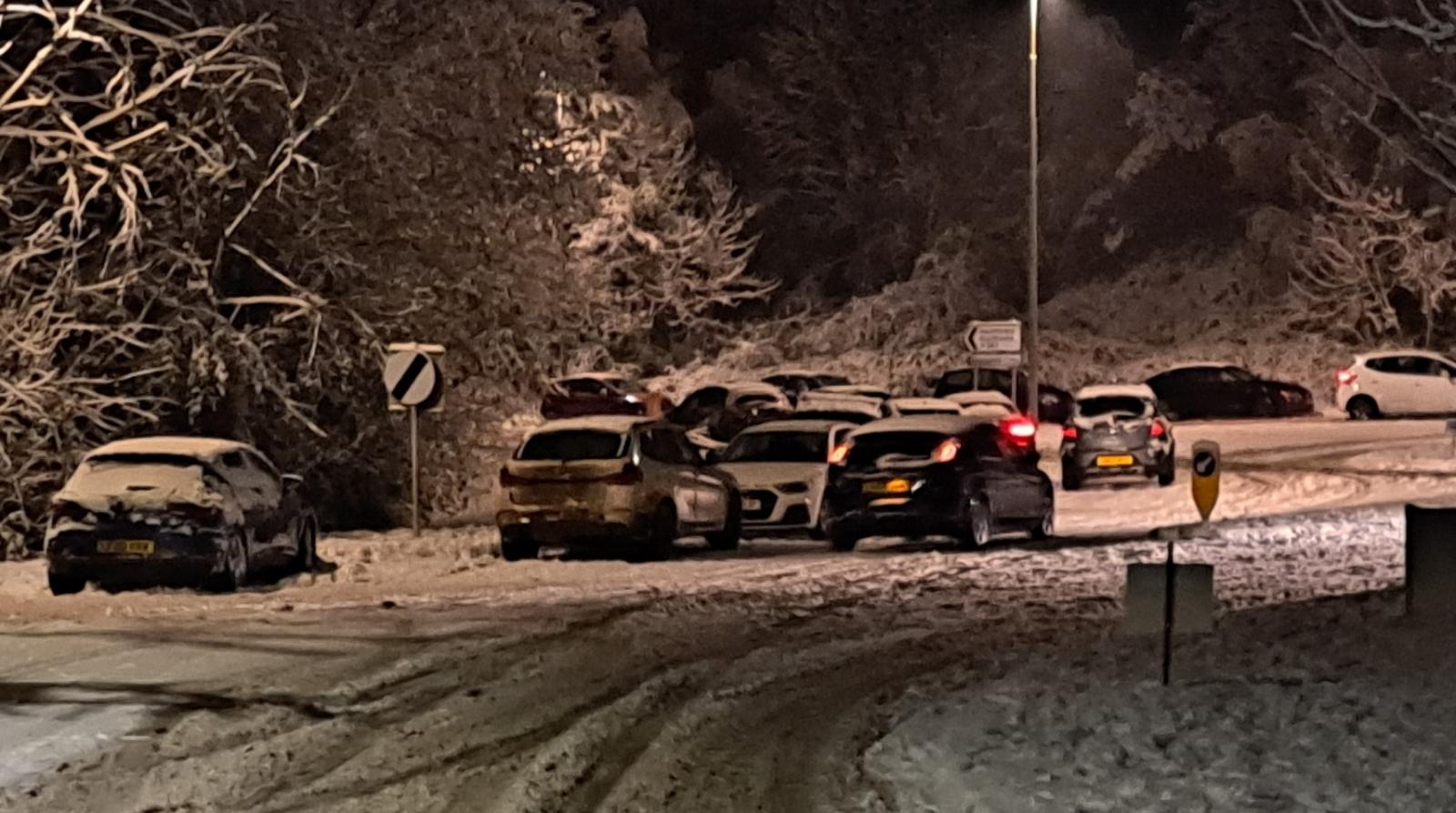
Back to the impacts. With so many factors which might or might not be feeding into the warnings pot, how are the public supposed to judge how the weather will be? We will all know of local streets, hills or villages that get badly affected in snow and ice. Under a blanket yellow warning, these spots would stand out to locals. And yet this was the M25 and M26, which are still blocked this morning in Kent. Delays on the M2 then M20 in Kent with A roads closed as accidents occurred and lorries came to a standstill. 40 people had to spend the night in a pub in East Sussex after becoming stranded on the A265.
Someone built a snowman on the A406 (North Circular) whilst waiting. It is probably still there.
The warnings use this three-tier system and looking at the social media output that is what you see. There are links to further details with text and then finally the matrix. So lightning warnings often hava e low likelihood (unlikely) but very high impacts, equals yellow. For Monday morning, northern Scotland has a yellow warning for snow and ice. It is likely that these areas will have snow and ice, but as it has been occurring for a week now, the impacts aren’t huge as everyone is used to it, knows what’s what and live in northern Scotland. The ice warning for SE Britain is very likely (as it is already there) but says low impacts.
Sometimes it feels like the warning system implodes due to its own constraints. If the public doesn’t know or doesn’t understand how the warnings are created or what they are saying then the system won’t work. Also, if the forecast does go awry (and UK snow is tricky), or the warning wasn’t suitable how does that process improve?
There are warnings systems for other users, like the weather health ones for health services in England. It is currently showing Level 3 - Cold Weather Action all week and is warning specific services about the forecast conditions. The Met Office will remind us that all colours, all these warnings are about 'severe weather' .The current public warning levels of: yellow, amber and the rare red, are clear and simple but did it help yesterday, was it the right call? Or is there too much other stuff going on in the background, influencing or restricting the levels that it’s not helping the public make their decisions? Which is the whole point.
Photos from SE, London and East Anglia Community group in the Netweather online forum- uploaded by DarkCloud and Nick Finnis. Plenty more discussion and chat about local snow, warnings and the rest of winter. No more snow for the southeast in the next few days, just cold and dry this week.
Decision making - Severe weather warnings and The Matrix