Everywhere has been cold and temperatures will fall below freezing again with the risk of ice after coastal showers by day. Grampian has seen plenty of snow showers and some disruption.
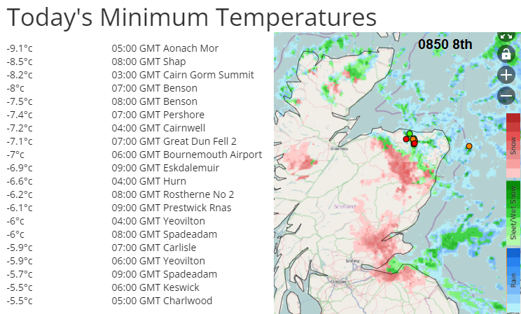
Winter has arrived with a widespread frost overnight and snow showers for parts of the UK. Temperatures were widely at or below freezing by Thursday morning with Shap Fell up in the Cumbrian hills seeing -8.9C. Moderate snow showers moved over Grampian to Lothian and then Northumberland on Thursday morning with a covering of white and excitement for the first snow of the season.
There were signalling problems on the rail line between Aberdeen and Inverness this morning as snow and ice blocked the points system. There were delays at Aberdeen airport and on the snow-covered roads. More widely, gritting lorries and pavement gritters have been out but all that slush will soon freeze after dark and anywhere that saw showers today, of snow, sleet or rain, will become icy later. The frost overnight will be severe in places.
There are ice warnings from the Met Office for tonight mainly for coastal Britain, N. Ireland and much of Scotland. Eastern areas become drier as the flow changes into the weekend so not as much risk but still worth taking care. Western Britain and Northern Ireland keeps the risk of ice into Saturday and the combined Snow & Ice warning over Northern Scotland runs over several days into Sunday. This remains the main focus for heavier snow showers moving in on the northerly flow of cold air from the Arctic.
This spell of cold weather has triggered the Cold Weather Payments for this week in some areas.
“if the average temperature in your area is recorded as, or forecast to be, zero degrees Celsius or below over 7 consecutive days. £25 for each 7-day period of very cold weather between 1 November and 31 March.”
People in Stannington and Hillsborough, Sheffield have been without heating for nearly a week now after a major incident was declared and 2,000 homes were affected. A huge amount of water entered a gas main last Friday and the gas supply has been off ever since.
The forecast for the area is much like everywhere else, staying cold. Night-time temperatures will fall below zero and by day only around +1 to +3C but feeling colder so the grim conditions continue.
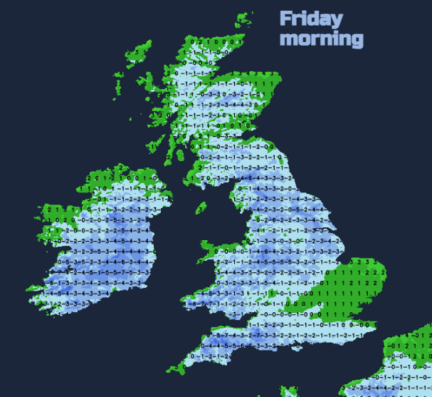
Many parts of Britain have had a stunning winter’s day with blue skies and sunshine but frosty cold. Under those clear skies, temperatures will fall away again with values around -8C appearing further south and at lower levels early on Friday.
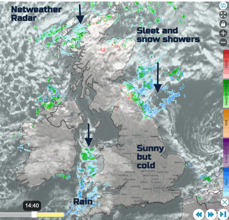
The cluster of wintry showers over NE England and accompanying cloud will sink southwards tonight. These will reach The Wash by the small hours and then pull away from East Anglia early on Friday. They mostly look like icy rain, but wet snow is possible too. Showers continue to pepper the north coast of Northern Ireland. The showers over western Wales continue with more cloud over SW Britain. After a wet spell with wintry bits over the Moors during the night, it should be clear and sunny by Friday morning for Cornwall and Devon.
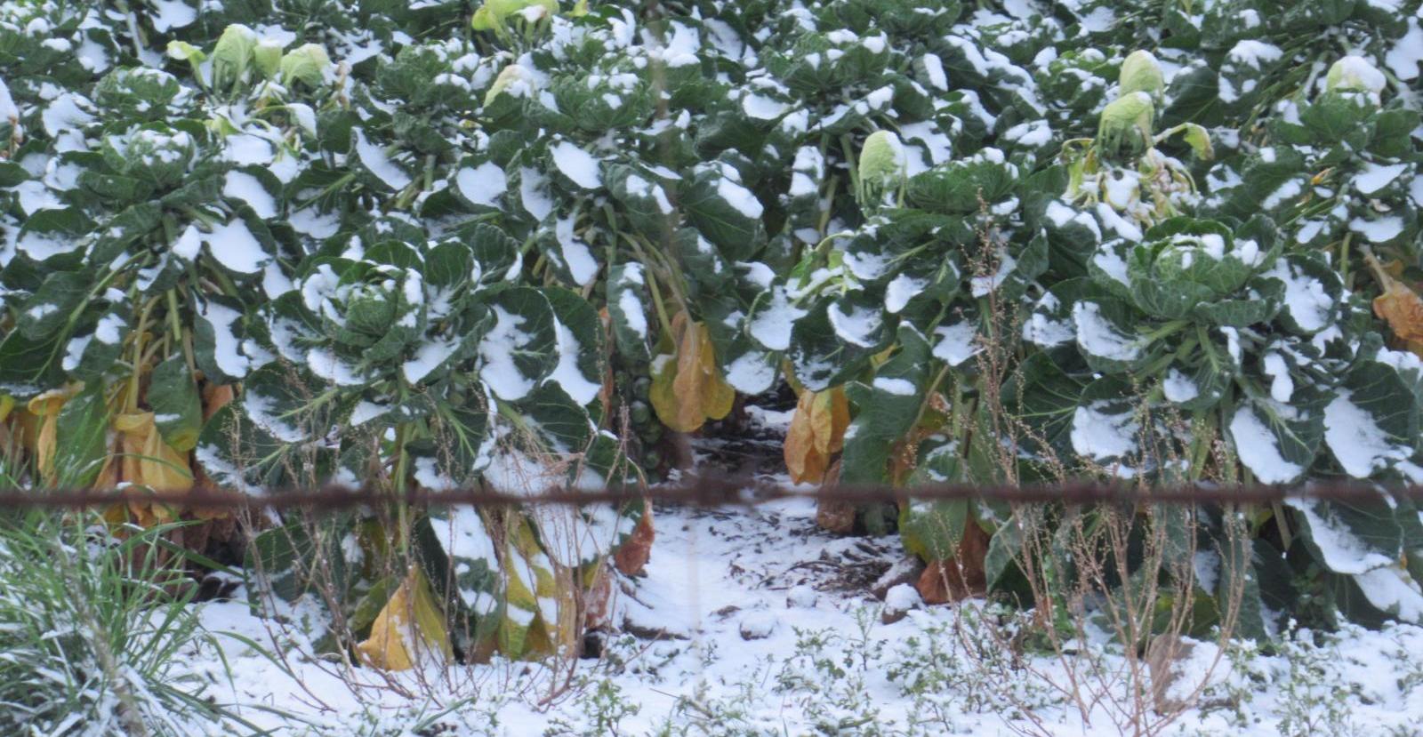
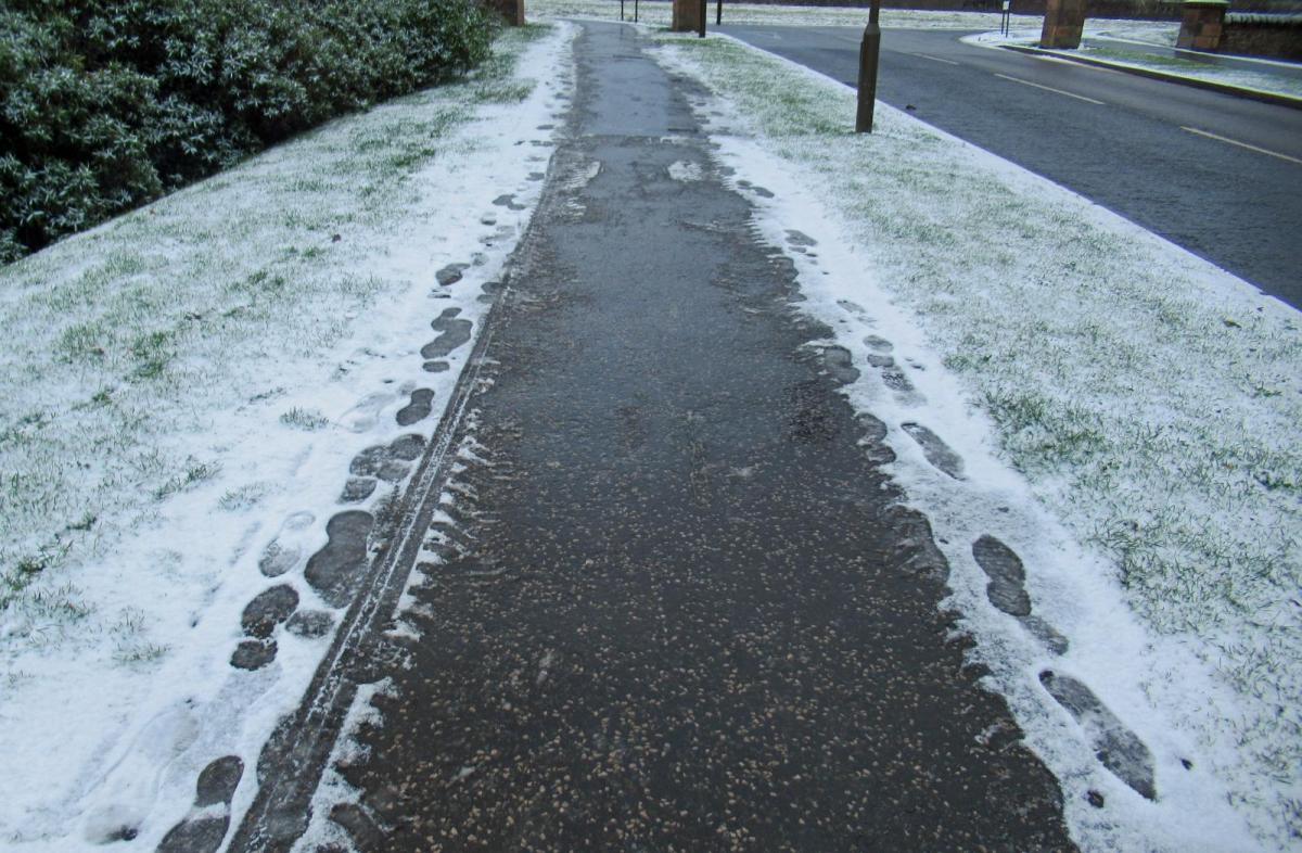
Snowy Brussel Sprouts
The snow continues to build up for northern Scotland, with clusters of snow showers from the northeast. “Accumulations of 2-5 cm are possible at lower levels, with 10-15 cm above 200 metres, especially across North Highland, Moray and Aberdeenshire. Some drifting and blizzard conditions are possible on hill routes” MO
The cold weather will continue over the next few days with more frost, the risk of ice but not too much snowfall, away from the north of Scotland.