More Atlantic weather is on the way, with wind and rain spreading east on Thursday. Sunshine and a scattering of showers follow behind on Friday.
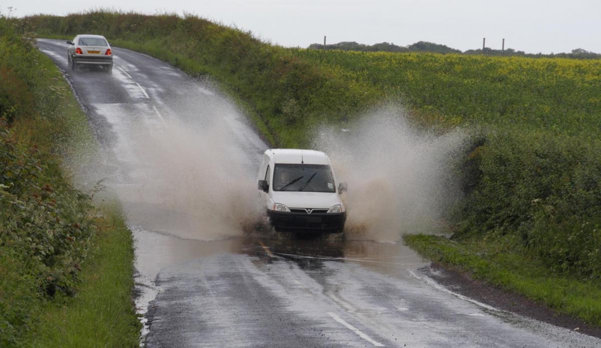
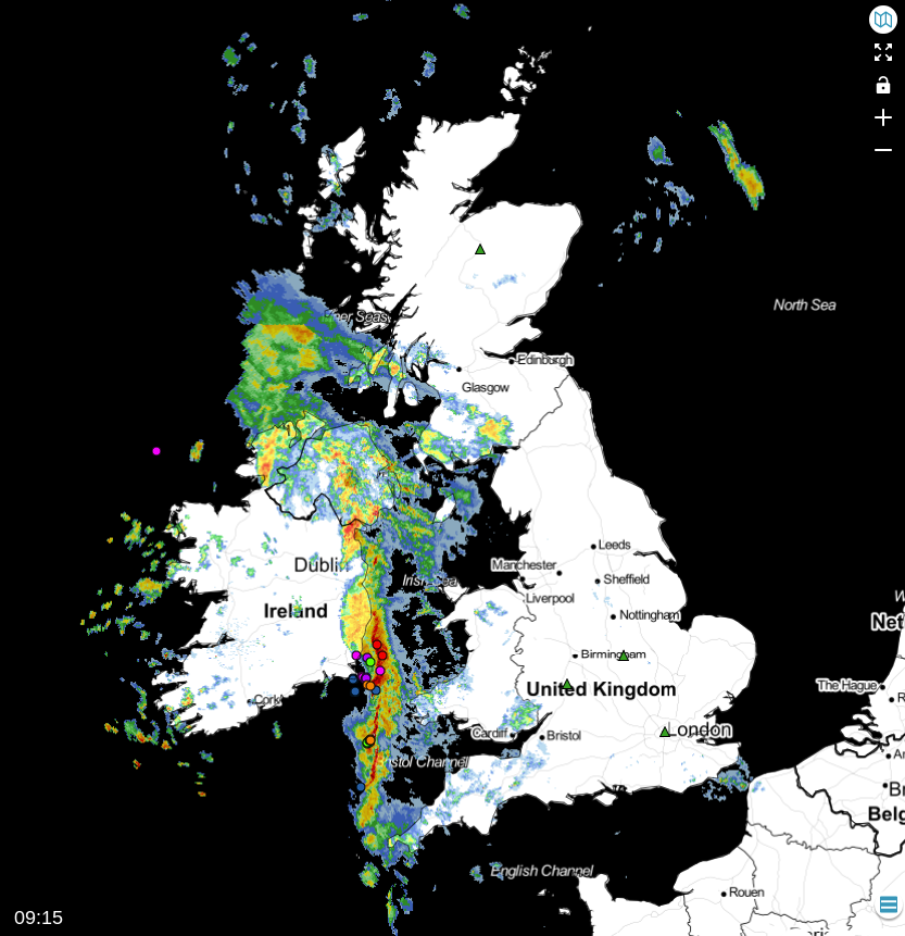
As yet another trough moves in off the Atlantic, bringing a further spell of wind and rain today, we have renewed warnings of heavy rain and gales for Wales, the South, South West, Northern Ireland and Dumfries. In addition, this, coupled with the recent heavy rains, has led to many flood alerts or warnings up and down the country, with Yorkshire, the Midlands, the South and South West worst affected at the moment, where a few of the warnings are severe.
While we have a scattering of blustery showers, mainly in the West, it's a fine start for most with some sunshine, especially in eastern areas. But skies will 'fill in' ahead of the following system sweeping in off the Atlantic that has already brought rain and squally winds to Northern Ireland. This'll spread to most parts through the day, eventually reaching eastern areas by or soon after dusk. Some of the rain, especially in the West, will be heavy, with a brief torrential downpour, maybe a crack of thunder and very squally winds possible as the front moves through. Following on will be clearer weather into the West, but still with blustery showers.
A storm forecast has been issued for today.
A southerly wind becomes fresh and gusty, 'veering' South Westerly as the weather clears. Gales, perhaps severe, are likely across Northern Ireland and in the West and South, with damaging squally gusts in excess of 50mph in the West and as the front moves through. Despite the conditions, it'll end up a very mild day, with top temperatures in the range of 9 to 13C.
Wet and windy weather in the East and over the North of Scotland soon clears to leave a mixture of clear intervals and passing blustery showers after dark. These'll be most frequent in the West, across Northern Ireland, northern England and along the South coast, where some will be heavy, giving local hail and thunder, while more sheltered eastern areas see fewer showers.
A fresh and blustery South West wind continues to provide gales in the West before moderating a little towards dawn. While perhaps feeling a little chilly, temperatures generally fall no lower than 6 to 9C.
Friday brings a rise in pressure in a much brighter day for most with sunny spells. But a fresh or strong South Westerly wind will continue to bring blustery showers to the North and West, where some will still be heavy, perhaps with thunder towards the Western Isles. The South coast may also continue to see a few showers at first, but across central and eastern areas, where winds will be somewhat lighter, you'll see the best of the sunshine, with any showers here few and far between. It'll stay mild, with top temperatures between 8 and 13C
After dark, there are clear spells, and with lighter breezes across central and eastern areas, it could turn a little chilly in some sheltered rural locations later. Elsewhere it'll be milder and breezier, with a southerly wind probably bringing further rain or drizzle towards Donegal and to the North and West of Scotland overnight. Lowest temperatures 4 to 6C in the East and 7 to 11C in the West.