There is milder air on the way by Saturday but it is accompanied by strong southerly winds and a band of heavy rain from the Atlantic. There is uncertainty about its clearance on Sunday from the southeast.
There has been a lot of rain this week as frontal bands blow in from the Atlantic. It is a similar story for the weekend and so the risk of flooding continues
"Local flooding from both rivers and surface water is possible in NW and SW England on Saturday and more widely across England on Sunday. " Environment Agency
Friday evening will see a quieter lull as the day’s winds ease down and most areas stay dry. Cloud will increase over Ireland and western Britain with a scattering of showers blown in on the moderate to fresh SW winds. Western Scotland will see more showers on Friday evening, although the heavier ones fade into the night. Western areas become windy with a fresh southerly but the winds will be lighter for eastern England and here temperatures will fall away, well down into single figures. This will allow a frost in the countryside and patchy fog to form.
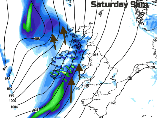
The surface winds will be from the south, bringing fairly mild air to the UK. The frontal band of rain will edge slowly eastwards on Saturday. It spends most of the morning over Northern Ireland and most of the day through the Irish Sea and over western Britain, accompanied by strong winds. There will be gales, even severe gales for exposed coasts and hills and gusts around 50 to 60mph around the Irish Sea, North Channel and for west coast Scotland in the morning.
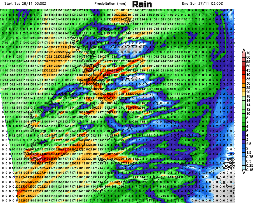
Much of England and parts of eastern Scotland will escape the rain on Saturday but have a fairly grey, cloudy day. Breaks will appear to the lee of high ground in the brisk winds but the rain will reach over more of Scotland during the afternoon and further over western and central England.
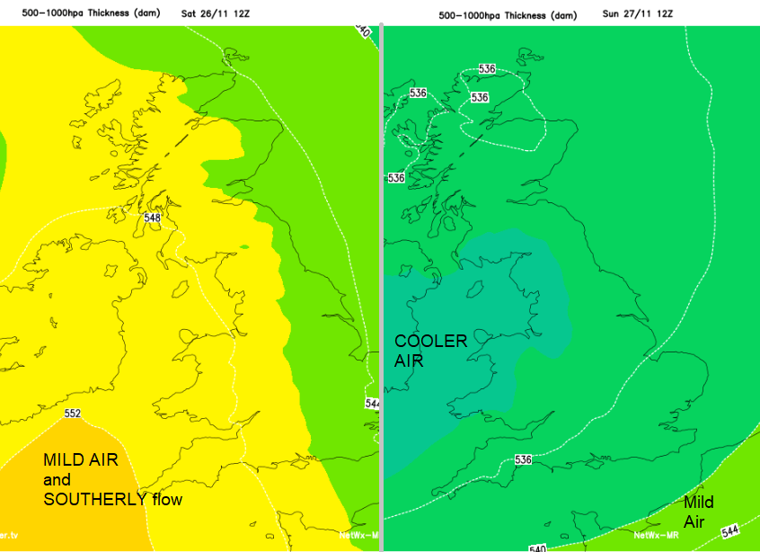
Temperatures will be around 10 to 15C so milder than it has been. By the afternoon the strong southerly winds and high gusts will be affecting west coast Wales and Cornwall with a windy end to the day for the whole of the UK. The winds strengthen over the Northern Isles during Saturday night with gales, even severe gales. The rain band works its way across Britain during Saturday night and it will be milder in that southerly flow although could feel chilly in the wind and rain.
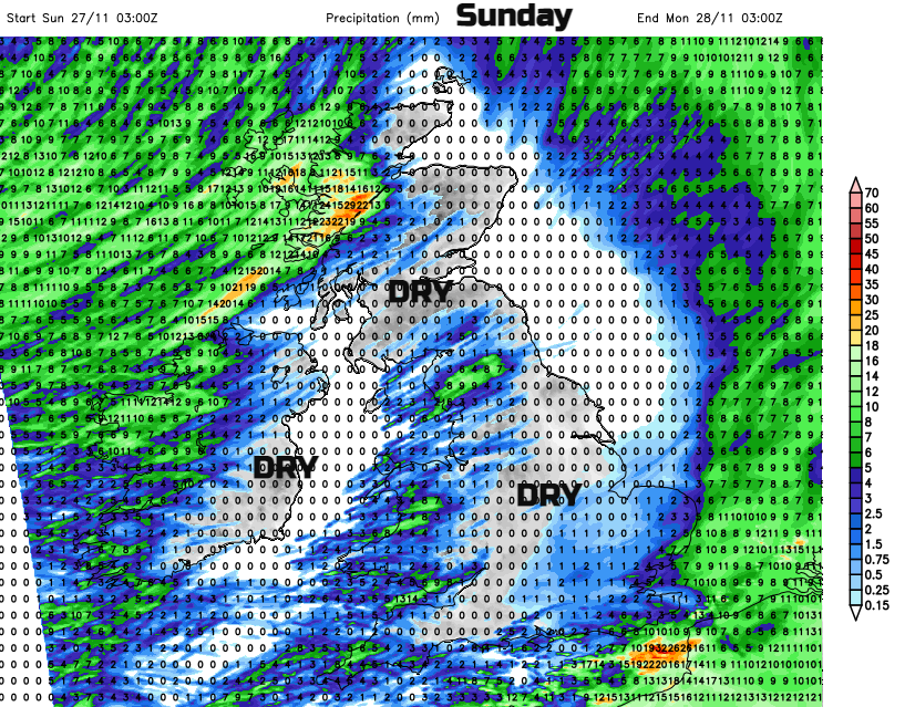
Sunday starts with the last of Saturday’s rain still over SE England and numerous showers spinning in from the far northwest. A low centre to the south of Iceland will bring strong southerly winds, even gales to the Western Isles and NW Highlands on Sunday morning. Showers will continue to feed into western counties during the day but many other areas will be dry and bright. It will be a more cheery day but still blustery and although not quite as mild in terms of temperature values it might feel better in any sunny spells. The GFS model shows a wave along the clearing rain in the southeast, which would throw rain for Sunday morning over southern Britain, which might not even clear through the whole of the day. The ECM model takes until lunchtime for the rain to clear from London and SE England, perhaps East Anglia. There will be outbreaks of blustery showers moving across Northern Ireland and Scotland at times during the day, although mostly in the west.